-
DARTS: Multi-year database of AI detected retrogressive thaw slumps (RTS) in hotspots of the circum-arctic...
This dataset, called DARTS, comprises footprints of active parts of retrogressive thaw slump (RTS) identified and quantified using an automated deep learning approach in RTS...
-
DARTS: Multi-year database of AI detected retrogressive thaw slumps (RTS) and active layer detachment slides (ALD)...
This dataset, called DARTS, comprises footprints of retrogressive thaw slump (RTS) and active layer detachments slides (ALD) identified and quantified using an automated deep... -
Maps of ice wedge thermokarst pool expansion from twenty-seven circumpolar survey areas
This repository includes data and code to accompany the manuscript 'Topography controls variability in circumpolar permafrost thaw pond expansion' by Abolt et al. The data...
-
Rockglacier and Slope Instability Inventory from differential SAR interferograms and optical imagery, 1998-2016,...
Rockglaciers and other periglacial processes were mapped using visual analysis of differential SAR interferograms and satellite optical images (Google Satellite, Bing Aerial)...
-
Thermo-erosional valleys and streams in ice-rich permafrost lowlands from RapidEye, 2010, Buor Khaya Peninsula,...
The published data set provides an inventory of thermo-erosional landforms and streams in three lowland areas underlain by ice-rich permafrost of the Yedoma-type Ice Complex at...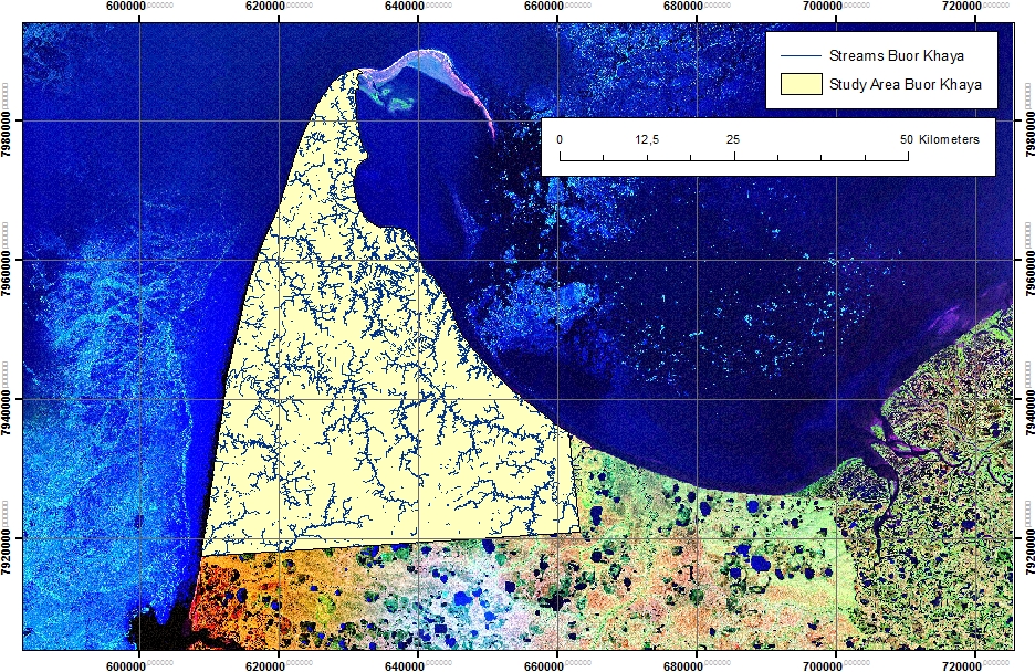
-
Thermo-erosional valleys and streams in ice-rich permafrost lowlands from Landsat, 2000, Hexagon, 1975, Lena Delta,...
The published dataset provides an inventory of thermo-erosional landforms and streams in three lowland areas underlain by ice-rich permafrost of the Yedoma-type Ice Complex at...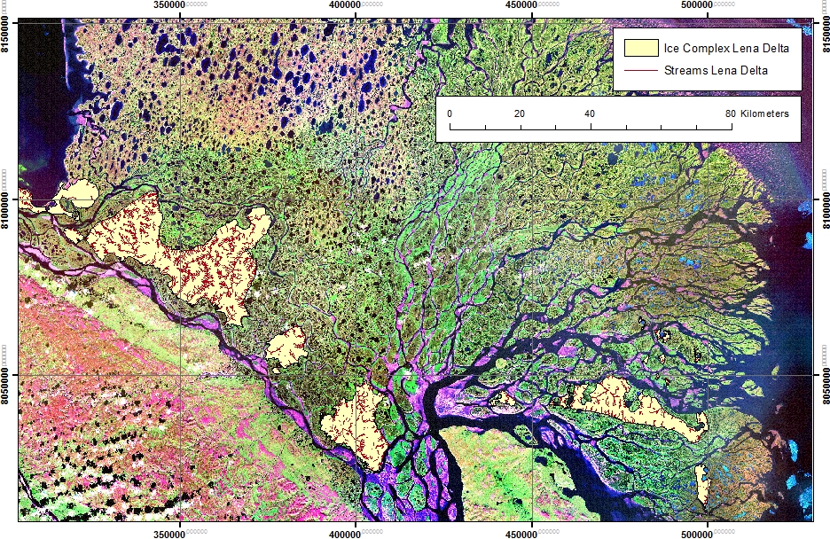
-
Thermo-erosional valleys and streams in ice-rich permafrost lowlands from Landsat, 2000, Hexagon, 1975, Cape...
The published dataset provides an inventory of thermo-erosional landforms and streams in three lowland areas underlain by ice-rich permafrost of the Yedoma-type Ice Complex at...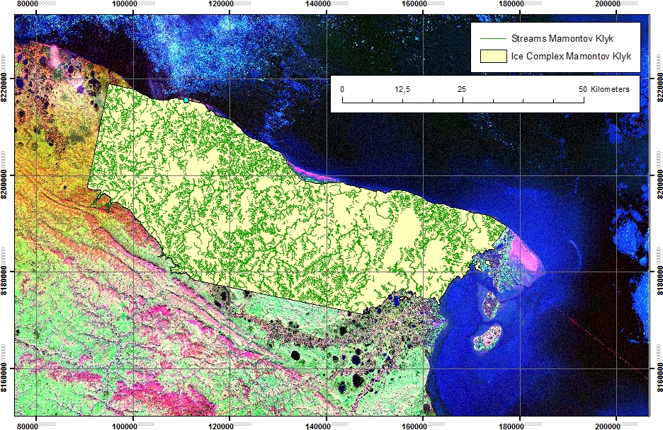
-
Coastal Retrogressive Thaw Slumps from GeoEye-1, WorldView-2 and Aerial Photographs, 2011, Yukon Coast (CA)
Coastal retrogressive thaw slumps (RTSs) were manually digitized at a 1:2000 scale using ArcMap (ESRI, version 10.3) from high‐resolution satellite images acquired in July (13...
-
Rockglacier and Slope Instability Inventory from differential SAR interferograms and optical imagery, 1998-2016,...
Rockglaciers and other periglacial processes were mapped using visual analysis of differential SAR interferograms and satellite optical images (Google Satellite, Bing Aerial)...
-
Rockglacier and Slope Instability Inventory from differential SAR interferograms and optical imagery, 1998-2016,...
Rockglaciers and other periglacial processes were mapped using visual analysis of differential SAR interferograms and satellite optical images (Google Satellite, Bing Aerial)...
-
Rockglacier and Slope Instability Inventory from differential SAR interferograms and optical imagery, 1998-2016,...
Rockglaciers and other periglacial processes were mapped using visual analysis of differential SAR interferograms and satellite optical images (Google Satellite, Bing Aerial)...