-
Bacteria cells in the surface water during 4 expeditions from spring to fall in 2019, Mackenzie Delta Region (CA)
Samples for bacterial abundance (1.5 mL) were preserved with glutaraldehyde (1% final concentration) and stored at -80°C. Samples were stained with SYBRTM Green I (Thermofisher... -
Particulate organic carbon (POC) and particulate organic nitrogen (PON) concentrations in the surface water during 4...
Particulate organic carbon (POC) and particulate organic nitrogen (PON) concentrations were obtained from water samples filtered on precombusted (450°C for >5 hours) 47mm... -
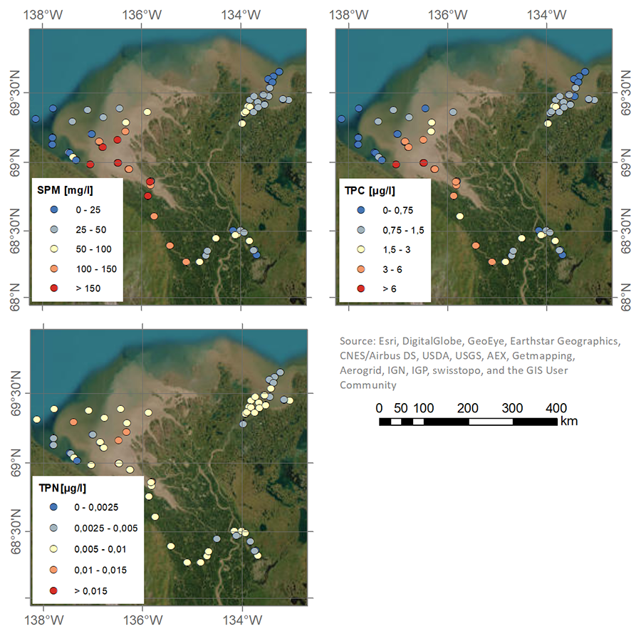
Suspended particulate matter (SPM), Total particulate carbon (TPC) and Total particulate nitrogen (TPN)...
Material for the determination of suspended particulate matter (SPM), total particulate carbon (TPC) and total particulate nitrogen (TPN) was obtained by filtering 300-700 mL... -
Nutrient (NO3, NO2, PO4, SiO4) concentrations in the surface water during 4 expeditions from spring to fall in 2019,...
Water for nitrate (NO3), nitrite (NO2), phosphate (PO4) and silicate (SiO4) was filtered using an acid-washed 60-mL luer-lock syringe combined with an Acrodisc filter (GF/F 0.7... -
Holocene vegetation dynamics of circum-Arctic permafrost peatlands
Vegetation shifts in circum-Arctic permafrost peatlands drive feedbacks with important consequences for peatland carbon budgets and the extent of permafrost thaw under changing... -
Isotopic composition of ground ice, ebullition gases and thermokarst lake water, Alaska, 2008-2010
Thermokarst lakes are thought to have been an important source of methane (CH4) during the last deglaciation when atmospheric CH4 concentrations increased rapidly. Here we... -
GHG data from inverse models and UNFCCC national inventories, Global, 1990-2019
Anthropogenic greenhouse gas (carbon dioxide, methane, nitrous oxide) data from inverse models and UNFCCC national inventories This dataset contains 5 datasets, including GHG... -
Methane and nitrous oxide dissolved gas concentrations in seawater from the North American Arctic Ocean (2015–2018)
This dataset contains methane and nitrous oxide dissolved gas concentration, dissolved methane carbon isotope, and ancillary hydrographic data from research cruises in the North... -
Methane and nitrous oxide dissolved gas concentrations from rivers in the North American Arctic (2017–2019)
This dataset contains methane and nitrous oxide dissolved gas concentration and dissolved methane carbon isotope data from rivers in the Canadian Arctic Archipelago region... -
PEATMAP - peatland distribution maps based on meta-analysis, 1999-2010, Global
PEATMAP is a GIS shapefile dataset that shows a distribution of peatlands that covers the entire world. It was produced by combining the most high quality available peatland map... -
CO2 and CH4 Production in Soil Incubations from Low and High Centered Polygons, Barrow, Alaska, 2012-2013
The dataset consists of respiration and methane production rates obtained from soil microcosm studies carried out under controlled temperature and incubation conditions. Soils... -
Land Surface Feature Classification from TerraSAR-X, 2013, Lena Delta, Laptev and East Siberian Sea Region (RU)
Land surface features (water, wetland, tundra, and bare surfaces) were classified from TerraSAR-X with a resolution of 5 m for August 2012 and July 2014. The product is based on... -
Chamber methane fluxes with spectrometer from a polygon tundra, 2015, northeastern Siberia
This dataset contains in situ CH4 fluxes measured through the chamber technique over the growing season of 2015 (from July to September) at a wet polygon center and a dry... -
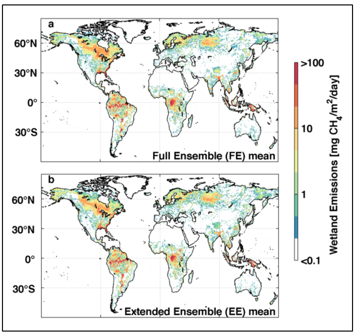
Global 0.5-deg Wetland Methane Emissions and Uncertainty (WetCHARTs v1.0), 2009-2010
This data set provides global monthly wetland methane (CH4) emissions and uncertainty data products derived from an ensemble of multiple terrestrial biosphere models, wetland... -
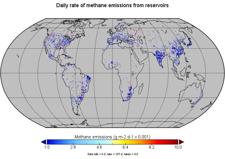
Global-Gridded Daily Methane Emissions from Inland Dam-Reservoir Systems, 2002-2015
This dataset includes global maps of methane (CH4) emissions from inland dam-reservoir systems at 0.25-degree spatial resolution. Daily emission rates (as grams of CH4 per day... -
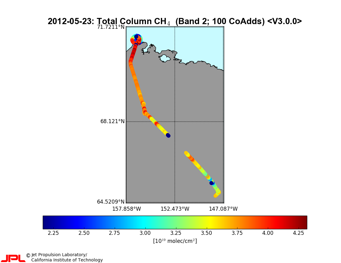
CARVE column gas from Airborne fourier transform spectrometer, Alaska, 2012-2015
This data set provides total vertical column O2, CO2, CH4, CO, and H2O, as well as dry-air columns of CO2, CH4, CO, and H2O from airborne campaigns over the Alaskan and Canadian... -
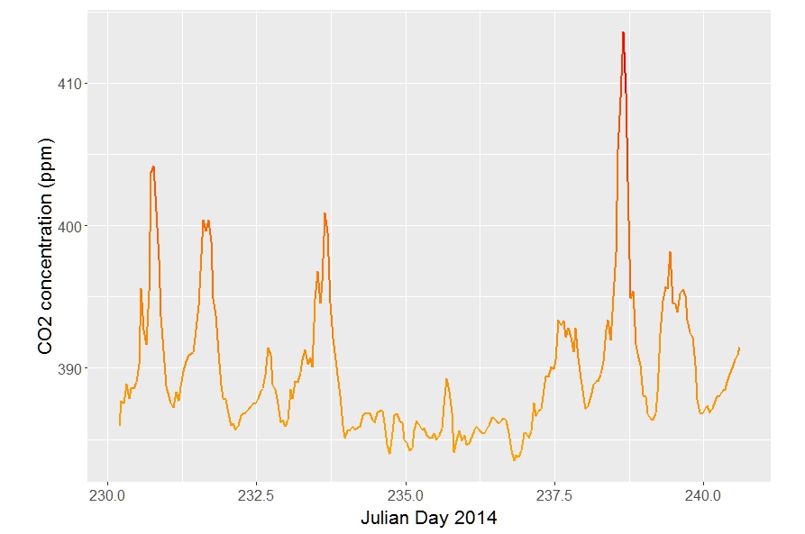
CARVE atmospheric gas concentrations, tower based, Alaska, 2012-2015
This data set provides atmospheric methane (CH4), carbon dioxide (CO2), and carbon monoxide (CO) dry air mole fractions and water vapor mole fractions (H2O) from continuous in... -
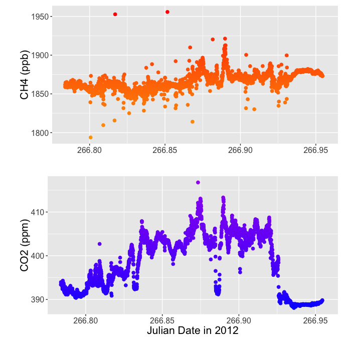
CARVE atmospheric gas concentrations, airborne flasks, Alaska, 2012-2015
This dataset provides atmospheric carbon dioxide (CO2), methane (CH4), carbon monoxide (CO), molecular hydrogen (H2), nitrous oxide (N2O), sulfur hexafluoride (SF6), and other... -
Wetland maps including open water extent dynamics based on ENVISAT ASAR WS for Siberia, 2007 and 2008
Wetlands store large amounts of carbon, and depending on their status and type, they release specific amounts of methane gas to the atmosphere. The connection between wetland... -
CARVE atmospheric gas concentrations, airborne spectrometer, Alaska, 2012-2015
This data set provides atmospheric carbon dioxide (CO2), methane (CH4), carbon monoxide (CO), ozone (O3), and water vapor (H2O) concentrations from airborne campaigns over the...


