-
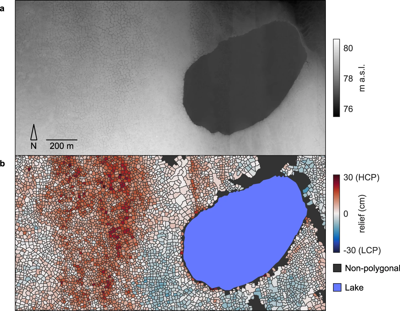
Ice wedge polygon occurrence and geomorphology from LiDAR elevation data, 2012 and 2014, south of Prudhoe Bay, Alaska (US)
We mapped the occurrence of more than one million ice wedge polygons over a landscape of approximately 1,200 square kilometers, just south of Prudhoe Bay in northern Alaska,... -
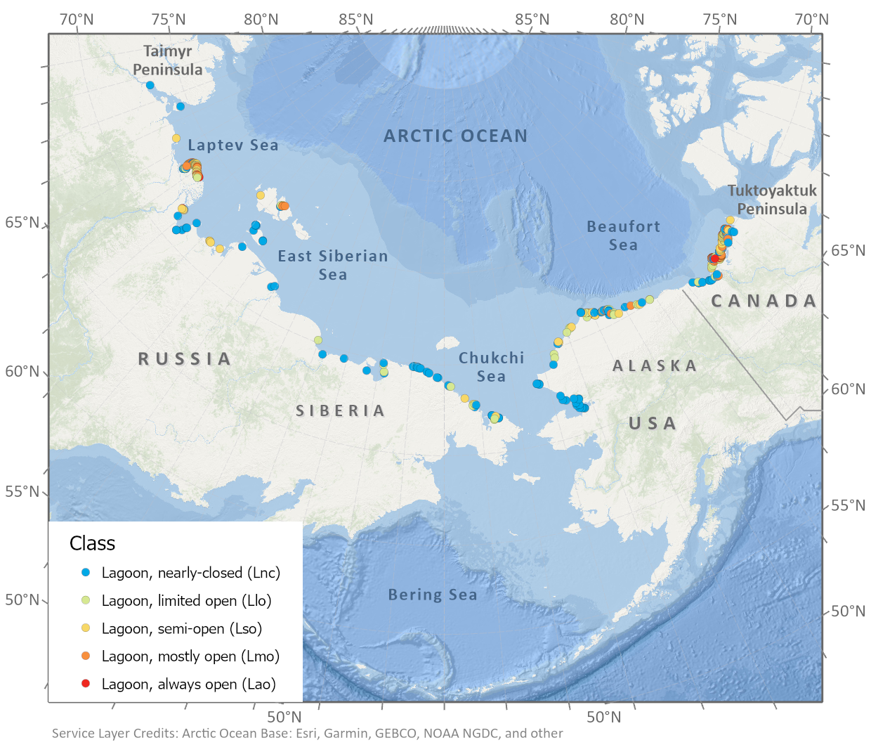
Pan-Arctic thermokarst lagoon distribution, area and classification from Landsat images, 1984 to 2021
Thermokarst lagoons develop in permafrost lowlands along the ice-rich Arctic coast when thermokarst lakes or basins with bottom elevations at or below sea level are breached by... -
Spatial lake dynamics and lake-ice datasets of the Northern Seward and Baldwin Peninsulas in Alaska
The data publication contains supplementary data to the article "Supplementary Dataset to: The catastrophic thermokarst lake drainage events of 2018 in northwestern Alaska:... -
Total above-ground biomass of 25 sites from 2018 central Lena Delta (RU)
Field investigations were performed in the central Lena Delta. In total, 25 sites were investigated. The sites were chosen to represent a variety of vegetation communities of... -
Pan-Arctic Visualization of Landscape Change (2003-2022), Arctic PASSION Permafrost Service
This raster dataset, in Cloud Optimized GeoTIFF format (COG), provides information on land surface changes at the pan-arctic scale. Multispectral Landsat-5 TM, Landsat-7 ETM+,... -
Dissolved methane and hydrochemical parameters in ice cores from 2017, Bykovsky Peninsula, Lena Delta
Data were analyzed to study the role of an winter ice cover for methane cycles of three different stages in the lake-lagoon-shelf transition in a region of rapidly thawing... -
Quaternary deposits map of Yana-Indigirka and Kolyma lowlands tundra zone, R-55-57, based on Landsat imagery
The Quaternary geology map was created for the Yana-Indigirka (eastern part) and Kolyma lowlands, tundra and partly forest-tundra zones. The map corresponds to the nomenclature... -
Database of Ice-Rich Yedoma Permafrost (IRYP)
We synthesized data on the circum-Arctic and sub-Arctic distribution and thickness of Yedoma for compiling a preliminary circum-polar Yedoma map. For compiling this map, we used... -
Methane and nitrous oxide sea-air fluxes calculated from samples collected in the North American Arctic Ocean (2015–2018)
This dataset contains methane and nitrous oxide dissolved gas concentration, dissolved methane carbon isotope, and ancillary hydrographic data from research cruises in the North... -
Chamber measured methane transport through individual aerenchymous plants at a boreal fen and a bog
The presented dataset contains chamber measurements of methane transport (mg CH₄ g dry plant mass-1 day-1) through individual aerenchymous peatland plants and the ancillary data... -
Eddy covariance carbon fluxes and ancillary data, Samoylov Island, Lena River Delta, 2014-2015
This dataset contains fluxes of carbon dioxide and methane on an active flood plain in the Siberian Lena River Delta during the growing seasons 2014 and 2015 by means of the... -
Methane fluxes, soil gas profiles and microbial activities in ponds at Samoylov, 2002 & 2013
Methane (CH4) production, oxidation, and emission were studied in ponds of the permafrost-affected polygonal tundra in northeast Siberia. Summer CH4 fluxes were measured with... -
Soil incubation data from ice-rich permafrost deposits in Northeast Siberia, 2014
CO2 and CH4 production in aerobic and anaerobic incubation in sediments samples from Muostakh Island (sample code MUO12), the Buor Khaya Peninsula (BK8), and Bol'shoy Lyakhovsky... -
Soil and incubation data of permafrost-affected soils in Samoylov, 2011 & 2013
The effects of oxygen availability, freezing and thawing, temperature, and labile organic matter (OM) additions on greenhouse gas production were studied in northeast Siberian... -
Geochemistry of incubated permafrost and seawater from the western Canadian Arctic
We present geochemical and hydrochemical information on individual permafrost and seawater samples from the Yukon Coast in the western Canadian Arctic used for an incubation... -
Anaerobic incubation measurements (CH4+CO2) and microbe quantification, Lena Delta, 2018
The data sets were made during the summer 2021, with samples collected from three cores, at two depths (active and permafrost layers). In total, six samples (3 replicates by... -
UAV-based methane data from Barter Island, September 2017, Barrow, 1986-2017, Alaska (US)
Arctic permafrost stores vast amounts of methane (CH4) in subsurface reservoirs. Thawing permafrost creates areas for this potent greenhouse gas to be released to the... -
Surface Soil Moisture from ENVISAT ASAR GM, 2005-2010, Laptev Sea Coast, Laptev and East Siberian Sea Region (RU)
The SAR Surface Soil Moisture (SSM) product is derived from the ENVISAT ASAR sensor operating in Global Monitoring (GM) mode. The SAR SSM product is a weekly mean composite at 1... -
Surface Soil Moisture from ENVISAT ASAR GM, 2005-2011, Mackenzie River Valley and Delta, Beaufort Sea Region (CA)
The SAR Surface Soil Moisture (SSM) product is derived from the ENVISAT ASAR sensor operating in Global Monitoring (GM) mode. The SAR SSM product is a weekly mean composite at 1... -
Surface Soil Moisture from ENVISAT ASAR GM, 2005-2011, Ob Estuary and Yamal Peninsula, Western Siberia (RU)
The SAR Surface Soil Moisture (SSM) product is derived from the ENVISAT ASAR sensor operating in Global Monitoring (GM) mode. The SAR SSM product is a weekly mean composite at 1...


