-
DARTS: Multi-year database of AI detected retrogressive thaw slumps (RTS) and active layer detachment slides (ALD)...
This dataset, called DARTS, comprises footprints of retrogressive thaw slump (RTS) and active layer detachments slides (ALD) identified and quantified using an automated deep... -
Land Surface Feature Classification from TerraSAR-X, 2013, Lena Delta, Laptev and East Siberian Sea Region (RU)
Land surface features (water, wetland, tundra, and bare surfaces) were classified from TerraSAR-X with a resolution of 5 m for August 2012 and July 2014. The product is based on... -
Distribution of pingos from an IfSAR digital surface model, 2002-2006, western Arctic Coastal Plain, Northern Alaska (US)
A detailed attributed point feature shapefile of 1247 pingo locations was manually assembled from a 5m resolution digital surface model (DSM) derived from an airborne... -
Distribution of pingos from topographic maps, permafrost region, Siberia (RU)
A detailed attributed point feature shapefile of 6059 pingo locations in a 3.5 × 10⁶ km² region of northern Asia was manually assembled from 1:200 000 scale Russian... -
Coastal Retrogressive Thaw Slumps from GeoEye-1, WorldView-2 and Aerial Photographs, 2011, Yukon Coast (CA)
Coastal retrogressive thaw slumps (RTSs) were manually digitized at a 1:2000 scale using ArcMap (ESRI, version 10.3) from high‐resolution satellite images acquired in July (13... -
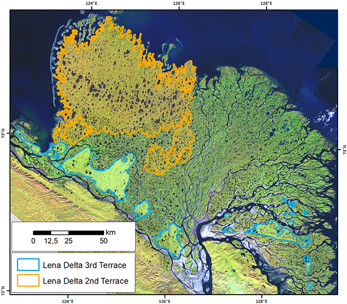
Geomorphological main terraces from Landsat 2000-2001, Lena Delta, Laptev and East Siberian Sea Region (RU)
This data set provides a detailed inventory of lakes in the Lena Delta, northern Siberia, with respect to the lakes' association with one of the three geomorphological main... -
Samoylov Datasets on PANGAEA
This is a preliminary link to a data publication list on PANGAEA. It will be replaced in future by more detailed dataset descriptions. https://www.pangaea.de/?q=location:Samoylov -
Land Surface Feature Classification from TerraSAR-X, 2016, Hershel Island, Beaufort Sea Region (CA)
Land surface features (water, wetland, tundra, and bare surfaces) were classified from TerraSAR-X with a resolution of 5 m for August 2016. The product is based on the... -
Land Surface Feature Classification from TerraSAR-X, 2016, Vaskiny Dachi, Western Siberia (RU)
Land surface features (water, wetland, tundra, and bare surfaces) were classified from TerraSAR-X with a resolution of 5 m for August 2016. The product is based on the... -
Land Surface Feature Classification from TerraSAR-X, 2013, Kytalyk, Central Yakutia (RU)
Land surface features (water, wetland, tundra, and bare surfaces) were classified from TerraSAR-X with a resolution of 5 m for July 2013. The product is based on the... -
Land Surface Feature Classification from TerraSAR-X, 2013, Mackenzie Delta, Beaufort Sea Region (CA)
Land surface features (water, wetland, tundra, and bare surfaces) were classified from TerraSAR-X with a resolution of 5 m for the period of July and August 2013. The product is... -
Land Surface Feature Classification from TerraSAR-X, 2013, Barrow, Alaska (US)
Land surface features (water, wetland, tundra, and bare surfaces) were classified from TerraSAR-X with a resolution of 5 m for the period of July and August 2013. The product is... -
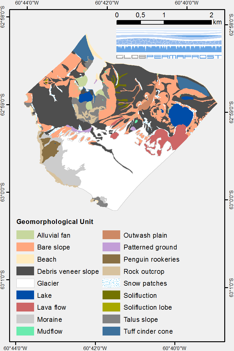
Geomorphological units from field mapping, Irizar - Crater Lake Area, Deception Island, Antarctica
The map describes the main geomorphological features according to surface cover type on Irizar - Crater Lake Area, Deception Island, Antarctica. The map was developed to support... -
Geomorphological units from field mapping, Hurd Peninsula, Livingston Island, Antarctica
The map shows the geomorphological units of Hurd Peninsula on Livingston Island. Mapping was done with high resolution field mapping supported by the analysis of a QuickBird...


