-
CARVE atmospheric gas concentrations, tower based, Alaska, 2012-2015
This data set provides atmospheric methane (CH4), carbon dioxide (CO2), and carbon monoxide (CO) dry air mole fractions and water vapor mole fractions (H2O) from continuous in...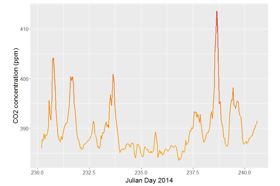
-
CARVE atmospheric gas concentrations, airborne flasks, Alaska, 2012-2015
This dataset provides atmospheric carbon dioxide (CO2), methane (CH4), carbon monoxide (CO), molecular hydrogen (H2), nitrous oxide (N2O), sulfur hexafluoride (SF6), and other...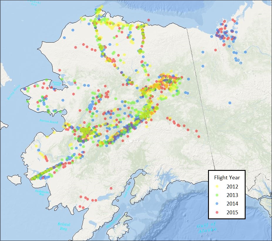
-
Wetland maps including open water extent dynamics based on ENVISAT ASAR WS for Siberia, 2007 and 2008
Wetlands store large amounts of carbon, and depending on their status and type, they release specific amounts of methane gas to the atmosphere. The connection between wetland...
-
CARVE atmospheric gas concentrations, airborne spectrometer, Alaska, 2012-2015
This data set provides atmospheric carbon dioxide (CO2), methane (CH4), carbon monoxide (CO), ozone (O3), and water vapor (H2O) concentrations from airborne campaigns over the...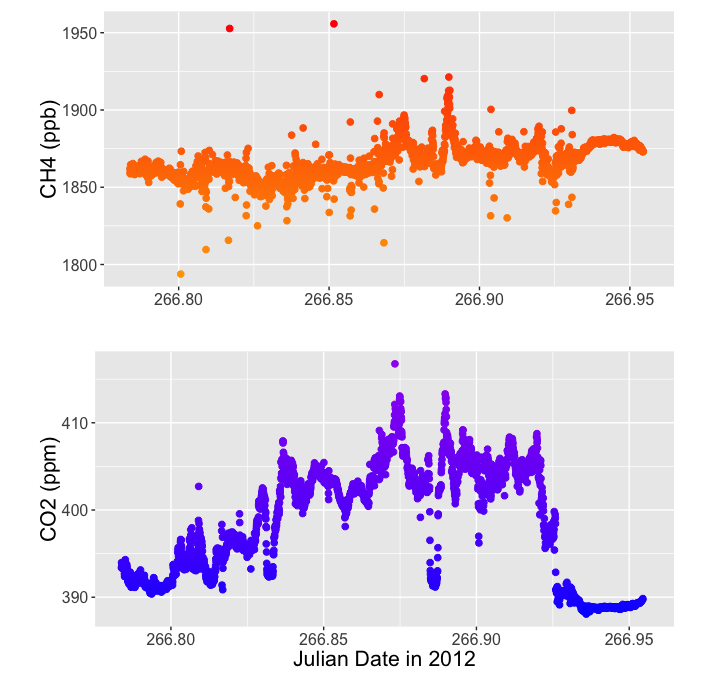
-
Dataset of a globally relevant stock of soil nitrogen in the Yedoma permafrost domain, 1998-2016, Circum-Arctic
This dataset merges nitrogen data from the Yedoma domain. It includes numerous fieldwork campaigns, which take place since 1998. In total 467 samples from the active layer...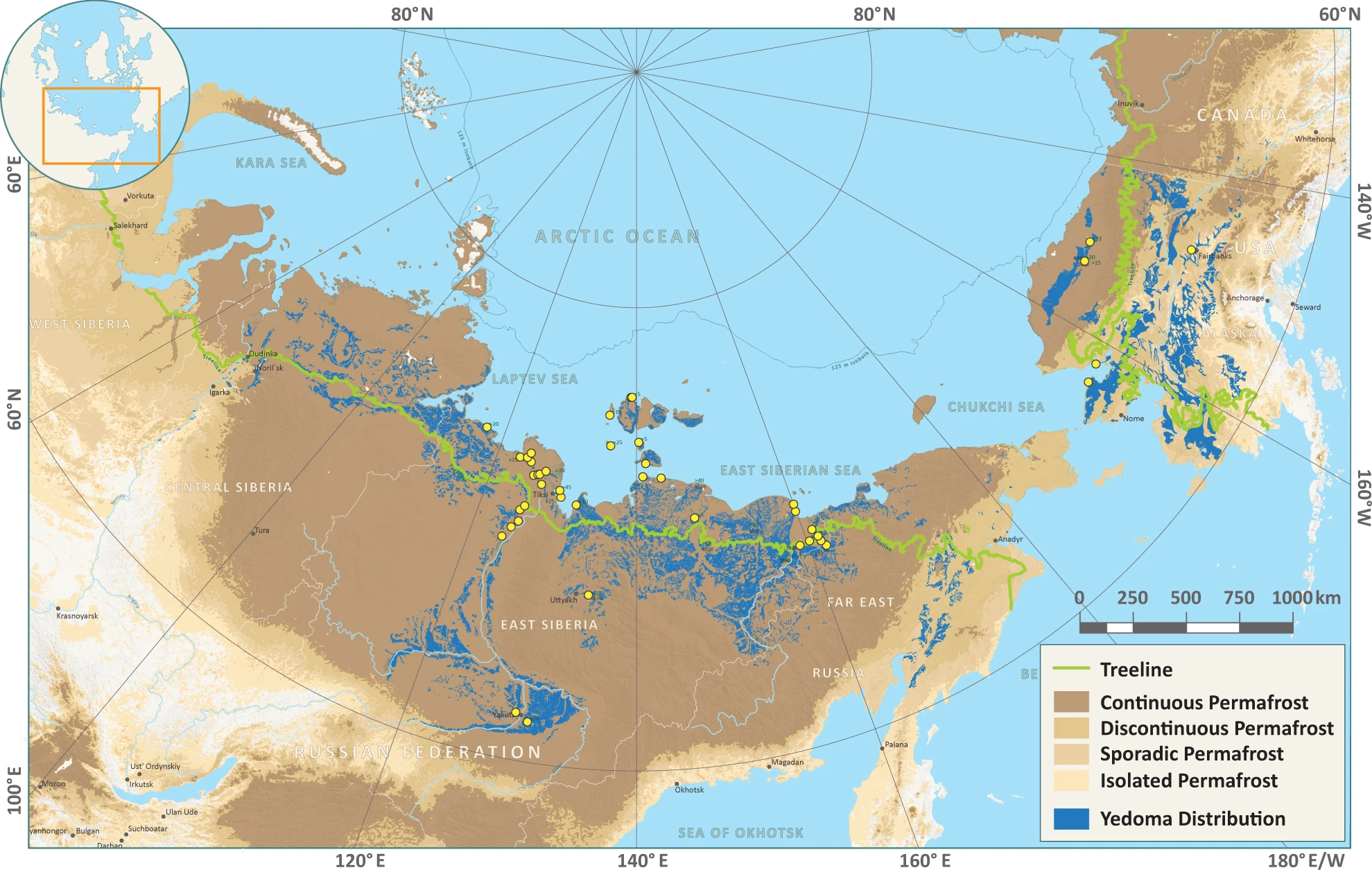
-
Methane flux from closed chamber with spectrometer across two thermokarst lake ecosystems, 2018, Interior Alaska (US)
This dataset provides diffusive methane (CH4) fluxes collected from two thermokarst lakes in the Goldstream Valley, north of Fairbanks in interior Alaska. Fluxes were collected...
-
Methane Fluxes from Shorelines and Differing Surfaces, 2019, Big Trail Lake, Alaska (US)
This dataset provides methane fluxes from hot-spot and non-hot spot differing surfaces at Big Trail Lake (BTL) in the Goldstream Valley near Fairbanks, AK, USA. Measurements...
-
The fractional land cover estimates from the Boreal–Arctic Wetland and Lake Dataset (BAWLD), 2021, Circum-Arctic
The Boreal and Arctic Wetland and Lake Dataset (BAWLD) provides estimates of fractional land cover of 19 land cover classes within 0.5° ×0.5° grid cells. The total area of the...
-
Hyperspectral Imagery AVIRIS-NG V2, 2017-2019, Alaskan and Canadian Arctic
This dataset provides Level 1 radiance and Level 2 surface reflectance measured by the Airborne Visible/Infrared Imaging Spectrometer-Next Generation (AVIRIS-NG) instrument...
-
Circumarctic wetland dataset based on ENVISAT ASAR Global Monitoring Mode, 2005-2011, Panarctic
A circumpolar representative and consistent wetland map is required for a range of applications ranging from upscaling of carbon fluxes and pools to climate modelling and...
-
Vegetation map of Trail Valley Creek from airborne orthophotos, laser scanning and field work data, Northwest...
The vegetation map distinguishes between five tundra vegetation types, trees, and open water at the forest-tundra transition north of Inuvik, Northwest Territories, Canada. The...
-
Detailed pedon data on soil carbon and nitrogen for the northern permafrost region
Soils in the northern high latitudes are a key component in the global carbon cycle; the northern permafrost region covers 22% of the Northern Hemisphere and holds almost twice...
-
A high spatial resolution soil carbon and nitrogen dataset for the northern permafrost region
This spatial dataset is quantifying soil organic carbon (SOC) and total nitrogen (TN) storage with their carbon to nitrogen ratio (C/N) in soils of the northern circumpolar...
-
Global methane data from 2002 to present derived from satellite observations
This dataset provides observations of atmospheric methane (CH4) amounts obtained from observations collected by several current and historical satellite instruments. Methane is...
-
Raster Circumpolar Arctic Vegetation Map (CAVM) from AVHRR, MODIS and elevation data
Land cover maps are the basic data layer required for understanding and modeling ecological patterns and processes. The Circumpolar Arctic Vegetation Map (CAVM), produced in...
-
Monthly global dataset of Wetland Area and Dynamics for Methane Modeling (WAD2M) from Remote Sensing, 2000-2020
Seasonal and interannual variations in global wetland area is a strong driver of fluctuations in global methane (CH4) emissions. Current maps of global wetland extent vary with...
-
Lake-DOC Database (PeRL-DOCv1), 1979-2017, Permafrost-Region
The pan-Arctic Permafrost-Region Lake-DOC version1 database contains surface water samples of lakes in the permafrost regions of Alaska (49.3 %), Canada (24.2 %), Greenland (3.2...
-
Near-surface permafrost conditions from synthesis data, 1997-2016, Alaska
We compiled a near-surface permafrost temperature dataset from 72 monitoring stations in Alaska using data collected by the U. S. Geological Survey, the National Park Service,...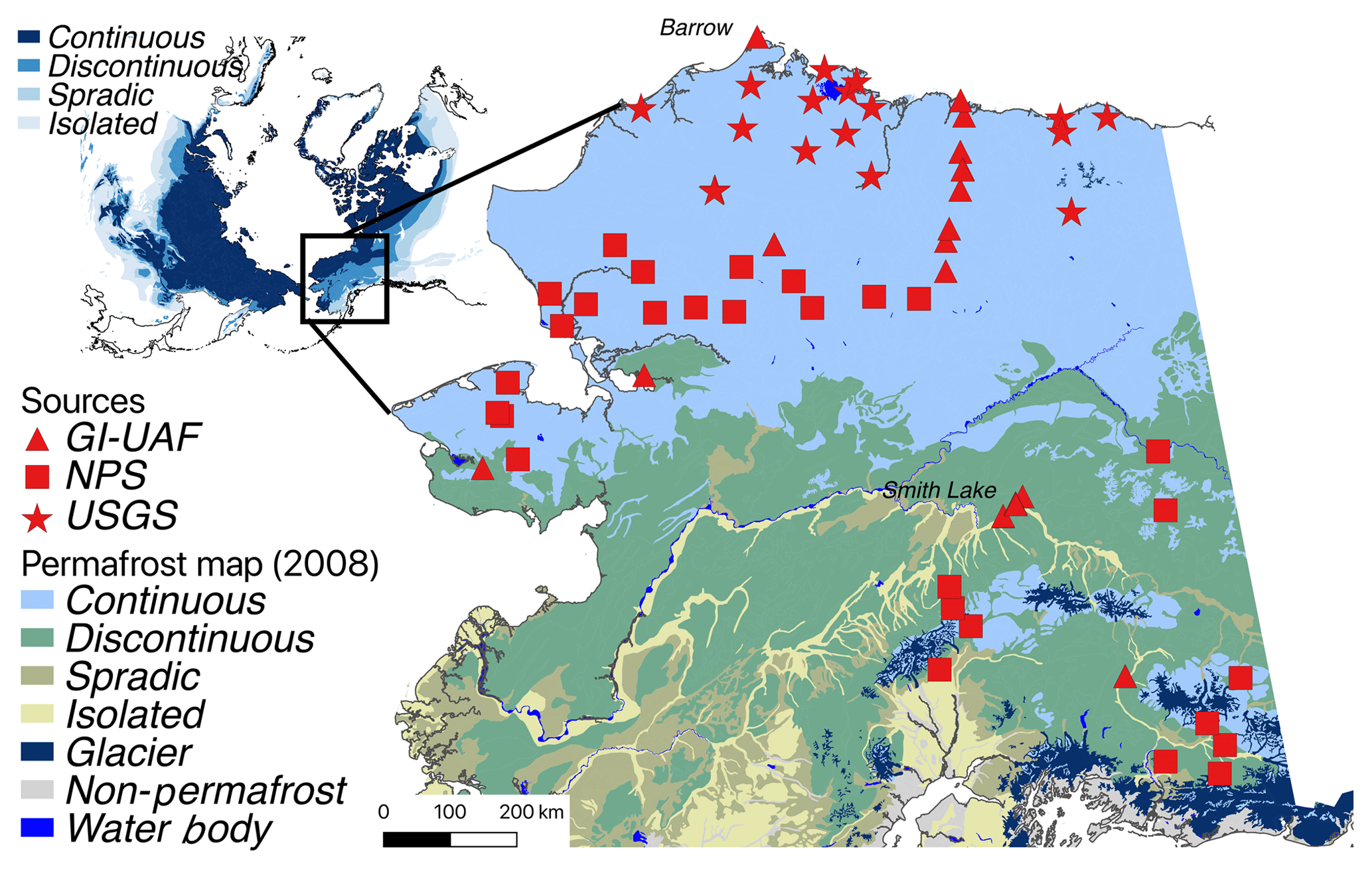
-
Database of Ice-Rich Yedoma Permafrost Version 2 (IRYP v2)
Ice-rich permafrost in the circum-Arctic and sub-Arctic, such as late Pleistocene Yedoma, are especially prone to degradation due to climate change or human activity. When...
-
Lake Database from Landsat TM and ETM+,1970s, 2000s, 2013-2014, Western Alaska (US)
This vector data layer covers 6 major lake districts (Baldwin Peninsula, Kobuk Delta, Selawik Lowland, Northern Seward Peninsula, Central Seward Peninsula, and Yukon-Kuskokwim...