-
DARTS: Multi-year database of AI detected retrogressive thaw slumps (RTS) and active layer detachment slides (ALD)...
This dataset, called DARTS, comprises footprints of retrogressive thaw slump (RTS) and active layer detachments slides (ALD) identified and quantified using an automated deep...
-
Thermo-erosional valleys and streams in ice-rich permafrost lowlands from RapidEye, 2010, Buor Khaya Peninsula,...
The published data set provides an inventory of thermo-erosional landforms and streams in three lowland areas underlain by ice-rich permafrost of the Yedoma-type Ice Complex at...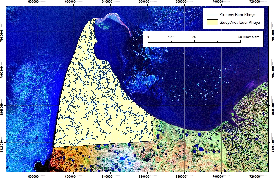
-
Thermo-erosional valleys and streams in ice-rich permafrost lowlands from Landsat, 2000, Hexagon, 1975, Lena Delta,...
The published dataset provides an inventory of thermo-erosional landforms and streams in three lowland areas underlain by ice-rich permafrost of the Yedoma-type Ice Complex at...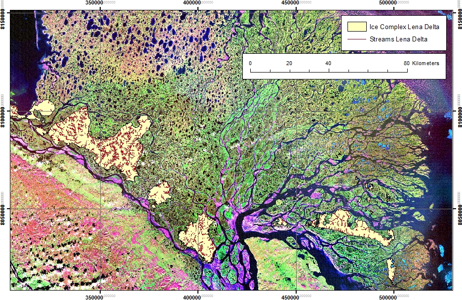
-
Thermo-erosional valleys and streams in ice-rich permafrost lowlands from Landsat, 2000, Hexagon, 1975, Cape...
The published dataset provides an inventory of thermo-erosional landforms and streams in three lowland areas underlain by ice-rich permafrost of the Yedoma-type Ice Complex at...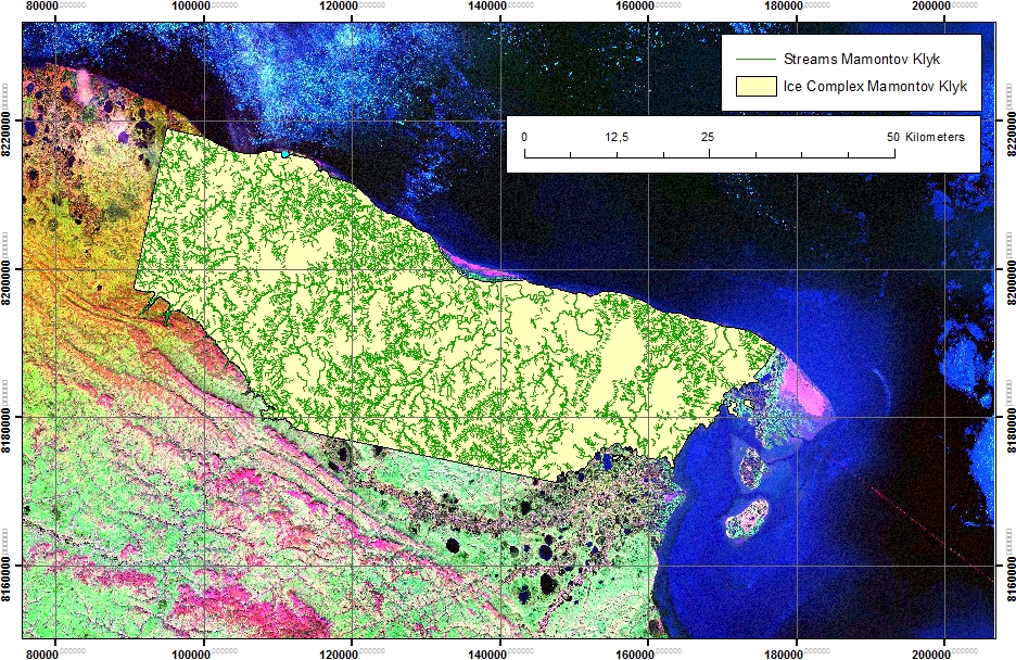
-
Mapped yedoma ice wedge polygon patterns from WorldView-1, 2008, Northern Seward Peninsula, Chukchi Sea coast, Alaska (US)
Detailed calculations of ground-ice volumes in permafrost deposits are necessary to understand and quantify the response of permafrost landscapes to thermal disturbance and...
-
Mapped yedoma ice wedge polygon patterns from GeoEye-1, 2010, Cape Mamontov Klyk, Laptev Sea coast, Siberia (RU)
Detailed calculations of ground-ice volumes in permafrost deposits are necessary to understand and quantify the response of permafrost landscapes to thermal disturbance and...
-
Mapped yedoma ice wedge polygon patterns from GeoEye-1, 2009, Buor Khaya, Laptev Sea coast, Siberia (RU)
Detailed calculations of ground-ice volumes in permafrost deposits are necessary to understand and quantify the response of permafrost landscapes to thermal disturbance and...
-
Mapped thermokarst ice wedge polygon patterns from WorldView-1, 2009, Ebe-Basyn-Sise Island, SW Lena Delta, Siberia (RU)
Detailed calculations of ground-ice volumes in permafrost deposits are necessary to understand and quantify the response of permafrost landscapes to thermal disturbance and...
-
Mapped thermokarst ice wedge polygon patterns from WorldView-1, 2008, Northern Seward Peninsula, Chukchi Sea coast,...
Detailed calculations of ground-ice volumes in permafrost deposits are necessary to understand and quantify the response of permafrost landscapes to thermal disturbance and...
-
Mapped thermokarst ice wedge polygon patterns from GeoEye-1, 2010, Cape Mamontov Klyk, Laptev Sea coast, Siberia (RU)
Detailed calculations of ground-ice volumes in permafrost deposits are necessary to understand and quantify the response of permafrost landscapes to thermal disturbance and...
-
Coastal Retrogressive Thaw Slumps from GeoEye-1, WorldView-2 and Aerial Photographs, 2011, Yukon Coast (CA)
Coastal retrogressive thaw slumps (RTSs) were manually digitized at a 1:2000 scale using ArcMap (ESRI, version 10.3) from high‐resolution satellite images acquired in July (13...
-
Mapped yedoma ice wedge polygon patterns from WorldView-1, 2009, Ebe-Basyn-Sise Island, SW Lena Delta, Siberia (RU)
Detailed calculations of ground-ice volumes in permafrost deposits are necessary to understand and quantify the response of permafrost landscapes to thermal disturbance and...
-
Mapped polygon pattern geomorphometry from HRSC-AX, 2009, IWS Adventdalen, Svalbard (NO)
Polygonal systems formed by thermal contraction cracking are complex landscape features widespread in terrestrial periglacial regions. The manner in which cracking occurs is...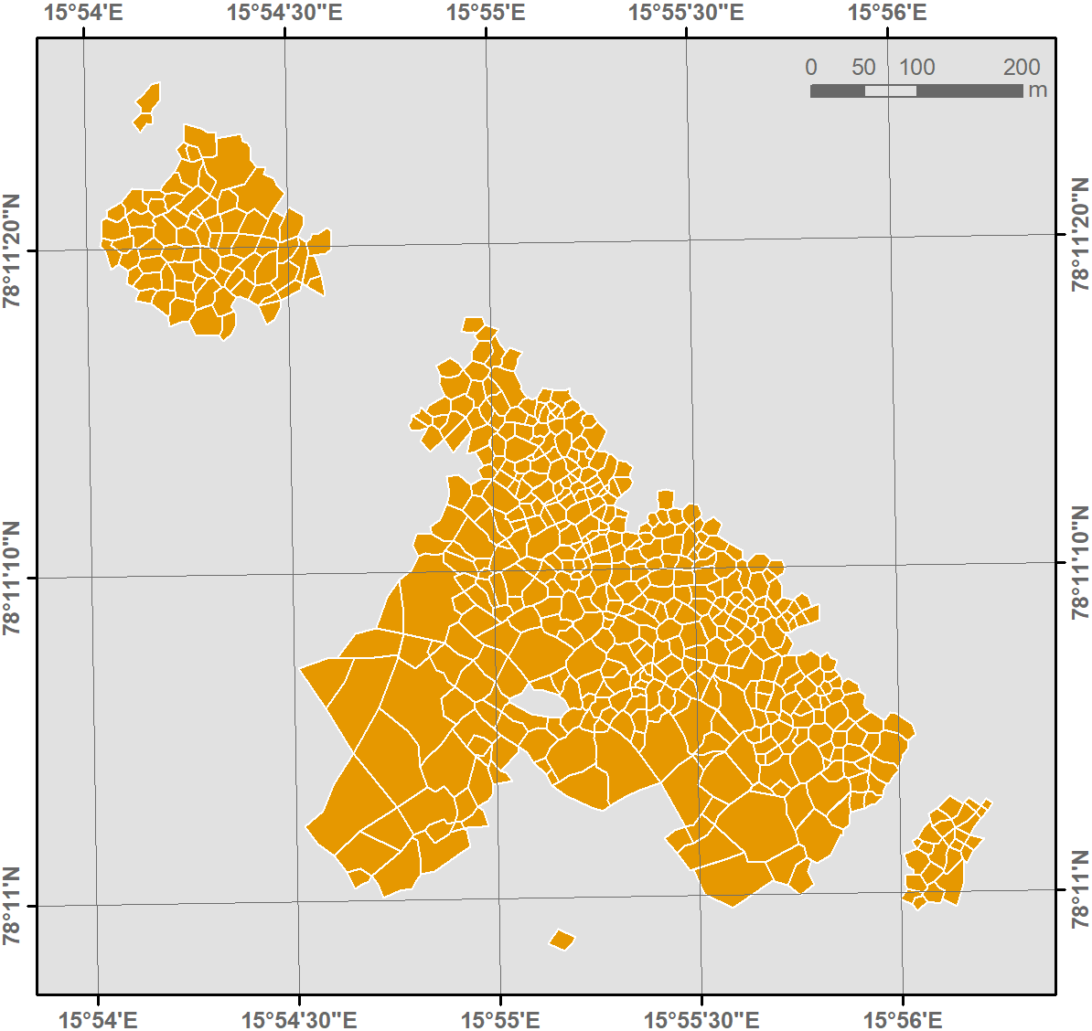
-
Mapped polygon pattern geomorphometry from HRSC-AX, 2009, HCP Adventdalen, Svalbard (NO)
Polygonal systems formed by thermal contraction cracking are complex landscape features widespread in terrestrial periglacial regions. The manner in which cracking occurs is...
-
Mapped polygon pattern geomorphometry from HRSC-AX, 2009, CALM Adventdalen, Svalbard (NO)
Polygonal systems formed by thermal contraction cracking are complex landscape features widespread in terrestrial periglacial regions. The manner in which cracking occurs is...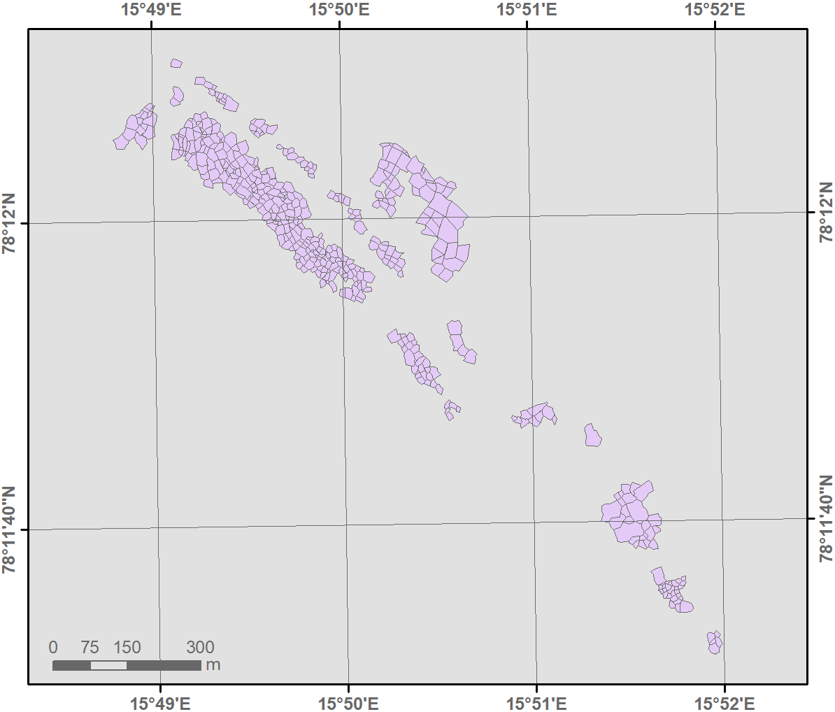
-
Mapped polygon pattern geomorphometry from HRSC-AX, 2009, AD4 Adventdalen, Svalbard (NO)
Polygonal systems formed by thermal contraction cracking are complex landscape features widespread in terrestrial periglacial regions. The manner in which cracking occurs is...
-
Mapped polygon pattern geomorphometry from HRSC-AX, 2009, AD3 Adventdalen, Svalbard (NO)
Polygonal systems formed by thermal contraction cracking are complex landscape features widespread in terrestrial periglacial regions. The manner in which cracking occurs is...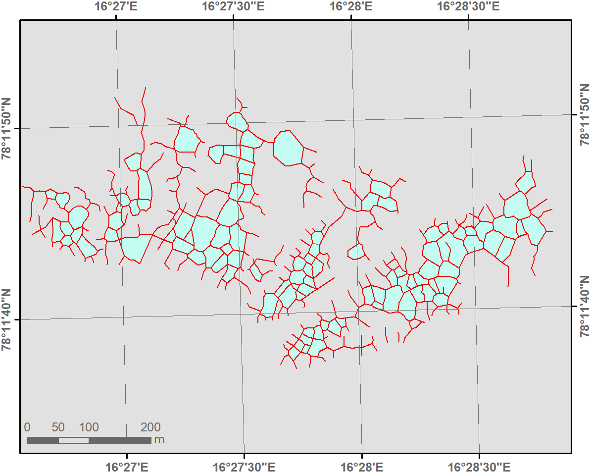
-
Mapped polygon pattern geomorphometry from HRSC-AX, 2009, AD2 Adventdalen, Svalbard (NO)
Polygonal systems formed by thermal contraction cracking are complex landscape features widespread in terrestrial periglacial regions. The manner in which cracking occurs is...
-
Mapped polygon pattern geomorphometry from HRSC-AX, 2009, Act-IWS Adventdalen, Svalbard (NO)
Polygonal systems formed by thermal contraction cracking are complex landscape features widespread in terrestrial periglacial regions. The manner in which cracking occurs is...
-
Mapped polygon pattern geomorphometry from HRSC-AX, 2009, Isdammen Adventdalen, Svalbard (NO)
Polygonal systems formed by thermal contraction cracking are complex landscape features widespread in terrestrial periglacial regions. The manner in which cracking occurs is...