-
Gridded monthly methane emissions from terrestrial wetlands, north of 45 °N, 2013-2014
This dataset provides wetland methane (CH4) emissions, their uncertainties and underlying CH4 flux densities north from 45 N using three different wetland maps. The data...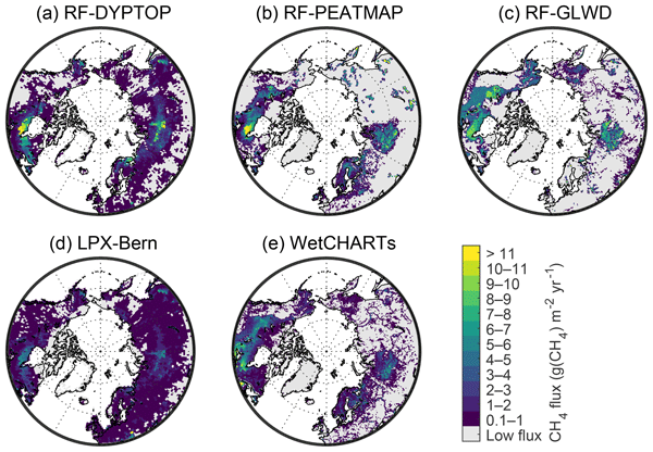
-
PEATMAP - peatland distribution maps based on meta-analysis, 1999-2010, Global
PEATMAP is a GIS shapefile dataset that shows a distribution of peatlands that covers the entire world. It was produced by combining the most high quality available peatland map...