-
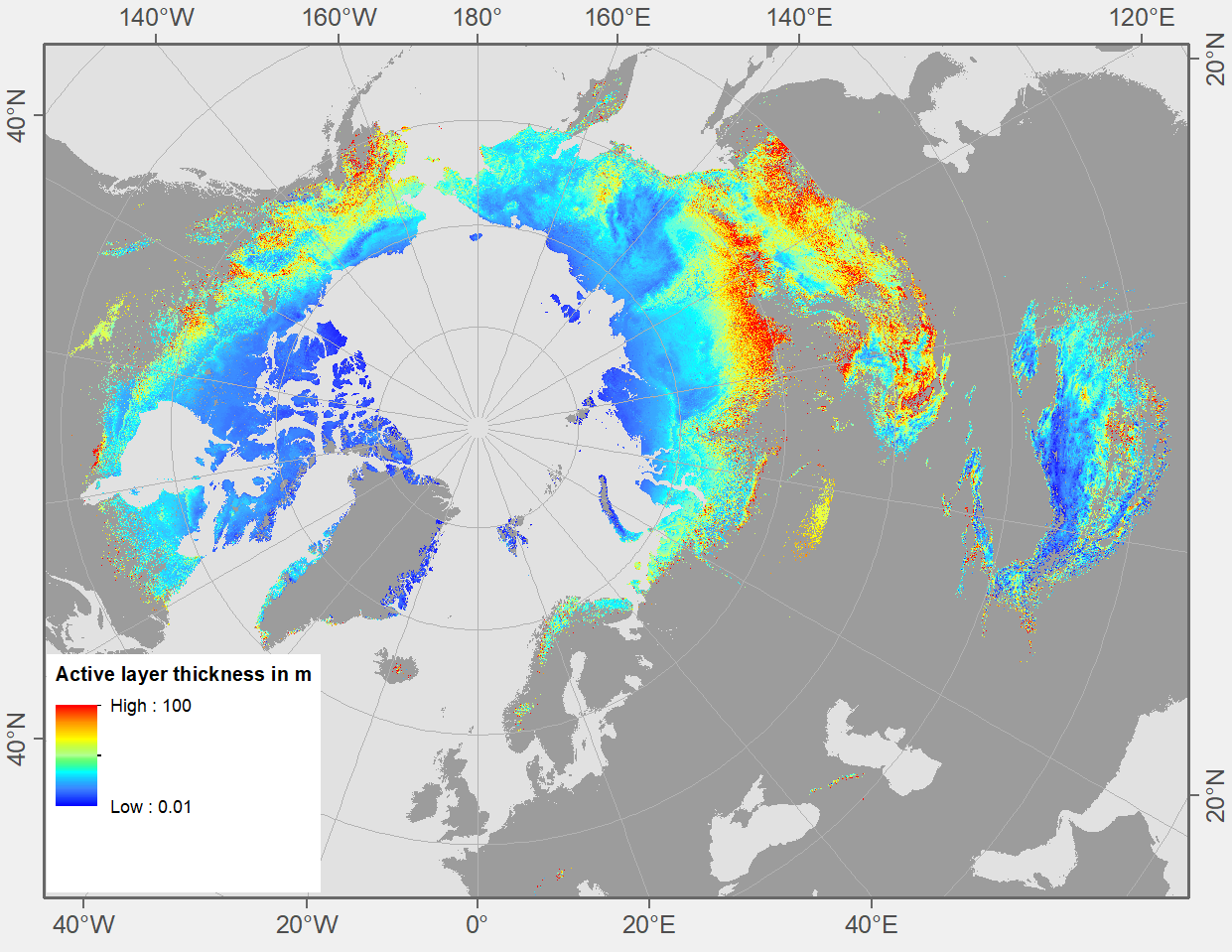
Permafrost active layer thickness for the Northern Hemisphere, v4.0 from MODIS LST, ERA5, 1997-2021
This dataset contains v4.0 permafrost active layer thickness data produced as part of the European Space Agency's (ESA) Climate Change Initiative (CCI) Permafrost project. It... -
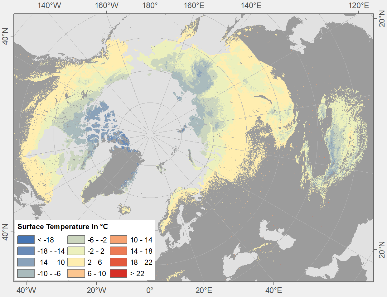
Permafrost ground temperature for the Northern Hemisphere, v4.0 from MODIS LST, ERA5, 1997-2021
This dataset contains v4.0 permafrost ground temperature data produced as part of the European Space Agency's (ESA) Climate Change Initiative (CCI) Permafrost project. It forms... -
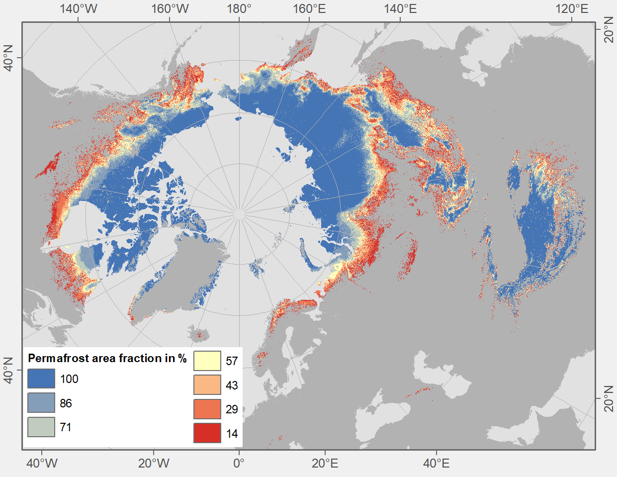
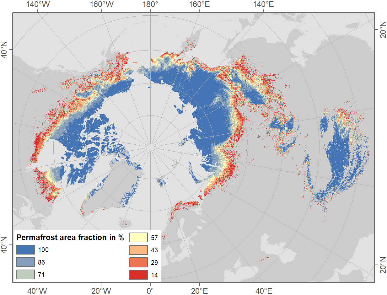
Permafrost extent for the Northern Hemisphere, v4.0 from MODIS LST, ERA5, 1997-2021
This dataset contains v4.0 permafrost extent data produced as part of the European Space Agency's (ESA) Climate Change Initiative (CCI) Permafrost project. It forms part of the... -
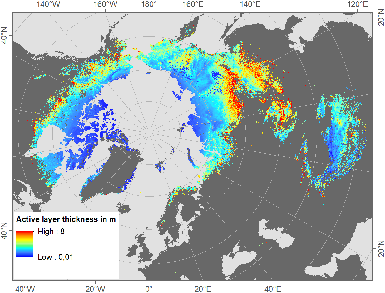
Permafrost active layer thickness for the Northern Hemisphere, v3.0 from MODIS LST, ERA5, 1997-2019
This dataset contains permafrost active layer thickness data produced as part of the European Space Agency's (ESA) Climate Change Initiative (CCI) Permafrost project. It forms... -
Permafrost active layer thickness for the Northern Hemisphere, v2.0 from MODIS LST, ERA5, 1997-2018
This dataset contains permafrost active layer thickness data produced as part of the European Space Agency's (ESA) Climate Change Initiative (CCI) Permafrost project. It forms... -
Permafrost ground temperature for the Northern Hemisphere, v2.0 from MODIS LST, ERA5, 1997-2018
This dataset contains permafrost ground temperature data produced as part of the European Space Agency's (ESA) Climate Change Initiative (CCI) Permafrost project. It forms part... -
Permafrost extent for the Northern Hemisphere, v2.0 from MODIS LST, ERA5, 1997-2018
This dataset contains permafrost extent data produced as part of the European Space Agency's (ESA) Climate Change Initiative (CCI) Permafrost project. It forms part of the first... -
Active layer depth map, 1960-1987, Yakutia, ASSR
The rasterized map of active layer depth of Yakutia, East Siberia, was derived based on the map of landscapes and permafrost conditions in Yakutia (Merzlotno-landshaftnaya karta... -
Permafrost temperature map, 1960-1987, Yakutia, ASSR
The rasterized map of permafrost temperature of Yakutia, East Siberia, was derived based on the map of landscapes and permafrost conditions in Yakutia (Merzlotno-landshaftnaya...

