-
Mapped polygon pattern geomorphometry from HRSC-AX, 2009, AD2 Adventdalen, Svalbard (NO)
Polygonal systems formed by thermal contraction cracking are complex landscape features widespread in terrestrial periglacial regions. The manner in which cracking occurs is...
-
Mapped polygon pattern geomorphometry from HRSC-AX, 2009, Act-IWS Adventdalen, Svalbard (NO)
Polygonal systems formed by thermal contraction cracking are complex landscape features widespread in terrestrial periglacial regions. The manner in which cracking occurs is...
-
Mapped polygon pattern geomorphometry from HRSC-AX, 2009, Isdammen Adventdalen, Svalbard (NO)
Polygonal systems formed by thermal contraction cracking are complex landscape features widespread in terrestrial periglacial regions. The manner in which cracking occurs is...
-
Geomorphological main terraces from Landsat 2000-2001, Lena Delta, Laptev and East Siberian Sea Region (RU)
This data set provides a detailed inventory of lakes in the Lena Delta, northern Siberia, with respect to the lakes' association with one of the three geomorphological main...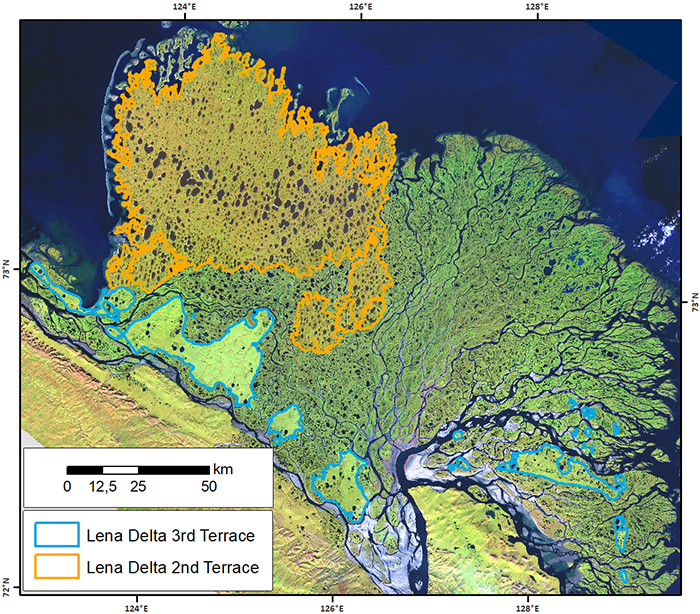
-
Mapped thermokarst ice wedge polygon patterns from GeoEye-1, 2009, Buor Khaya, Laptev Sea coast, Siberia (RU)
Detailed calculations of ground-ice volumes in permafrost deposits are necessary to understand and quantify the response of permafrost landscapes to thermal disturbance and...
-
Geomorphological units from field mapping, Irizar - Crater Lake Area, Deception Island, Antarctica
The map describes the main geomorphological features according to surface cover type on Irizar - Crater Lake Area, Deception Island, Antarctica. The map was developed to support...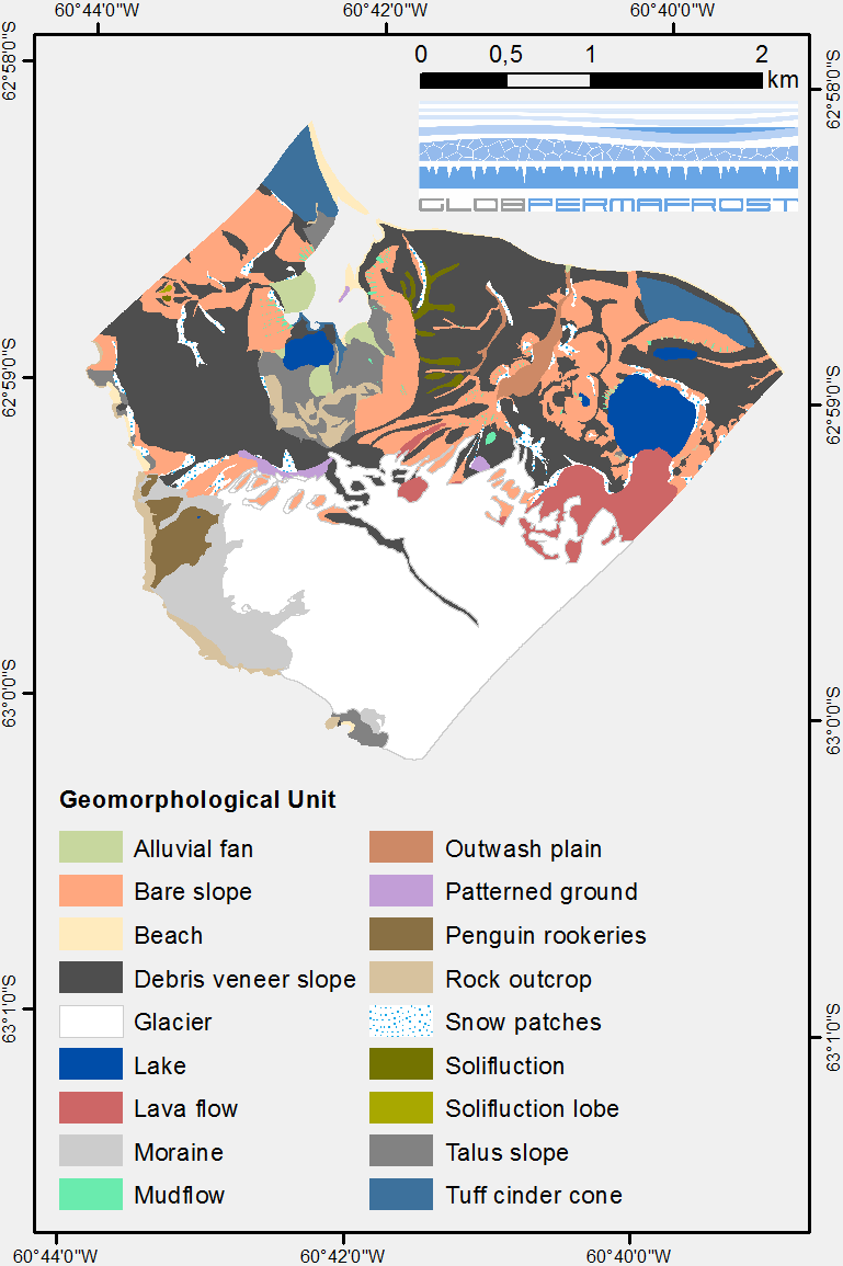
-
Geomorphological units from field mapping, Hurd Peninsula, Livingston Island, Antarctica
The map shows the geomorphological units of Hurd Peninsula on Livingston Island. Mapping was done with high resolution field mapping supported by the analysis of a QuickBird...