-
Surface Soil Moisture from ENVISAT ASAR GM, 2005-2010, Laptev Sea Coast, Laptev and East Siberian Sea Region (RU)
The SAR Surface Soil Moisture (SSM) product is derived from the ENVISAT ASAR sensor operating in Global Monitoring (GM) mode. The SAR SSM product is a weekly mean composite at 1... -
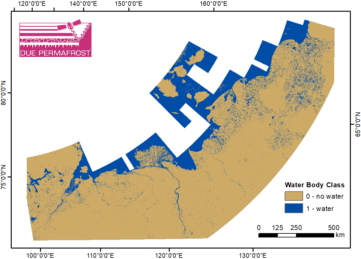
Water Body Classification from ENVISAT ASAR Wide Swath, 2007-2011, Lena Delta / East Taymir / Cherskii, Laptev and...
The regional waterbody classification is derived from ENVISAT ASAR Wide Swath data with 150 m resolution. Maps represent the extent of water bodies for the summer months July... -
Land Surface Feature Classification from TerraSAR-X, 2013, Lena Delta, Laptev and East Siberian Sea Region (RU)
Land surface features (water, wetland, tundra, and bare surfaces) were classified from TerraSAR-X with a resolution of 5 m for August 2012 and July 2014. The product is based on... -
Vegetation Height from Sentinel-1 and Sentinel-2, 2016-2018, Lena Delta, Laptev and East Siberian Sea Region (RU)
Vegetation height has been derived from Sentinel-1 satellite data acquired in VV mode with a resolution of 20 m. Vegetation height was estimated using an empirical model on... -
Frozen State Backscatter Intensity from Sentinel-1, 2014-2016, Lena Delta, Laptev and East Siberian Sea Region (RU)
Frozen state backscatter intensity was derived from Sentinel-1 acquisitions from December 2015 and 2016. By excluding the effects of liquid water content (acquisitions under... -
Freeze/Thaw Timing from ENVISAT ASAR GM, 2005-2010, Laptev Sea Coast, Laptev and East Siberian Sea Region (RU)
The SAR Freeze/Thaw product indicates the timing (day of year) of ground surface freeze-up and thawing at a resolution of 1 km. It is derived from the ENVISAT ASAR sensor... -
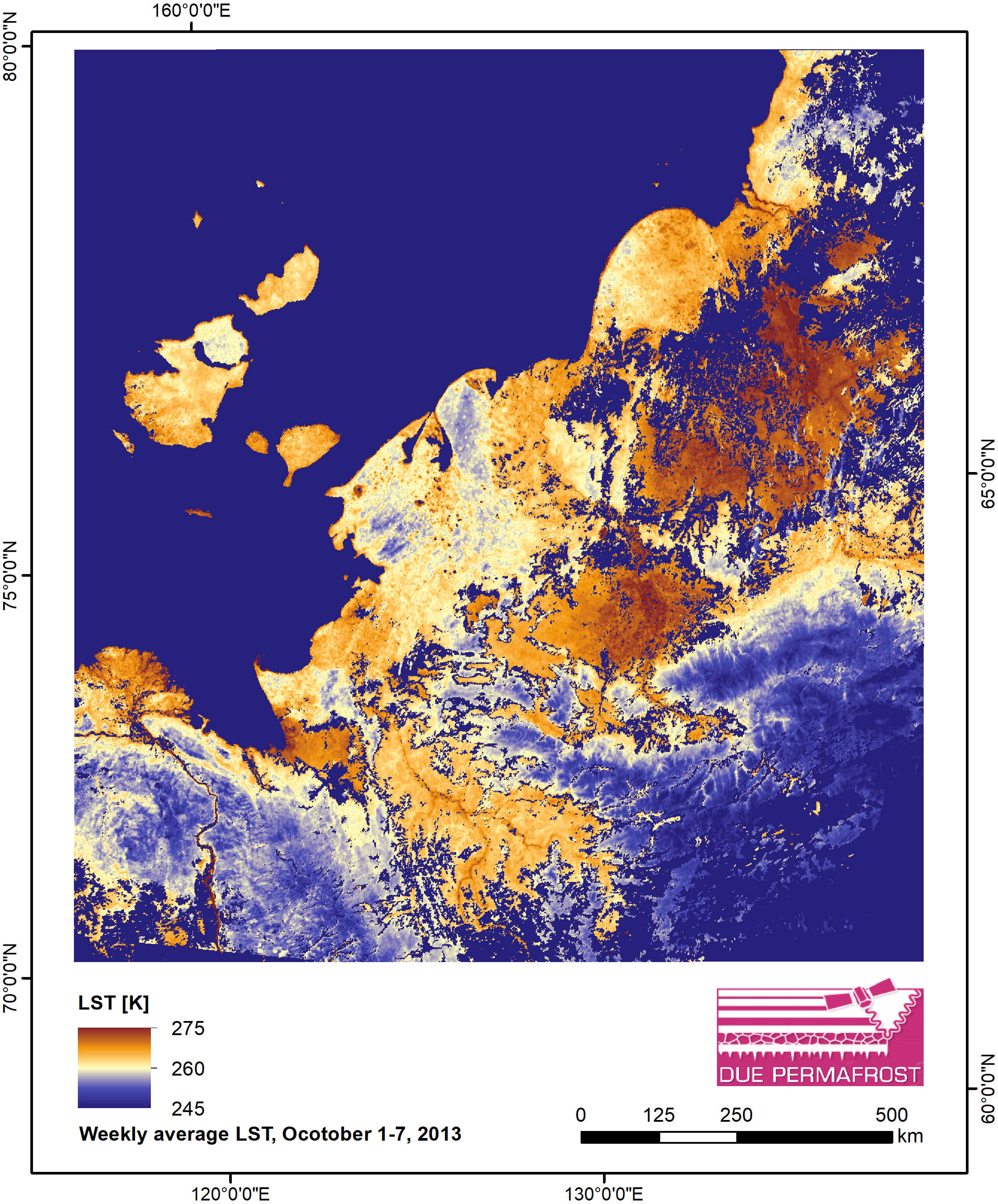
Weekly Land Surface Temperature from MODIS, 2013, Laptev Sea Coast, Laptev and East Siberian Sea Region (RU)
Weekly land surface temperature (LST) products of the ESA Data User Element (DUE) Permafrost are provided at 1 km spatial resolution. Weekly LST are available for the years 2007... -
Weekly Land Surface Temperature from MODIS, 2012, Laptev Sea Coast, Laptev and East Siberian Sea Region (RU)
Weekly land surface temperature (LST) products of the ESA Data User Element (DUE) Permafrost are provided at 1 km spatial resolution. Weekly LST are available for the years 2007... -
Weekly Land Surface Temperature from MODIS, 2011, Laptev Sea Coast, Laptev and East Siberian Sea Region (RU)
Weekly land surface temperature (LST) products of the ESA Data User Element (DUE) Permafrost are provided at 1 km spatial resolution. Weekly LST are available for the years 2007... -
Weekly Land Surface Temperature from MODIS, 2010, Laptev Sea Coast, Laptev and East Siberian Sea Region (RU)
Weekly land surface temperature (LST) products of the ESA Data User Element (DUE) Permafrost are provided at 1 km spatial resolution. Weekly LST are available for the years 2007... -
Weekly Land Surface Temperature from MODIS, 2009, Laptev Sea Coast, Laptev and East Siberian Sea Region (RU)
Weekly land surface temperature (LST) products of the ESA Data User Element (DUE) Permafrost are provided at 1 km spatial resolution. Weekly LST are available for the years 2007... -
Weekly Land Surface Temperature from MODIS, 2008, Laptev Sea Coast, Laptev and East Siberian Sea Region (RU)
Weekly land surface temperature (LST) products of the ESA Data User Element (DUE) Permafrost are provided at 1 km spatial resolution. Weekly LST are available for the years 2007... -
Weekly Land Surface Temperature from MODIS, 2007, Laptev Sea Coast, Laptev and East Siberian Sea Region (RU)
Weekly land surface temperature (LST) products of the ESA Data User Element (DUE) Permafrost are provided at 1 km spatial resolution. Weekly LST are available for the years 2007... -
Monthly Land Surface Temperature from MODIS, 2007-2013, Laptev Sea Coast, Laptev and East Siberian Sea Region (RU)
Monthly land surface temperature (LST) products of the ESA Data User Element (DUE) Permafrost are provided at 1 km spatial resolution for the Alaska, Mackenzie, Laptev Sea... -
Surface Subsidence Map from Sentinel-1 InSAR, 2016-2018, Lena Delta, Laptev and East Siberian Sea Region (RU)
Surface subsidence was derived from Sentinel-1 synthetic aperture radar time-series with a spatial resolution of 10 m. Maps show the averaged displacement rates during the snow... -
Lake Ice Classification from Sentinel-1, 2015-2018, Lena Delta, Laptev and East Siberian Sea Region (RU)
Weekly lake ice classifications distinguish grounded ice and floating ice in lakes based on Sentinel-1A and Sentinel-1B synthetic aperture radar time-series with a resolution of...


