-
Pan-Arctic thermokarst lagoon distribution, area and classification from Landsat images, 1984 to 2021
Thermokarst lagoons develop in permafrost lowlands along the ice-rich Arctic coast when thermokarst lakes or basins with bottom elevations at or below sea level are breached by...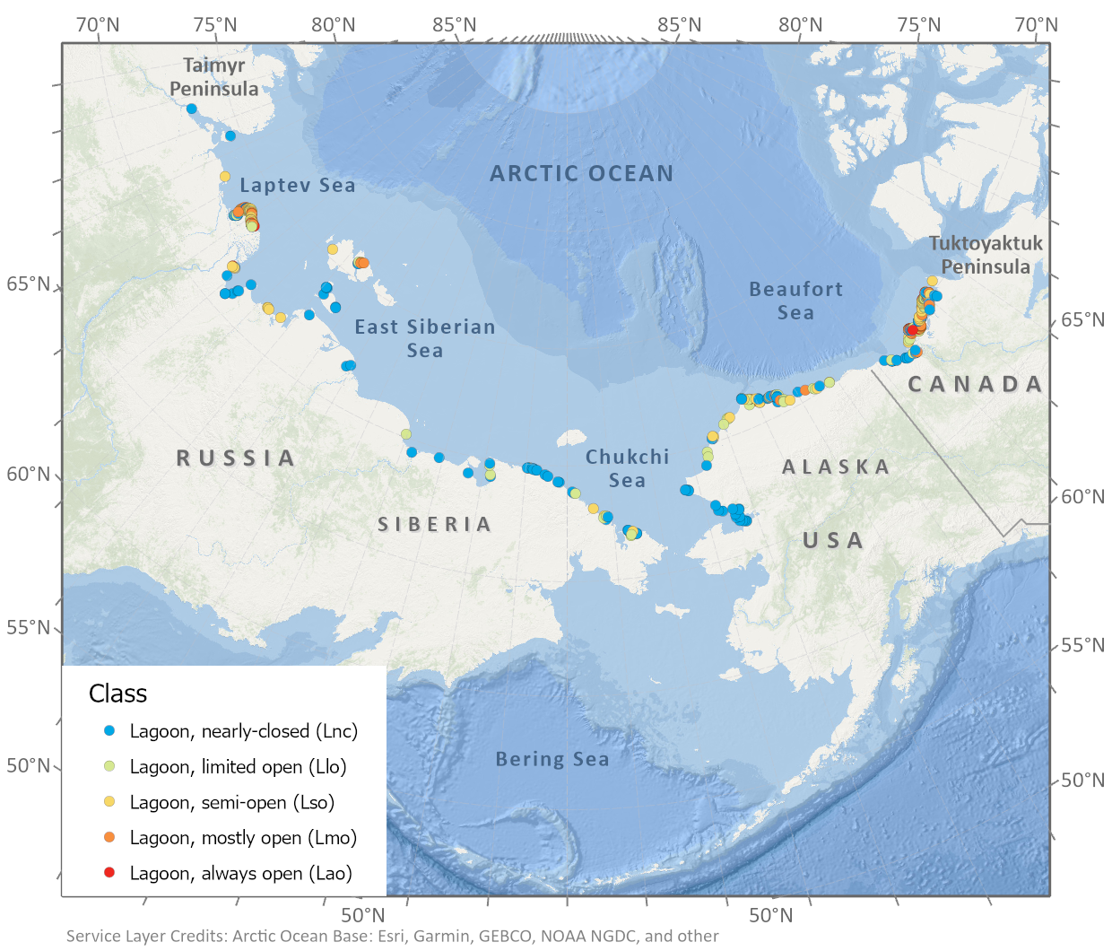
-
Spatial lake dynamics and lake-ice datasets of the Northern Seward and Baldwin Peninsulas in Alaska
The data publication contains supplementary data to the article "Supplementary Dataset to: The catastrophic thermokarst lake drainage events of 2018 in northwestern Alaska:...
-
Pan-Arctic Visualization of Landscape Change (2003-2022), Arctic PASSION Permafrost Service
This raster dataset, in Cloud Optimized GeoTIFF format (COG), provides information on land surface changes at the pan-arctic scale. Multispectral Landsat-5 TM, Landsat-7 ETM+,...
-
Inorganic and organic hydrochemistry of lakes and ponds in continuous permafrost landscapes in the western Canadian...
Between 2006 and 2015 inorganic and organic hydrochemical parameters and stable water isotope characteristics were measured in lakes and ponds in continuous permafrost...
-
Lake-DOC Database (PeRL-DOCv1), 1979-2017, Permafrost-Region
The pan-Arctic Permafrost-Region Lake-DOC version1 database contains surface water samples of lakes in the permafrost regions of Alaska (49.3 %), Canada (24.2 %), Greenland (3.2...
-
Quantification of shoreline movements from satellite remote sensing, 1951-2011, Yukon Territory mainland coast (CA)
The Arctic is warming, but the impacts on its coasts are not well documented. To better understand the reaction of Arctic coasts to increasing environmental pressure, shoreline...
-
Arctic Coastal Dynamics Classification Database
An important outcome of Arctic Coastal Dynamics I was the segmentation and characterization of the entire circum-Arctic coastline by regional experts which is presented in this...