-
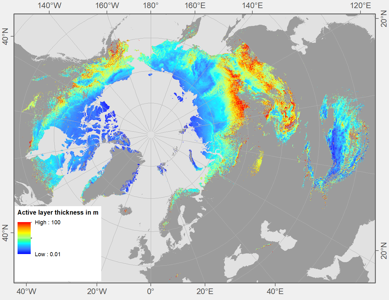
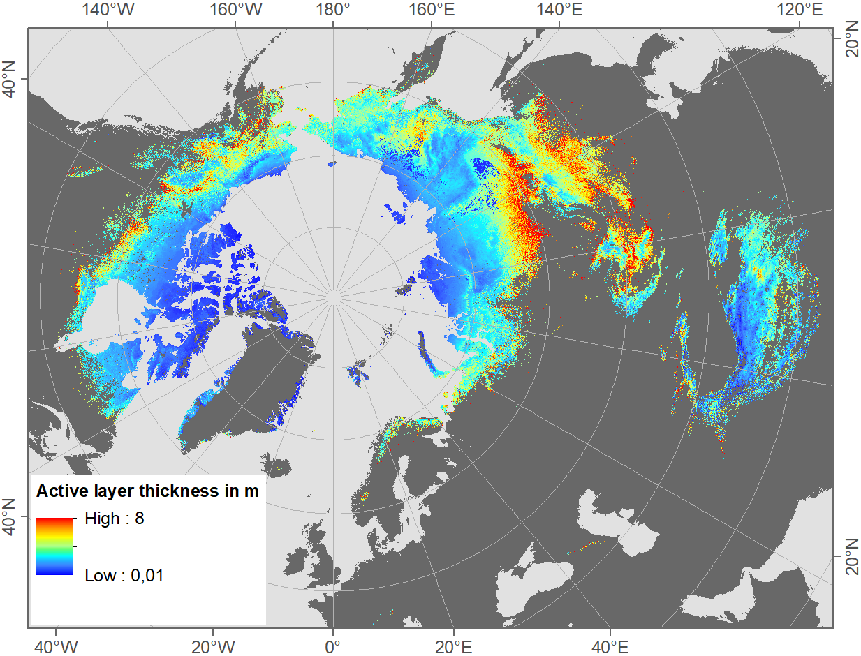
Permafrost active layer thickness for the Northern Hemisphere, v4.0 from MODIS LST, ERA5, 1997-2021
This dataset contains v4.0 permafrost active layer thickness data produced as part of the European Space Agency's (ESA) Climate Change Initiative (CCI) Permafrost project. It... -
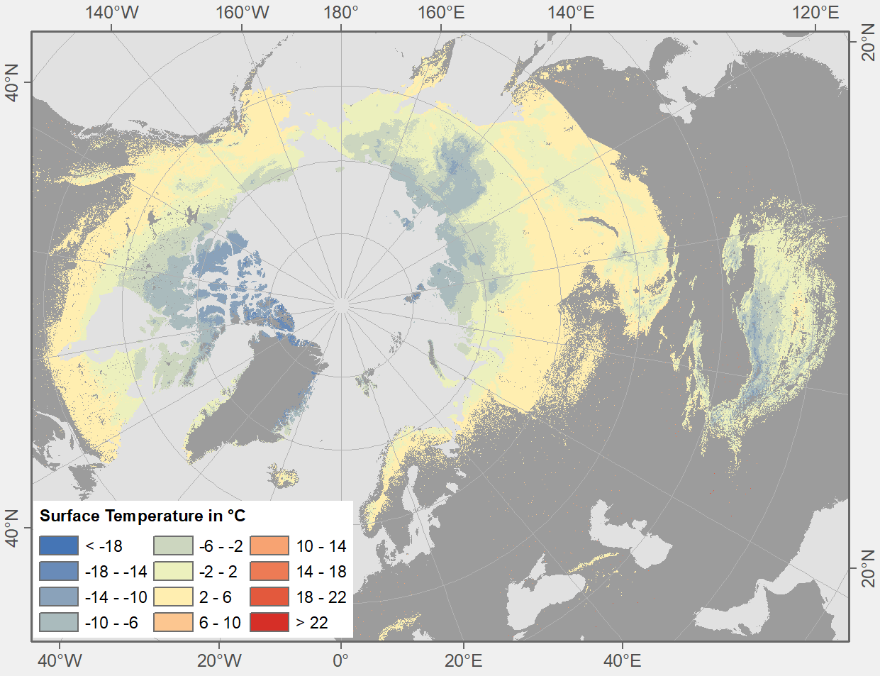
Permafrost ground temperature for the Northern Hemisphere, v4.0 from MODIS LST, ERA5, 1997-2021
This dataset contains v4.0 permafrost ground temperature data produced as part of the European Space Agency's (ESA) Climate Change Initiative (CCI) Permafrost project. It forms... -
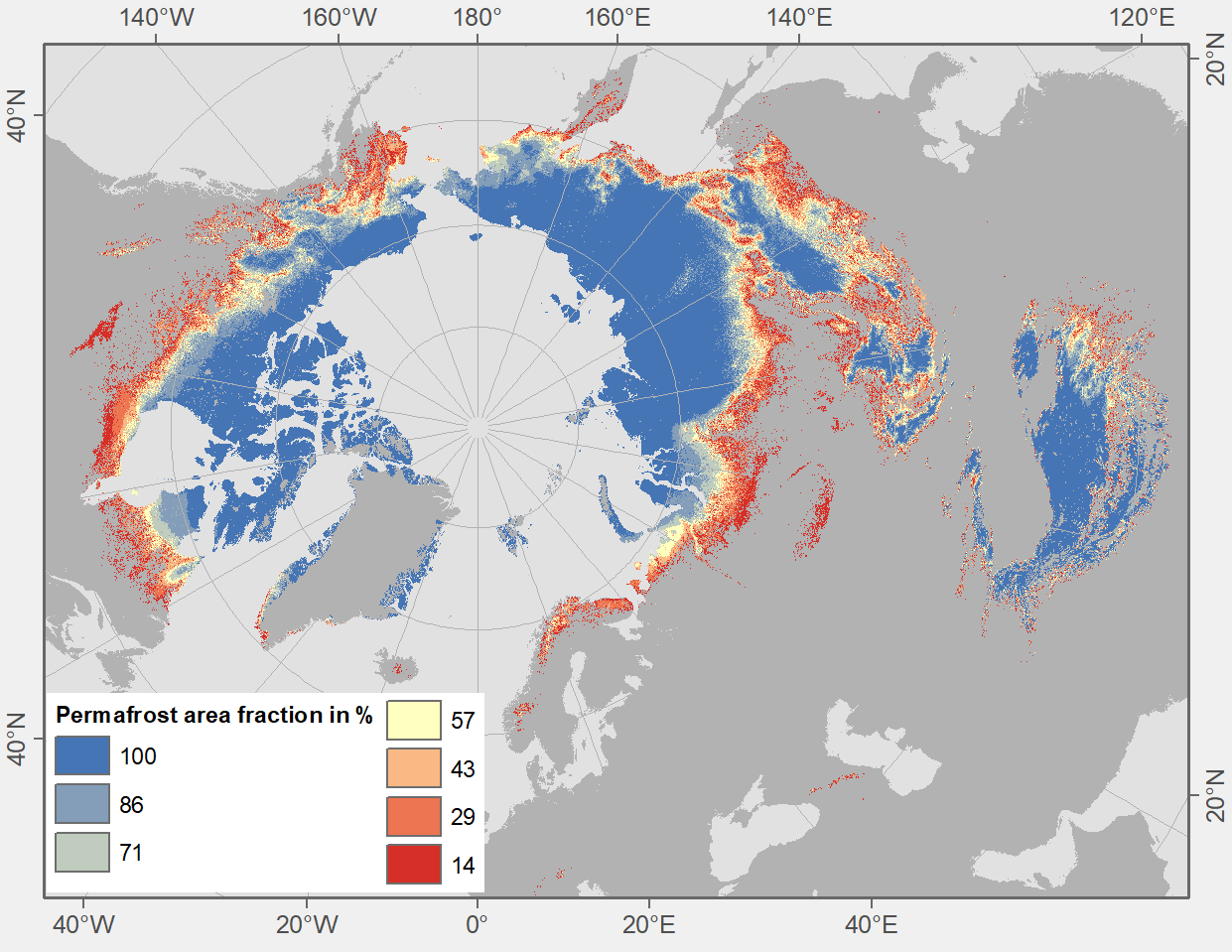
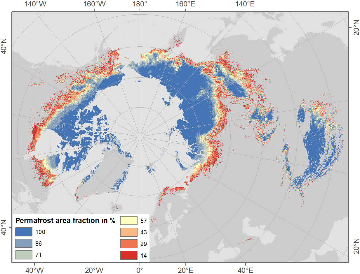
Permafrost extent for the Northern Hemisphere, v4.0 from MODIS LST, ERA5, 1997-2021
This dataset contains v4.0 permafrost extent data produced as part of the European Space Agency's (ESA) Climate Change Initiative (CCI) Permafrost project. It forms part of the... -
Surface Soil Moisture from ENVISAT ASAR GM, 2005-2010, Laptev Sea Coast, Laptev and East Siberian Sea Region (RU)
The SAR Surface Soil Moisture (SSM) product is derived from the ENVISAT ASAR sensor operating in Global Monitoring (GM) mode. The SAR SSM product is a weekly mean composite at 1... -
Surface Soil Moisture from ENVISAT ASAR GM, 2005-2011, Mackenzie River Valley and Delta, Beaufort Sea Region (CA)
The SAR Surface Soil Moisture (SSM) product is derived from the ENVISAT ASAR sensor operating in Global Monitoring (GM) mode. The SAR SSM product is a weekly mean composite at 1... -
Surface Soil Moisture from ENVISAT ASAR GM, 2005-2011, Ob Estuary and Yamal Peninsula, Western Siberia (RU)
The SAR Surface Soil Moisture (SSM) product is derived from the ENVISAT ASAR sensor operating in Global Monitoring (GM) mode. The SAR SSM product is a weekly mean composite at 1... -
Surface Soil Moisture from ENVISAT ASAR GM, 2005-2011, Yakutsk, Central Yakutia (RU)
The SAR Surface Soil Moisture (SSM) product is derived from the ENVISAT ASAR sensor operating in Global Monitoring (GM) mode. The SAR SSM product is a weekly mean composite at 1... -
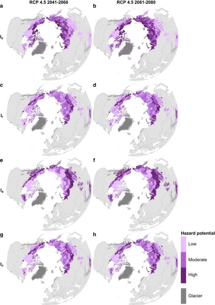
Circumpolar raster grids of permafrost extent and geohazard potential for near-future climate scenarios
One of the consequences of warming climate is rising ground temperatures and degradation of perennially frozen ground, permafrost. Thawing of near-surface permafrost can cause... -
Permafrost active layer thickness for the Northern Hemisphere, v3.0 from MODIS LST, ERA5, 1997-2019
This dataset contains permafrost active layer thickness data produced as part of the European Space Agency's (ESA) Climate Change Initiative (CCI) Permafrost project. It forms... -
Permafrost active layer thickness for the Northern Hemisphere, v2.0 from MODIS LST, ERA5, 1997-2018
This dataset contains permafrost active layer thickness data produced as part of the European Space Agency's (ESA) Climate Change Initiative (CCI) Permafrost project. It forms... -
Permafrost extent for the Northern Hemisphere, v3.0 from MODIS LST, ERA5, 1997-2019
This dataset contains permafrost extent data produced as part of the European Space Agency's (ESA) Climate Change Initiative (CCI) Permafrost project. It forms part of the... -
Permafrost ground temperature for the Northern Hemisphere, v3.0 from MODIS LST, ERA5, 1997-2019
This dataset contains permafrost ground temperature data produced as part of the European Space Agency's (ESA) Climate Change Initiative (CCI) Permafrost project. It forms part... -
Permafrost ground temperature for the Northern Hemisphere, v2.0 from MODIS LST, ERA5, 1997-2018
This dataset contains permafrost ground temperature data produced as part of the European Space Agency's (ESA) Climate Change Initiative (CCI) Permafrost project. It forms part... -
Permafrost extent for the Northern Hemisphere, v2.0 from MODIS LST, ERA5, 1997-2018
This dataset contains permafrost extent data produced as part of the European Space Agency's (ESA) Climate Change Initiative (CCI) Permafrost project. It forms part of the first... -
Permafrost Extent and Ground Temperature Map, 2000-2016, Northern Hemisphere Permafrost
The product provides modeled mean annual ground temperatures (MAGT) at the top of the permafrost for the Northern Hemisphere at 1 km spatial resolution. Permafrost probability... -
Surface Soil Moisture from ENVISAT ASAR GM, 2005-2011, Alaska North Slope and Alaska Highway, Alaska (US)
The SAR Surface Soil Moisture (SSM) product is derived from the ENVISAT ASAR sensor operating in Global Monitoring (GM) mode. The SAR SSM product is a weekly mean composite at 1... -
Freeze/Thaw Timing from ENVISAT ASAR GM, 2005-2010, Ob Estuary and Yamal Peninsula, Western Siberia (RU)
The SAR Freeze/Thaw product indicates the timing (day of year) of ground surface freeze-up and thawing at a resolution of 1 km. It is derived from the ENVISAT ASAR sensor... -
Freeze/Thaw Timing from ENVISAT ASAR GM, 2005-2010, Yakutsk, Central Yakutia (RU)
The SAR Freeze/Thaw product indicates the timing (day of year) of ground surface freeze-up and thawing at a resolution of 1 km. It is derived from the ENVISAT ASAR sensor... -
Freeze/Thaw Timing from ENVISAT ASAR GM, 2005-2010, Laptev Sea Coast, Laptev and East Siberian Sea Region (RU)
The SAR Freeze/Thaw product indicates the timing (day of year) of ground surface freeze-up and thawing at a resolution of 1 km. It is derived from the ENVISAT ASAR sensor... -
Freeze/Thaw Timing from ENVISAT ASAR GM, 2005-2010, Mackenzie River Valley and Delta, Beaufort Sea Region (CA)
The SAR Freeze/Thaw product indicates the timing (day of year) of ground surface freeze-up and thawing at a resolution of 1 km. It is derived from the ENVISAT ASAR sensor...
