-
Weekly Land Surface Temperature from MODIS, 2008, Mackenzie River Valley and Delta, Beaufort Sea Region (CA)
Weekly land surface temperature (LST) products of the ESA Data User Element (DUE) Permafrost are provided at 1 km spatial resolution. Weekly LST are available for the years 2007...
-
Weekly Land Surface Temperature from MODIS, 2007, Ob Estuary and Yamal Peninsula, Western Siberia (RU)
Weekly land surface temperature (LST) products of the ESA Data User Element (DUE) Permafrost are provided at 1 km spatial resolution. Weekly LST are available for the years 2007...
-
Weekly Land Surface Temperature from MODIS, 2007, Laptev Sea Coast, Laptev and East Siberian Sea Region (RU)
Weekly land surface temperature (LST) products of the ESA Data User Element (DUE) Permafrost are provided at 1 km spatial resolution. Weekly LST are available for the years 2007...
-
Weekly Land Surface Temperature from MODIS, 2007, Mackenzie River Valley and Delta, Beaufort Sea Region (CA)
Weekly land surface temperature (LST) products of the ESA Data User Element (DUE) Permafrost are provided at 1 km spatial resolution. Weekly LST are available for the years 2007...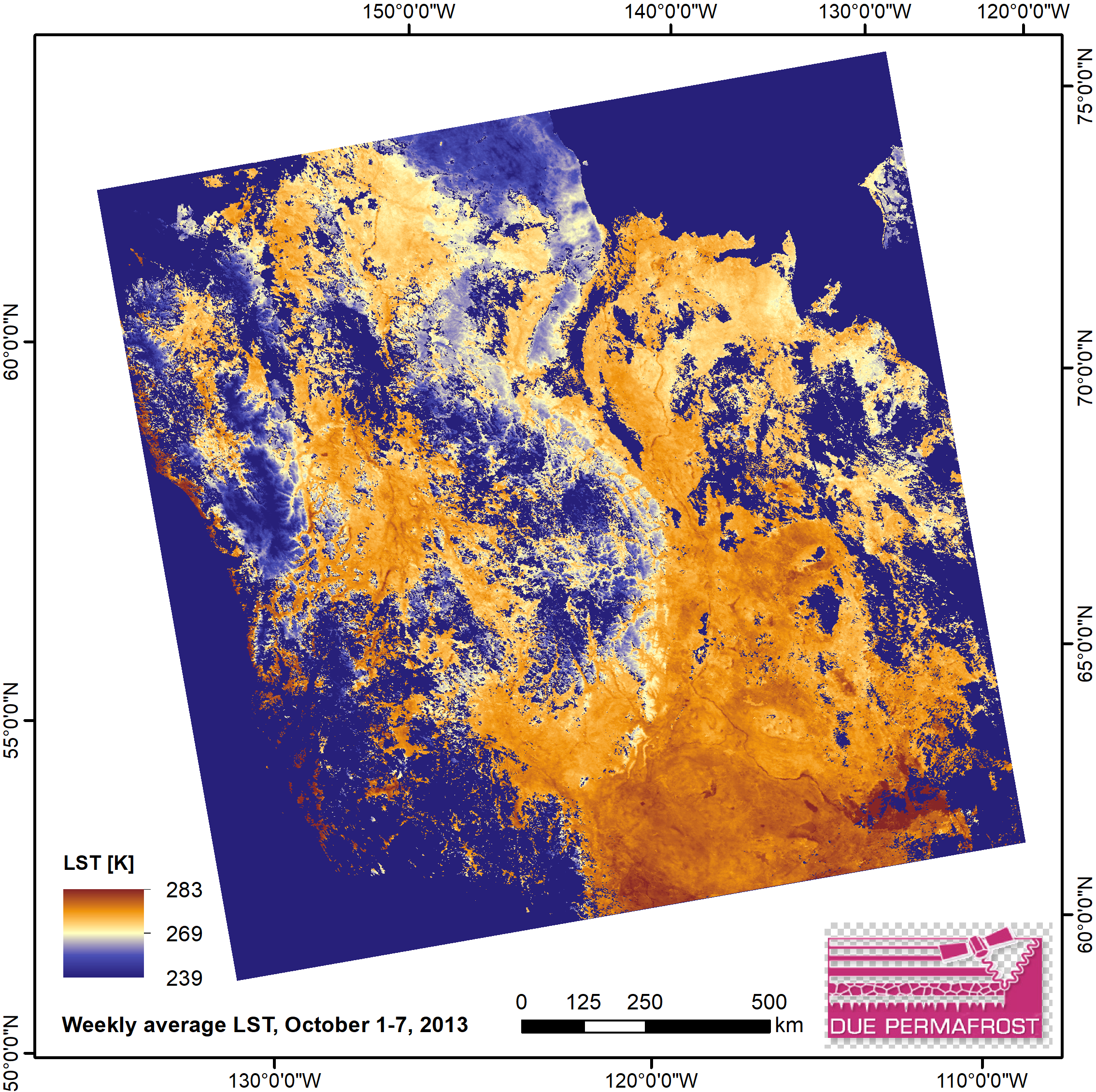
-
Database of Ice-Rich Yedoma Permafrost (IRYP)
We synthesized data on the circum-Arctic and sub-Arctic distribution and thickness of Yedoma for compiling a preliminary circum-polar Yedoma map. For compiling this map, we used...
-
Fluorescent dissolved organic matter (FDOM) intensity (Parafac components and FDOM indices) in the surface water...
Fluorescent dissolved organic matter intensity was measured with an Aqualog®. Measurements were corrected for inner-filter effects and for the Raman and Rayleigh scattering... -
Permafrost Region Pond and Lake Database (PeRL)
The Permafrost Region Pond and Lake Database (PeRL) presents the results of a circum-arctic effort to map ponds and lakes from modern (2002-2013) high-resolution aerial and...
-
Chamber measured methane transport through individual aerenchymous plants at a boreal fen and a bog
The presented dataset contains chamber measurements of methane transport (mg CH₄ g dry plant mass-1 day-1) through individual aerenchymous peatland plants and the ancillary data...
-
Remote sensing reflectance (Rrs) of the surface water during 4 expeditions from spring to fall in 2019, Mackenzie...
Vertical profiles of downwelling irradiance (Ed) and upwelling radiance (Lu) were measured during legs 2, 3, and 4 using a Compact-Optical Profiling System (C-OPS) in an ICE-Pro...
-
Coastal Retrogressive Thaw Slumps from GeoEye-1, WorldView-2 and Aerial Photographs, 2011, Yukon Coast (CA)
Coastal retrogressive thaw slumps (RTSs) were manually digitized at a 1:2000 scale using ArcMap (ESRI, version 10.3) from high‐resolution satellite images acquired in July (13...
-
Eddy covariance carbon fluxes and ancillary data, Samoylov Island, Lena River Delta, 2014-2015
This dataset contains fluxes of carbon dioxide and methane on an active flood plain in the Siberian Lena River Delta during the growing seasons 2014 and 2015 by means of the...
-
Wetland maps including open water extent dynamics based on ENVISAT ASAR WS for Siberia, 2007 and 2008
Wetlands store large amounts of carbon, and depending on their status and type, they release specific amounts of methane gas to the atmosphere. The connection between wetland...
-
Growing season, non-growing season and annual CH4 fluxes from temperate, boreal, and Arctic wetlands and uplands,...
Wetlands are the single largest natural source of atmospheric methane (CH4), a greenhouse gas, and occur extensively in the northern hemisphere. Large discrepancies remain...
-
Quantification of shoreline movements from satellite remote sensing, 1951-2011, Yukon Territory mainland coast (CA)
The Arctic is warming, but the impacts on its coasts are not well documented. To better understand the reaction of Arctic coasts to increasing environmental pressure, shoreline...
-
Database of Ice-Rich Yedoma Permafrost Version 2 (IRYP v2)
Ice-rich permafrost in the circum-Arctic and sub-Arctic, such as late Pleistocene Yedoma, are especially prone to degradation due to climate change or human activity. When...