-
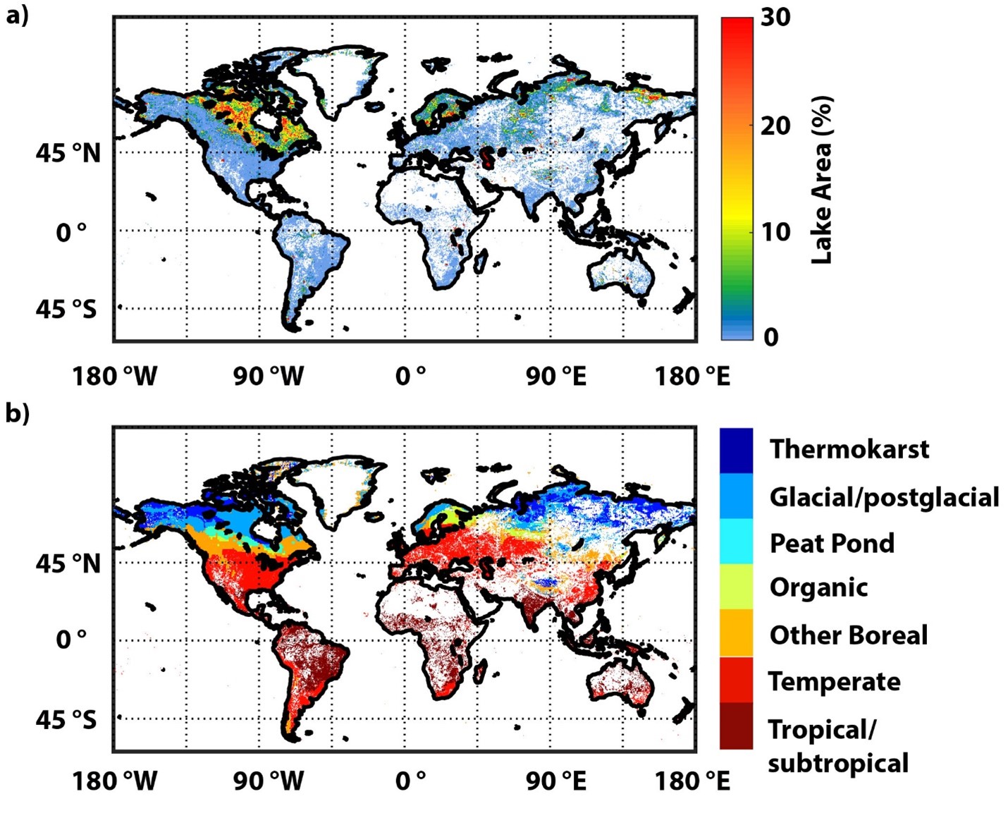
Global-Gridded Daily Methane Emissions from Lake Systems, 2003-2015
This dataset provides global gridded information on lake surface area and open water CH4 emissions at a resolution of 0.25-degree x 0.25-degree for an annual climatology... -
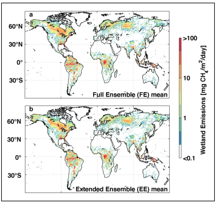
Gridded monthly methane emissions from terrestrial wetlands, north of 45 °N, 2013-2014
This dataset provides wetland methane (CH4) emissions, their uncertainties and underlying CH4 flux densities north from 45 N using three different wetland maps. The data... -
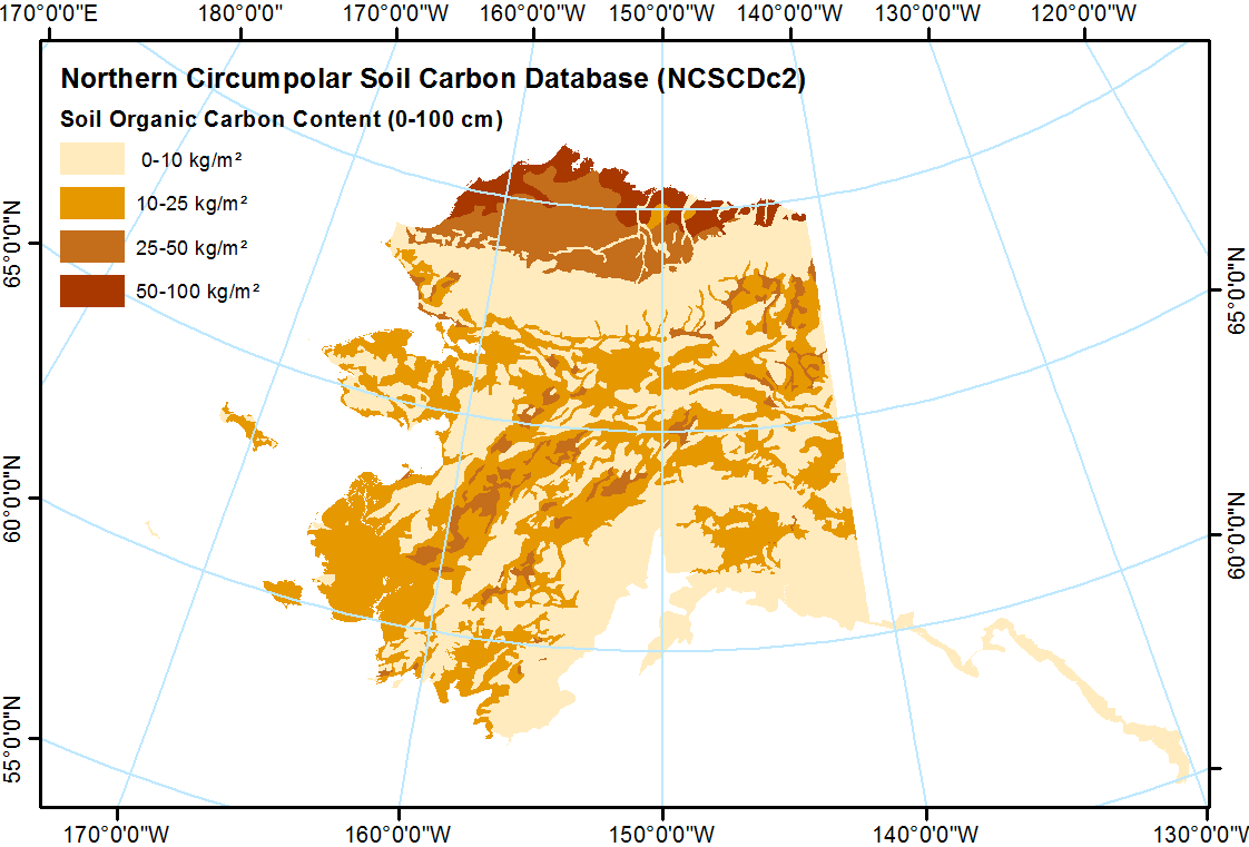
Northern Circumpolar Soil Carbon Database, Alaska, geotiff- and netCDF-files
The Northern Circumpolar Soil Carbon Database version 2 (NCSCDv2) is a geospatial database created for the purpose of quantifying storage of organic carbon in soils of the... -
ABoVE: Atmospheric Profiles of CO, CO2 and CH4 Concentrations from Arctic-CAP, 2017
This dataset provides in situ airborne measurements of atmospheric carbon monoxide (CO), carbon dioxide (CO2), methane (CH4), and water vapor concentrations, plus air... -
Gridded inventory of Canada's anthropogenic methane emissions for 2018
This dataset contains a gridded inventory of Canada's 2018 anthropogenic methane emissions at 0.1 x 0.1 degree. National and provincial emission totals in the inventory match... -
TCCON data from Sodankylä, Lapland (FI), Release GGG2020.R0
The Total Carbon Column Observing Network (TCCON) is a network of ground-based Fourier Transform Spectrometers that record direct solar absorption spectra of the atmosphere in... -
Global SCIAMACHY and GOSAT Level 3 gridded atmospheric column-average methane (XCH4) product in Obs4MIPs format, 2003-2014
This dataset contains satellite-derived atmospheric column-average dry-air mole fractions of methane (XCH4), and is a Level 3 gridded product in Obs4MIPs format. It has been... -
Global 0.5-deg Wetland Methane Emissions and Uncertainty (WetCHARTs v1.0), 2009-2010
This data set provides global monthly wetland methane (CH4) emissions and uncertainty data products derived from an ensemble of multiple terrestrial biosphere models, wetland... -
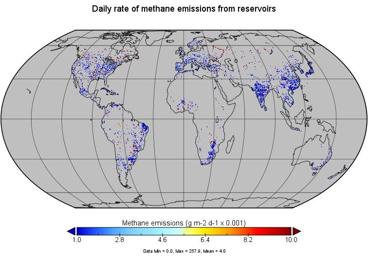
Global-Gridded Daily Methane Emissions from Inland Dam-Reservoir Systems, 2002-2015
This dataset includes global maps of methane (CH4) emissions from inland dam-reservoir systems at 0.25-degree spatial resolution. Daily emission rates (as grams of CH4 per day... -
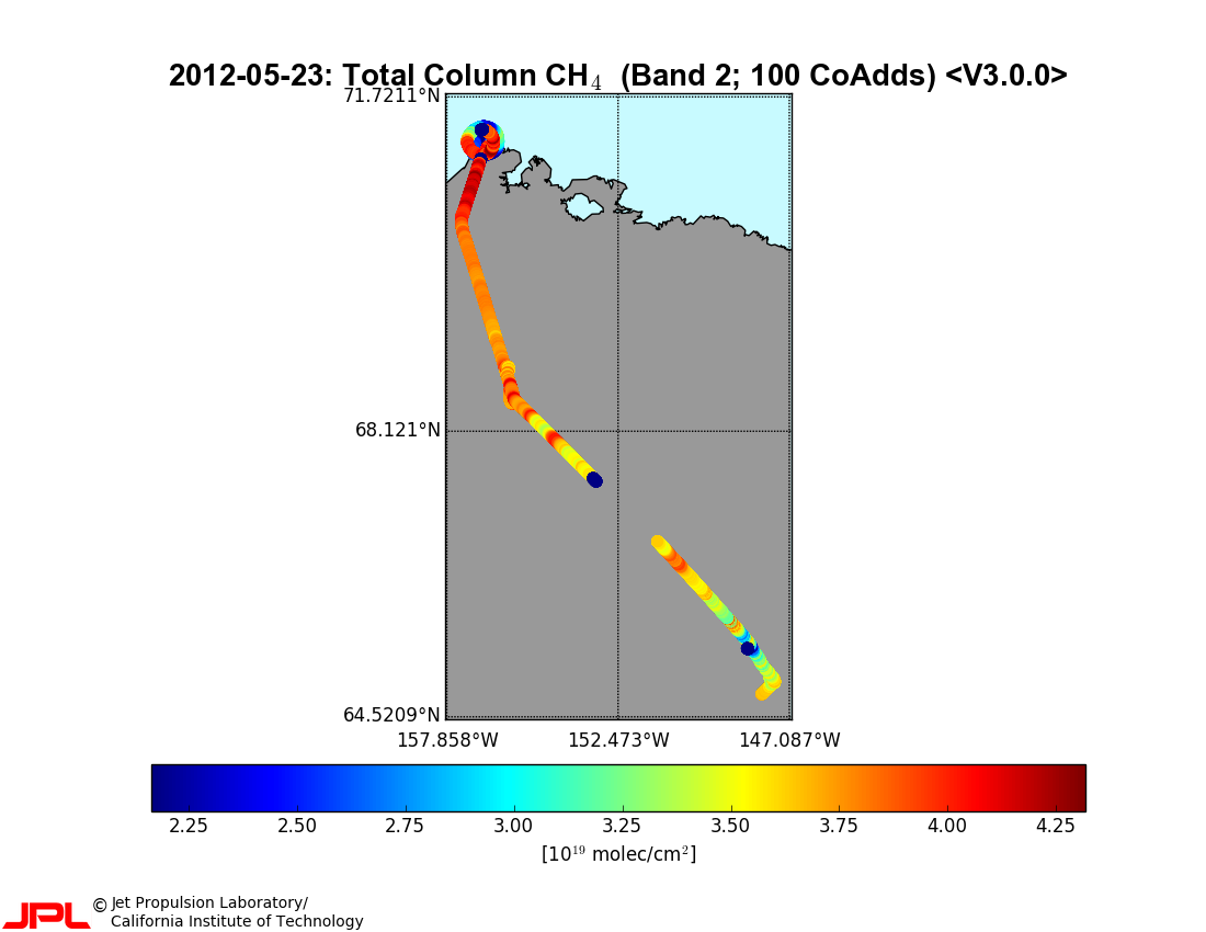
CARVE column gas from Airborne fourier transform spectrometer, Alaska, 2012-2015
This data set provides total vertical column O2, CO2, CH4, CO, and H2O, as well as dry-air columns of CO2, CH4, CO, and H2O from airborne campaigns over the Alaskan and Canadian... -
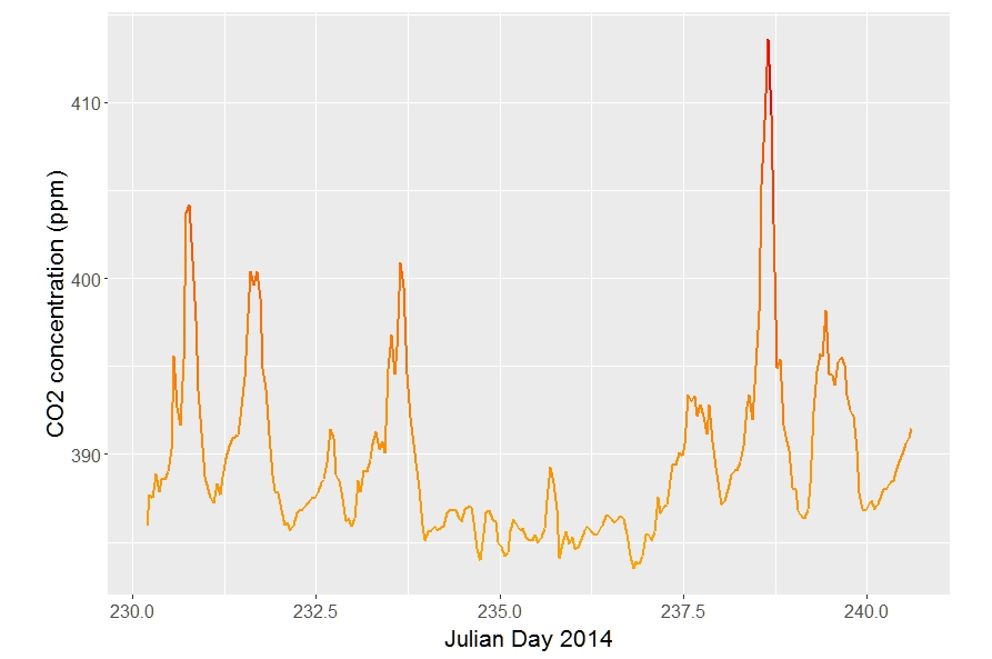
CARVE atmospheric gas concentrations, tower based, Alaska, 2012-2015
This data set provides atmospheric methane (CH4), carbon dioxide (CO2), and carbon monoxide (CO) dry air mole fractions and water vapor mole fractions (H2O) from continuous in... -
CARVE atmospheric gas concentrations, airborne flasks, Alaska, 2012-2015
This dataset provides atmospheric carbon dioxide (CO2), methane (CH4), carbon monoxide (CO), molecular hydrogen (H2), nitrous oxide (N2O), sulfur hexafluoride (SF6), and other... -
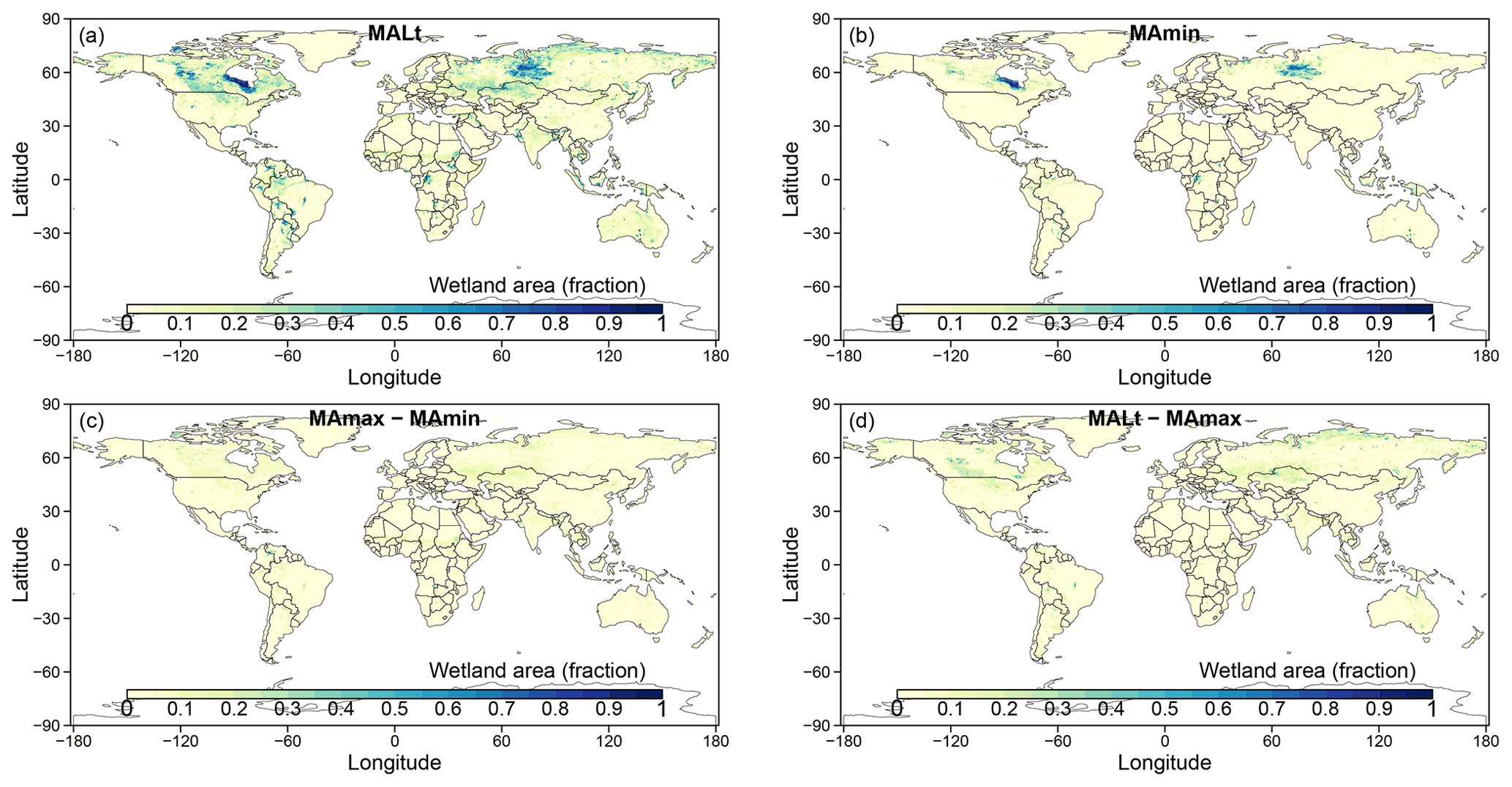
Monthly global dataset of Wetland Area and Dynamics for Methane Modeling (WAD2M) from Remote Sensing, 2000-2020
Seasonal and interannual variations in global wetland area is a strong driver of fluctuations in global methane (CH4) emissions. Current maps of global wetland extent vary with... -
TCCON data from Ny-Ålesund, Svalbard (NO), Release GGG2020.R0
The Total Carbon Column Observing Network (TCCON) is a network of ground-based Fourier Transform Spectrometers that record direct solar absorption spectra of the atmosphere in... -
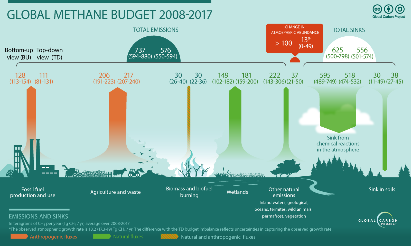
Global Methane Budget 2000-2017
The Global Carbon Project (GCP) publishes an up-date of the global methane (CH4) sources and sinks to the atmosphere. This budget show that global methane emissions have... -
Northern Circumpolar Soil Carbon Database, Russia, geotiff- and netCDF-files
The Northern Circumpolar Soil Carbon Database version 2 (NCSCDv2) is a geospatial database created for the purpose of quantifying storage of organic carbon in soils of the... -
Northern Circumpolar Soil Carbon Database, Svalbard, geotiff- and netCDF-files
The Northern Circumpolar Soil Carbon Database version 2 (NCSCDv2) is a geospatial database created for the purpose of quantifying storage of organic carbon in soils of the... -
Northern Circumpolar Soil Carbon Database, Mongolia, geotiff- and netCDF-files
The Northern Circumpolar Soil Carbon Database version 2 (NCSCDv2) is a geospatial database created for the purpose of quantifying storage of organic carbon in soils of the... -
Northern Circumpolar Soil Carbon Database, Kazaksthan, geotiff- and netCDF-files
The Northern Circumpolar Soil Carbon Database version 2 (NCSCDv2) is a geospatial database created for the purpose of quantifying storage of organic carbon in soils of the... -
Northern Circumpolar Soil Carbon Database, Iceland, geotiff- and netCDF-files
The Northern Circumpolar Soil Carbon Database version 2 (NCSCDv2) is a geospatial database created for the purpose of quantifying storage of organic carbon in soils of the...
