• Log in
Arctic Permafrost Geospatial Centre
    • Datasets
    • Categories
    • Projects
    • Collections
    • About
    • Map
  1. Home
  2. Categorys
  3. Land Cover
landcover

Land Cover

Permafrost Research Category read more

Datasets
156

Regions

  • Alaskan and Canadian Arctic (1)

Products

  • AVIRIS-NG Level 1... (1)

Sensors

  • Airborne... (1)

Spatial Resolution

  • 5 m (1)

Temporal Resolution

  • Areas were surveyed once (1)

Keywords

  • Infrared imagery (1)
  • Infrared radiance (1)
  • Land Surface (1)
  • Reflectance (1)
  • Visible imagery (1)

Show More Keywords

Data Formats

  • ENVI binary (1)
  • ENVI binary image (1)
  • HTML (1)
  • JPEG (1)
  • PDF (1)

Show More Data Formats

First Authors

  • Miller, Charles E. (1)

Projects

  • ABoVE (1)
  • AMPAC-Net Airborne (1)
  • Arctic Methane and... (1)
  • Land Cover (1)

Institutes

  • Jet Propulsion... (1)

Publishers

  • ORNL DAAC (1)

close
  • Datasets
  • Members
  • About
  • Activity Stream

1 dataset found

Projects: AMPAC-Net Airborne

Filter Results
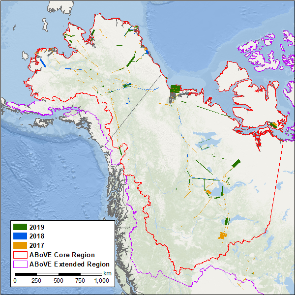
  • Hyperspectral Imagery AVIRIS-NG V2, 2017-2019, Alaskan and Canadian Arctic

    This dataset provides Level 1 radiance and Level 2 surface reflectance measured by the Airborne Visible/Infrared Imaging Spectrometer-Next Generation (AVIRIS-NG) instrument...
    • HTML
    • ENVI binary image
    • ENVI binary
    • JPEG
    • SHP
    • PDF
  • About Arctic Permafrost Geospatial Centre
  • CKAN API
  • Open Knowledge Foundation

  • Powered by CKAN

Initiated by

Provided by

Imprint | Privacy Notice