  • Log in
Arctic Permafrost Geospatial Centre
    • Datasets
    • Categories
    • Projects
    • Collections
    • About
    • Map
  1. Home
  2. Groups
  3. Periglacial Inventories
periglacial-inventories

Periglacial Inventories

Permafrost Research Category read more

Datasets
41

Regions

  • Antarctica (1)

Products

  • Geomorphology (1)

Sensors

  • Site names (STN) (1)

Spatial Resolution

There are no Spatial Resolution that match this search

Temporal Resolution

There are no Temporal Resolution that match this search

Keywords

  • Geomorphology (1)
  • Permafrost (1)

Data Formats

  • PDF (1)
  • PNG (1)
  • SHP (1)

First Authors

  • Goyanes, Gabriel (1)

Projects

  • ESA GlobPermafrost (1)
  • Land Cover (1)
  • Periglacial Inventories (1)
  • PerSys (1)
  • PerSys - ColdSpot CSP (1)

Institutes

  • ZAMG... (1)

Publishers

  • PANGAEA (1)

close
  • Datasets
  • Members
  • About
  • Activity Stream

1 dataset found

Projects: PerSys Sensors: Site names (STN)

Filter Results
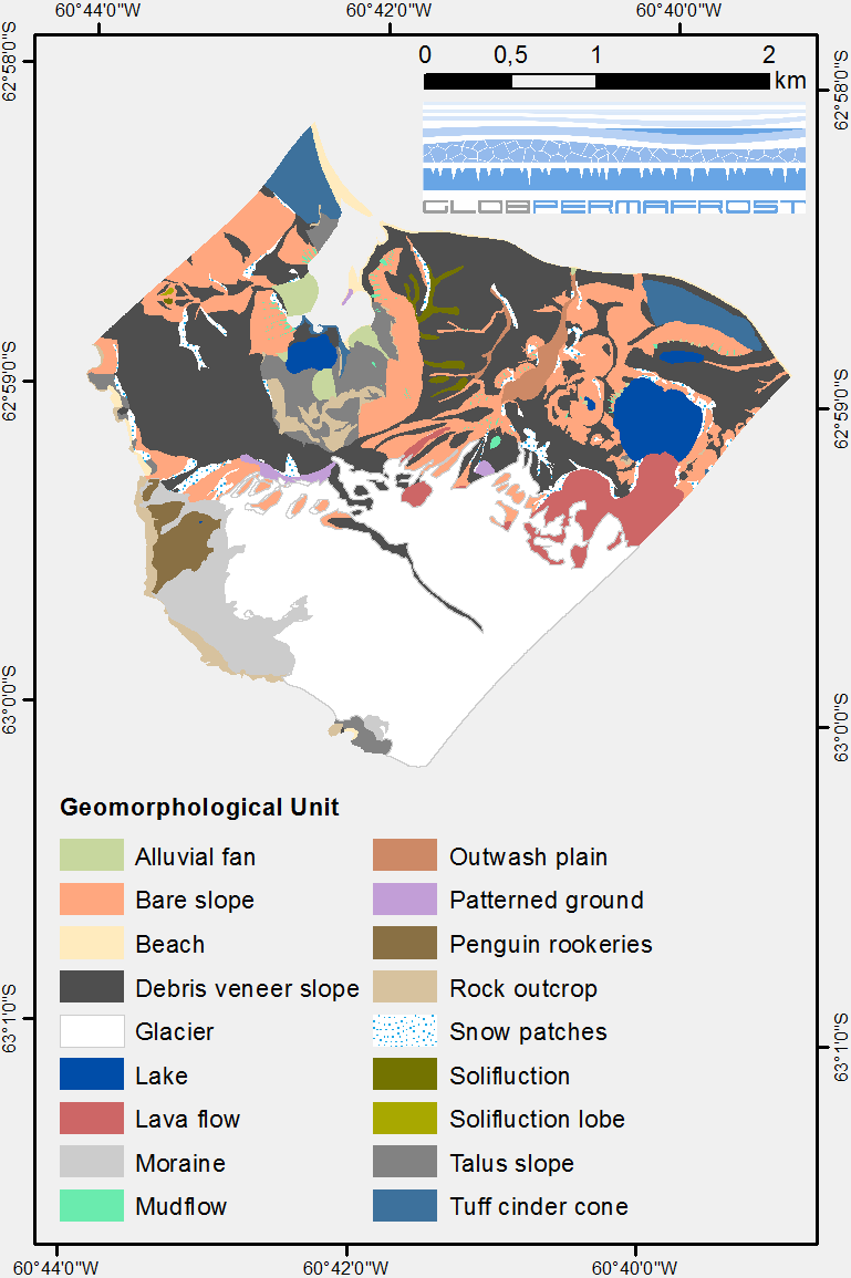
  • Geomorphological units from field mapping, Irizar - Crater Lake Area, Deception Island, Antarctica

    The map describes the main geomorphological features according to surface cover type on Irizar - Crater Lake Area, Deception Island, Antarctica. The map was developed to support...
    • PDF
    • SHP
    • PNG
  • About Arctic Permafrost Geospatial Centre
  • CKAN API
  • Open Knowledge Foundation

  • Powered by CKAN

Initiated by

Provided by

Imprint | Privacy Notice