Collections
-
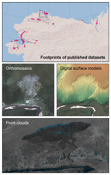
Aerial imagery datasets of permafrost landscapes in Alaska and northwestern Canada acquired by the Modular Aerial Camera System
During three airborne campaigns conducted between 2018 and 2021 and led by...
Ver Aerial imagery datasets of permafrost landscapes in Alaska and northwestern Canada acquired by the Modular Aerial Camera System -

AMPAC-Net Airborne
This dataset collection is a data type subset of the
-

AMPAC-Net Anthropogenic sources
This dataset collection is a data type subset of the
-

AMPAC-Net Chambers
This dataset collection is a data type subset of the
-

AMPAC-Net Eddy Covariance
This dataset collection is a data type subset of the
-
AMPAC-Net Geospatial
This dataset collection is a data type subset of the
-

AMPAC-Net Incubations
This dataset collection is a data type subset of the
-

AMPAC-Net Inversions
This dataset collection is a data type subset of the
-

AMPAC-Net Isotopes
Contains isotopic analysis data relevant to high latitude methane dynamics
Ver AMPAC-Net Isotopes -
AMPAC-Net Reference observations
This dataset collection is a data type subset of the
-

AMPAC-Net Satellite Concentrations
This dataset collection is a data type subset of the
-

AMPAC-Net Spatial Models
This dataset collection is a data type subset of the
-

Aufeis (naleds) from 1958 historical maps and 2013-2017/2019 Landsat-8 OLI images in North-Eastern Eurasia
Historical data collection is created based on the Cadastre of aufeis (naled)...
Ver Aufeis (naleds) from 1958 historical maps and 2013-2017/2019 Landsat-8 OLI images in North-Eastern Eurasia -

Frozen State Backscatter Intensity from Sentinel-1
Frozen state backscatter intensity was derived from Sentinel-1 acquisitions...
Ver Frozen State Backscatter Intensity from Sentinel-1 -

Lake Ice Classification from Sentinel-1
Lake ice classifications distinguish grounded ice and floating ice in lakes...
Ver Lake Ice Classification from Sentinel-1 -
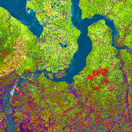
Land Cover Classification from Sentinel-1 and Sentinel-2
Land cover classes have been derived from bands of Sentinel-2 (bands 3...
Ver Land Cover Classification from Sentinel-1 and Sentinel-2 -

Mapped ice wedge polygon patterns from GeoEye-1, WorldView-1
Detailed calculations of ground-ice volumes in permafrost deposits are...
Ver Mapped ice wedge polygon patterns from GeoEye-1, WorldView-1 -
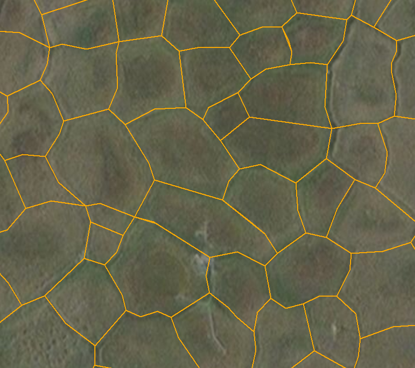
Mapped polygon pattern geomorphometry from HRSC-AX
Polygonal systems formed by thermal contraction cracking are complex...
Ver Mapped polygon pattern geomorphometry from HRSC-AX -

MODIS Land Surface Temperature
MODIS land surface temperature (LST) products of the ESA Data User Element...
Ver MODIS Land Surface Temperature -
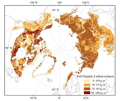
Northern Circumpolar Soil Carbon Database version 2
The Northern Circumpolar Soil Carbon Database version 2 (NCSCDv2) is a...
Ver Northern Circumpolar Soil Carbon Database version 2