Überspringen zum Hauptinhalt
  • Einloggen
Arctic Permafrost Geospatial Centre
    • Datensätze
    • Kategorien
    • Projekte
    • Sammlungen
    • Über uns
    • Kartenanwendung
  1. Start
  2. Gruppen
  3. PerSys
persys

PerSys

The Permafrost Information System (PerSys) is conceptualized as an open access geospatial data dissemination and visualization portal for the ESA GlobPermafrost project. PerSys... mehr erfahren

Datensätze
176

Regionen

  • Antarctica (1)

Produkte

  • Geomorphology (1)

Sensoren

  • Site names (STN) (1)

Räumliche Auflösung

Für diese Suche wurden keine Räumliche Auflösung gefunden.

Zeitliche Auflösung

Für diese Suche wurden keine Zeitliche Auflösung gefunden.

Stichworte

  • Geomorphology (1)
  • Permafrost (1)

Datenformate

  • PDF (1)
  • PNG (1)
  • SHP (1)

Erstautoren

  • Goyanes, Gabriel (1)

Projekte

  • ESA GlobPermafrost (1)
  • Land Cover (1)
  • Periglacial Inventories (1)
  • PerSys (1)
  • PerSys - ColdSpot CSP (1)

Institute

  • ZAMG... (1)

Herausgeber

  • PANGAEA (1)

close
  • Datensätze
  • Mitglieder
  • Über uns
  • Aktivitätsanzeige

1 Datensatz gefunden

Sensoren: Site names (STN)

Ergebnisse filtern
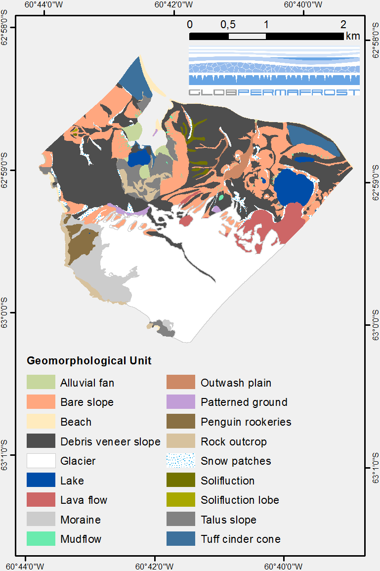
  • Geomorphological units from field mapping, Irizar - Crater Lake Area, Deception Island, Antarctica

    The map describes the main geomorphological features according to surface cover type on Irizar - Crater Lake Area, Deception Island, Antarctica. The map was developed to support...
    • PDF
    • SHP
    • PNG
  • Über Arctic Permafrost Geospatial Centre
  • CKAN API
  • Open Knowledge Foundation

  • Unterstützt durch CKAN

Initiiert von

Bereitgestellt durch

Impressum | Datenschutzhinweis