Überspringen zum Hauptinhalt
  • Einloggen
Arctic Permafrost Geospatial Centre
    • Datensätze
    • Kategorien
    • Projekte
    • Sammlungen
    • Über uns
    • Kartenanwendung
  1. Start
  2. Gruppen
  3. PerSys - Land Cover Prototype LCP
persys-lcp

PerSys - Land Cover Prototype LCP

Land cover in the Northern permafrost regions is currently not suitably mapped for permafrost monitoring with existing global products. Challenges include the differentiation... mehr erfahren

Datensätze
25

Regionen

  • European Russia (1)

Produkte

  • Frozen State... (1)

Sensoren

  • Sentinel-1 (1)

Räumliche Auflösung

  • 30 m (1)

Zeitliche Auflösung

Für diese Suche wurden keine Zeitliche Auflösung gefunden.

Stichworte

  • Land Surface Structure (1)
  • Permafrost (1)
  • Sentinel-1 (1)
  • Surface Wetness (1)

Datenformate

  • Geotiff (1)
  • HTML (1)
  • PDF (1)
  • PNG (1)

Erstautoren

  • Widhalm, Barbara (1)

Projekte

  • ESA GlobPermafrost (1)
  • Frozen State... (1)
  • PerSys (1)
  • PerSys - Land... (1)
  • Properties & Extent (1)

Institute

  • ZAMG... (1)

Herausgeber

  • PANGAEA (1)

close
  • Datensätze
  • Mitglieder
  • Über uns
  • Aktivitätsanzeige

1 Datensatz gefunden

Regionen: European Russia

Ergebnisse filtern
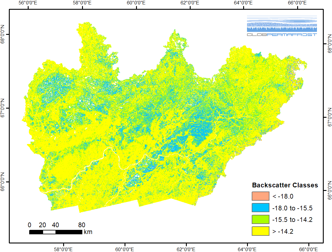
  • Frozen State Backscatter Intensity from Sentinel-1, 2015-2016, Usa Basin, European Russia (RU)

    Frozen state backscatter intensity was derived from Sentinel-1 acquisitions from December 2015 and 2016. By excluding the effects of liquid water content (acquisitions under...
    • PNG
    • Geotiff
    • PDF
    • HTML
  • Über Arctic Permafrost Geospatial Centre
  • CKAN API
  • Open Knowledge Foundation

  • Unterstützt durch CKAN

Initiiert von

Bereitgestellt durch

Impressum | Datenschutzhinweis