Überspringen zum Hauptinhalt
  • Einloggen
Arctic Permafrost Geospatial Centre
    • Datensätze
    • Kategorien
    • Projekte
    • Sammlungen
    • Über uns
    • Kartenanwendung
  1. Start
  2. Gruppen
  3. Landscape Dynamics
landscape-dynamics

Landscape Dynamics

Permafrost Research Category mehr erfahren

Datensätze
117

Regionen

  • Arctic Coastal... (1)

Produkte

  • NDVI trend map (1)

Sensoren

  • Landsat (TM, ETM+, OLI) (1)

Räumliche Auflösung

  • 30 m (1)

Zeitliche Auflösung

  • July to August (1)

Stichworte

  • NDVI (1)
  • Permafrost (1)
  • Vegetation productivity (1)

Datenformate

  • Geotiff (1)
  • HTML (1)
  • PNG (1)
  • XML (1)

Erstautoren

  • Lara, Mark J. (1)

Projekte

  • Land Cover (1)
  • Landscape Dynamics (1)

Institute

  • University of... (1)

Herausgeber

  • SNAP Data Portal (1)

close
  • Datensätze
  • Mitglieder
  • Über uns
  • Aktivitätsanzeige

1 Datensatz gefunden

Zeitliche Auflösung: July to August

Ergebnisse filtern
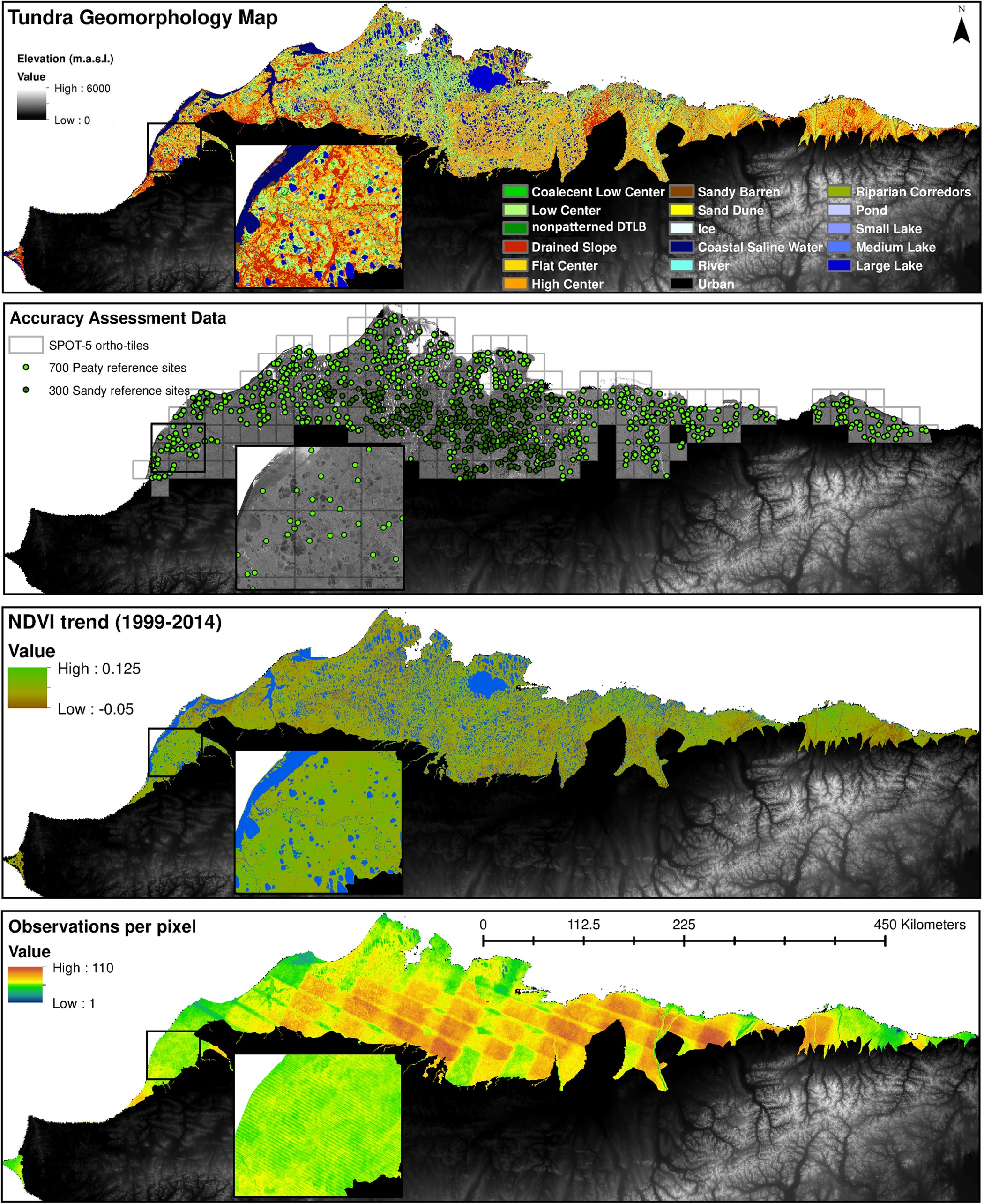
  • NDVI trend from Landsat time series, 1999-2014, Alaskan Arctic Coastal Plain (US)

    Normalized difference vegetation index (NDVI) trend map was computed for the Alaskan Arctic Coastal Plain between 1999 and 2014. The decadal trend of each pixel was computed...
    • Geotiff
    • XML
    • HTML
    • PNG
  • Über Arctic Permafrost Geospatial Centre
  • CKAN API
  • Open Knowledge Foundation

  • Unterstützt durch CKAN

Initiiert von

Bereitgestellt durch

Impressum | Datenschutzhinweis