Überspringen zum Hauptinhalt
  • Einloggen
Arctic Permafrost Geospatial Centre
    • Datensätze
    • Kategorien
    • Projekte
    • Sammlungen
    • Über uns
    • Kartenanwendung
  1. Start
  2. Gruppen
  3. Land Cover
landcover

Land Cover

Permafrost Research Category mehr erfahren

Datensätze
156

Regionen

  • Siberia (1)

Produkte

  • Wetland maps (1)

Sensoren

  • ENIVSAT ASAR (1)

Räumliche Auflösung

  • 75m (1)

Zeitliche Auflösung

  • 10 day intervals (1)

Stichworte

  • C-band (1)
  • Synthetic Aperture Radar (1)
  • Wetland extent (1)
  • Wetlands (1)

Datenformate

  • ZIP (1)

Erstautoren

  • Reschke, Julia (1)

Projekte

  • AMPAC-Net Geospatial (1)
  • Arctic Methane and... (1)
  • Land Cover (1)

Institute

  • Vienna University... (1)

Herausgeber

  • PANGAEA (1)

close
  • Datensätze
  • Mitglieder
  • Über uns
  • Aktivitätsanzeige

1 Datensatz gefunden

Sensoren: ENIVSAT ASAR

Ergebnisse filtern
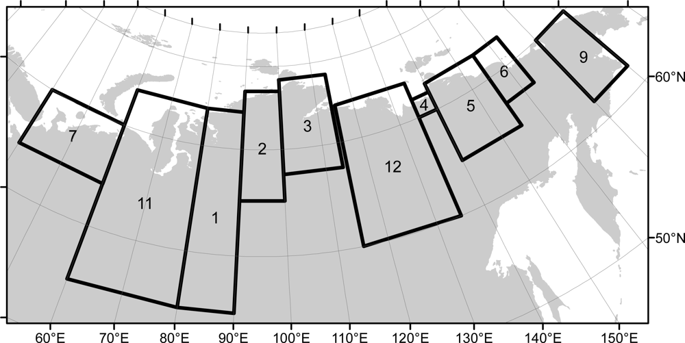
  • Wetland maps including open water extent dynamics based on ENVISAT ASAR WS for Siberia, 2007 and 2008

    Wetlands store large amounts of carbon, and depending on their status and type, they release specific amounts of methane gas to the atmosphere. The connection between wetland...
    • ZIP
  • Über Arctic Permafrost Geospatial Centre
  • CKAN API
  • Open Knowledge Foundation

  • Unterstützt durch CKAN

Initiiert von

Bereitgestellt durch

Impressum | Datenschutzhinweis