Überspringen zum Hauptinhalt
  • Einloggen
Arctic Permafrost Geospatial Centre
    • Datensätze
    • Kategorien
    • Projekte
    • Sammlungen
    • Über uns
    • Kartenanwendung
  1. Start
  2. Gruppen
  3. PAGE21
page21

PAGE21

Changing Permafrost in the Arctic and its Global Effects in the 21th Century PAGE21 will aim to understand and quantify the vulnerability of permafrost environments to a... mehr erfahren

Datensätze
32

Regionen

  • Circum-Arctic (1)

Produkte

  • Land Surface Temperature (1)

Sensoren

  • MODIS (1)

Räumliche Auflösung

  • 25 km (1)

Zeitliche Auflösung

  • Weekly (1)

Stichworte

  • Land Surface Temperature (1)
  • MODIS (1)
  • Permafrost (1)

Datenformate

  • Geotiff (1)
  • PDF (1)
  • PNG (1)

Erstautoren

  • Duguay, Claude R. (1)

Projekte

  • ESA DUE Permafrost (1)
  • MODIS Land Surface... (1)
  • PAGE21 (1)
  • PerSys (1)
  • Properties & Extent (1)

Institute

  • University of Waterloo (1)

Herausgeber

  • PANGAEA (1)

close
  • Datensätze
  • Mitglieder
  • Über uns
  • Aktivitätsanzeige

1 Datensatz gefunden

Datenformate: PNG Räumliche Auflösung: 25 km

Ergebnisse filtern
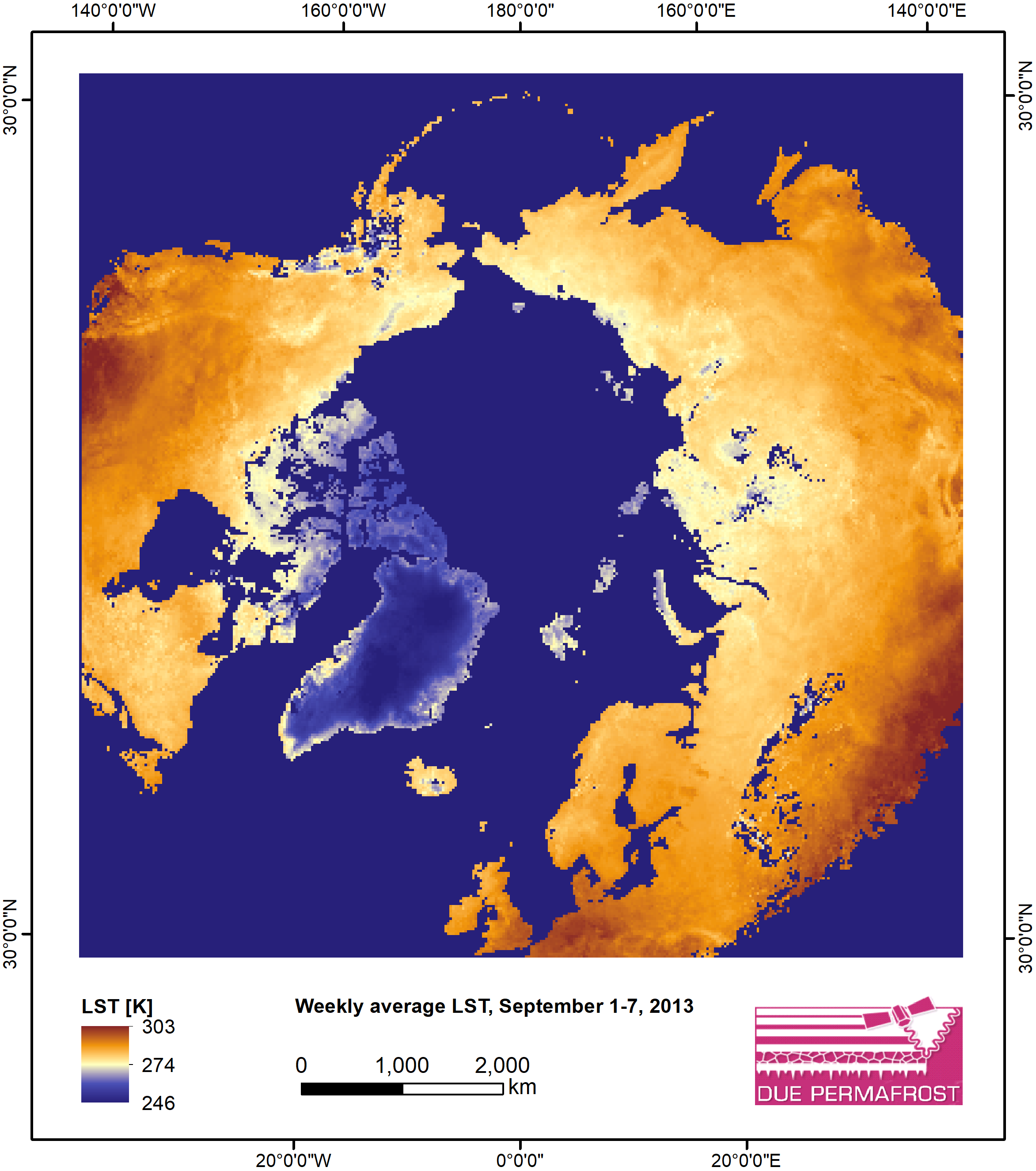
  • Weekly Land Surface Temperature from MODIS, 2007-2013, Circum-Arctic Region

    Weekly land surface temperature (LST) products of the ESA Data User Element (DUE) Permafrost are provided at 1 km spatial resolution. Weekly LST are available for the years 2007...
    • PNG
    • PDF
    • Geotiff
  • Über Arctic Permafrost Geospatial Centre
  • CKAN API
  • Open Knowledge Foundation

  • Unterstützt durch CKAN

Initiiert von

Bereitgestellt durch

Impressum | Datenschutzhinweis