Preview
Dataset description:
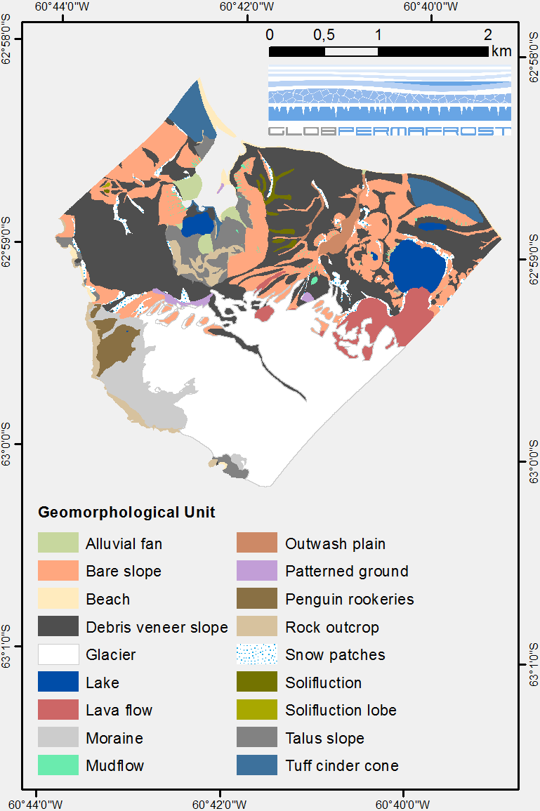
The map describes the main geomorphological features according to surface cover type on Irizar - Crater Lake Area, Deception Island, Antarctica. The map was developed to support the...
Source: Geomorphological units from field mapping, Irizar - Crater Lake Area, Deception Island, Antarctica
Additional Information
| Field | Value |
|---|---|
| Data last updated | February 18, 2019 |
| Metadata last updated | November 1, 2021 |
| Created | February 18, 2019 |
| Format | PNG |
| License | Creative Commons Attribution 4.0 |
| Datastore active | False |
| Datastore contains all records of source file | False |
| Has views | True |
| Id | c39456fe-7a11-42cf-95e7-afef5cd2d0bd |
| Mimetype | image/png |
| Package id | 74a3cac4-5a36-4556-93a0-fd3ed353250e |
| Position | 2 |
| Size | 63.2 KiB |
| State | active |
| Url type | upload |
Attention! The specified license is that of the dataset. Licenses from other sources, e.g. publications or figures related to the dataset, may be subject to other licenses.