-
Trends of Land Surface Change from Landsat time-series 1999-2014, Western Siberia, UTM Zone 42N, 60°N - 62°N (RU)
The Hot Spot Regions of Permafrost Change (HRPC) product maps changes in surface characteristics using the full Landsat archive (TM, ETM+, OLI) for the peak summer season (July,...
-
Trends of Land Surface Change from Landsat time-series 1999-2014, Western Siberia, UTM Zone 42N, 58°N - 60°N (RU)
The Hot Spot Regions of Permafrost Change (HRPC) product maps changes in surface characteristics using the full Landsat archive (TM, ETM+, OLI) for the peak summer season (July,...
-
Footprints of MACS aerial images from POLAR 6 ThawTrend_Air_2019 flight campaign in northern Alaska (US)
This datasets contains the footprints of the DLR MACS (Modular Aerial Camera System) acquisitions (RGB + NIR) during the AWI ThawTrendAir2019 campaign on POLAR 6 from 10 July...
-
Vegetation Height from Sentinel-1 and Sentinel-2, 2015-2018, Seward peninsula, Alaska (US)
Vegetation height has been derived from Sentinel-1 satellite data acquired in VV mode with a resolution of 20 m. Vegetation height was estimated using an empirical model on...
-
Vegetation Height from Sentinel1 and Sentinel-2, 2016-2018, Barrow, Alaska (US)
Vegetation height has been derived from Sentinel-1 satellite data acquired in VV mode with a resolution of 20 m. Vegetation height was estimated using an empirical model on...
-
Vegetation Height from Sentinel-1 and Sentinel-2, 2016-2018, Toolik, Alaska (US)
Vegetation height has been derived from Sentinel-1 satellite data acquired in VV mode with a resolution of 20 m. Vegetation height was estimated using an empirical model on...
-
Vegetation Height from Sentinel-1 and Sentinel-2, 2016-2018, Mackenzie Delta, Beaufort Sea Region (CA)
Vegetation height has been derived from Sentinel-1 satellite data acquired in VV mode with a resolution of 20 m. Vegetation height was estimated using an empirical model on...
-
Vegetation Height from Sentinel-1 and Sentinel-2, 2016-2018, Umiuaq, Quebec-Labrador (CA)
Vegetation height has been derived from Sentinel-1 satellite data acquired in VV mode with a resolution of 20 m. Vegetation height was estimated using an empirical model on...
-
Vegetation Height from Sentinel-1 and Sentinel-2, 2016-2018, Lena Delta, Laptev and East Siberian Sea Region (RU)
Vegetation height has been derived from Sentinel-1 satellite data acquired in VV mode with a resolution of 20 m. Vegetation height was estimated using an empirical model on...
-
Vegetation Height from Sentinel-1 and Sentinel-2, 2016-2018, Western Siberia (RU)
Vegetation height has been derived from Sentinel-1 satellite data acquired in VV mode with a resolution of 20 m. Vegetation height was estimated using an empirical model on...
-
Mapped thermokarst ice wedge polygon patterns from GeoEye-1, 2009, Buor Khaya, Laptev Sea coast, Siberia (RU)
Detailed calculations of ground-ice volumes in permafrost deposits are necessary to understand and quantify the response of permafrost landscapes to thermal disturbance and...
-
Surface Water Area from sub-meter resolution Satellite Imagery, 2002-2019, Kotzebue, Northwestern Baldwin Peninsula...
Arctic landscapes are in a state of transition due to changes in climate occurring during both the summer and winter seasons. Scattered observations indicate that beavers...
-
Submarine Permafrost Map (SuPerMAP), modeled with CryoGrid 2, Circum-Arctic
This data set contains a first‐order estimate of distribution, thickness and ice-content of submarine permafrost on the Arctic shelf based on a numerical heat transfer model....
-
Ground Temperature Map, 2000-2017, Antarctic
The product provides modeled mean annual ground temperatures (MAGT) at the top of the permafrost for Antarctica and Subantarctic islands at 1 km spatial resolution. Permafrost...
-
Ground Temperature Map, 2000-2016, Andes
The product provides modeled mean annual ground temperatures (MAGT) at the top of the permafrost for Andes at 1 km spatial resolution. Permafrost probability (fraction values...
-
Ground Temperature Map, 2000-2016, East African Plateau
The product provides modeled mean annual ground temperatures (MAGT) at the top of the permafrost for the East African Plateau at 1 km spatial resolution. Permafrost probability...
-
Northern Circumpolar Soil Carbon Database, Svalbard, geotiff- and netCDF-files
The Northern Circumpolar Soil Carbon Database version 2 (NCSCDv2) is a geospatial database created for the purpose of quantifying storage of organic carbon in soils of the...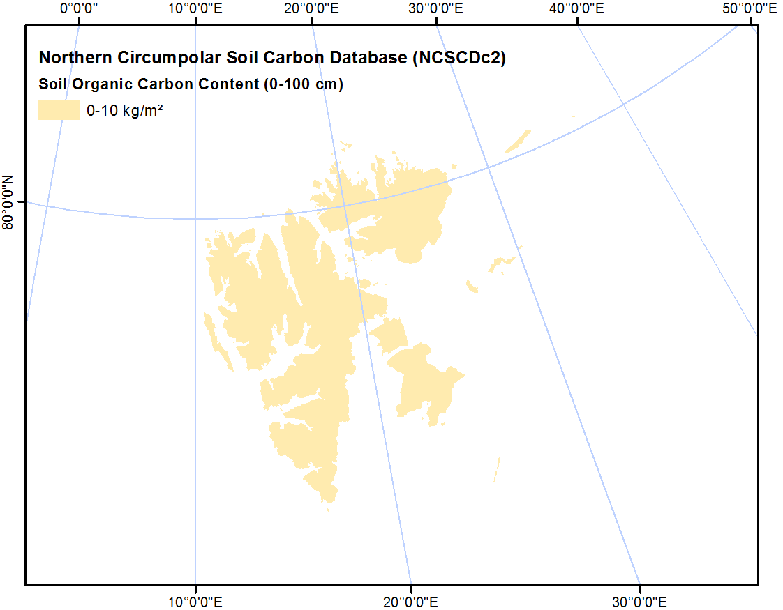
-
Northern Circumpolar Soil Carbon Database, Mongolia, geotiff- and netCDF-files
The Northern Circumpolar Soil Carbon Database version 2 (NCSCDv2) is a geospatial database created for the purpose of quantifying storage of organic carbon in soils of the...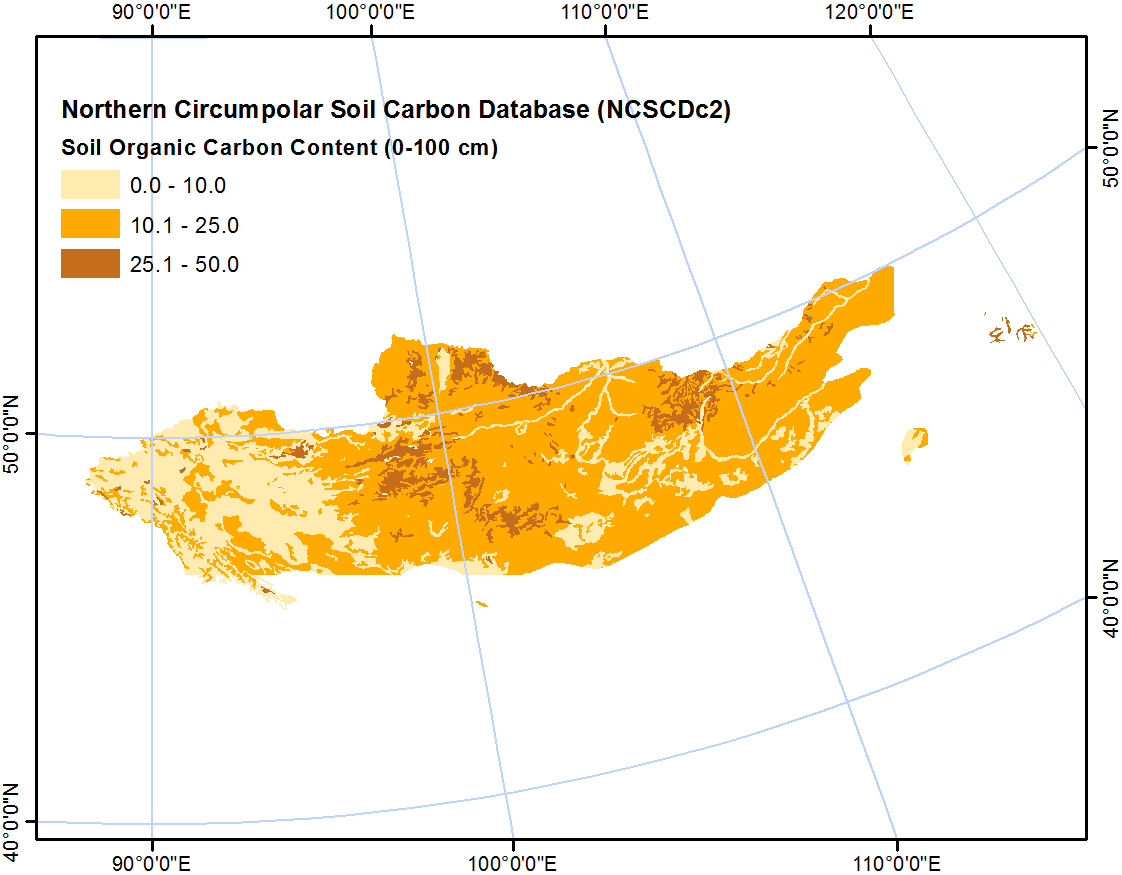
-
Northern Circumpolar Soil Carbon Database, Kazaksthan, geotiff- and netCDF-files
The Northern Circumpolar Soil Carbon Database version 2 (NCSCDv2) is a geospatial database created for the purpose of quantifying storage of organic carbon in soils of the...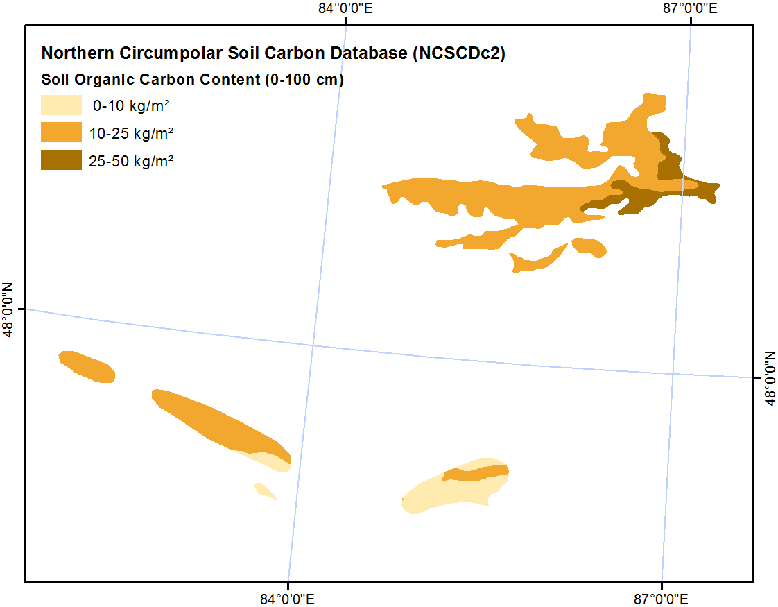
-
Northern Circumpolar Soil Carbon Database, Iceland, geotiff- and netCDF-files
The Northern Circumpolar Soil Carbon Database version 2 (NCSCDv2) is a geospatial database created for the purpose of quantifying storage of organic carbon in soils of the...


Можете да получите също така достъп до този регистър, като използвате връзката API (see API документация).