-
Surface Subsidence Map from Sentinel-1 InSAR, 2016-2018, South Shetland, Antarctica
Surface subsidence was derived from Sentinel-1 synthetic aperture radar time-series with a spatial resolution of 10 m. Maps show the averaged displacement rates during the snow... -
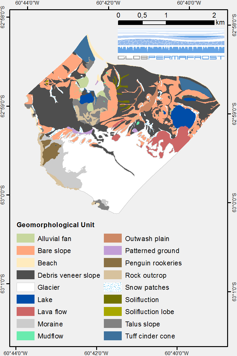
Geomorphological units from field mapping, Irizar - Crater Lake Area, Deception Island, Antarctica
The map describes the main geomorphological features according to surface cover type on Irizar - Crater Lake Area, Deception Island, Antarctica. The map was developed to support... -
Geomorphological units from field mapping, Hurd Peninsula, Livingston Island, Antarctica
The map shows the geomorphological units of Hurd Peninsula on Livingston Island. Mapping was done with high resolution field mapping supported by the analysis of a QuickBird...


