-
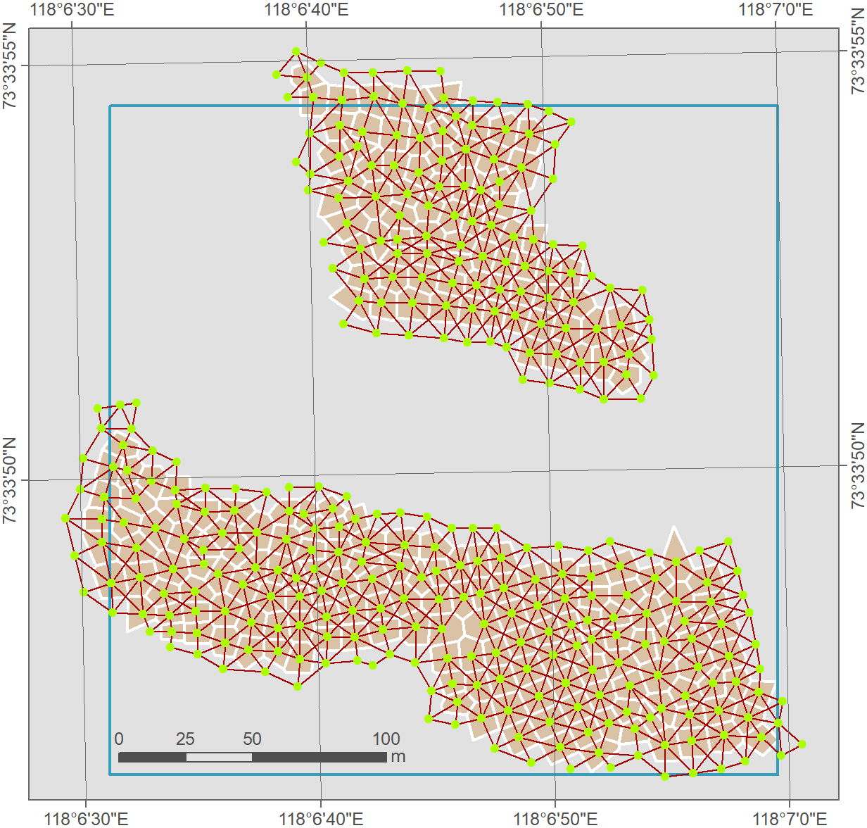
Mapped yedoma ice wedge polygon patterns from WorldView-1, 2008, Northern Seward Peninsula, Chukchi Sea coast, Alaska (US)
Detailed calculations of ground-ice volumes in permafrost deposits are necessary to understand and quantify the response of permafrost landscapes to thermal disturbance and... -
Mapped yedoma ice wedge polygon patterns from GeoEye-1, 2010, Cape Mamontov Klyk, Laptev Sea coast, Siberia (RU)
Detailed calculations of ground-ice volumes in permafrost deposits are necessary to understand and quantify the response of permafrost landscapes to thermal disturbance and... -
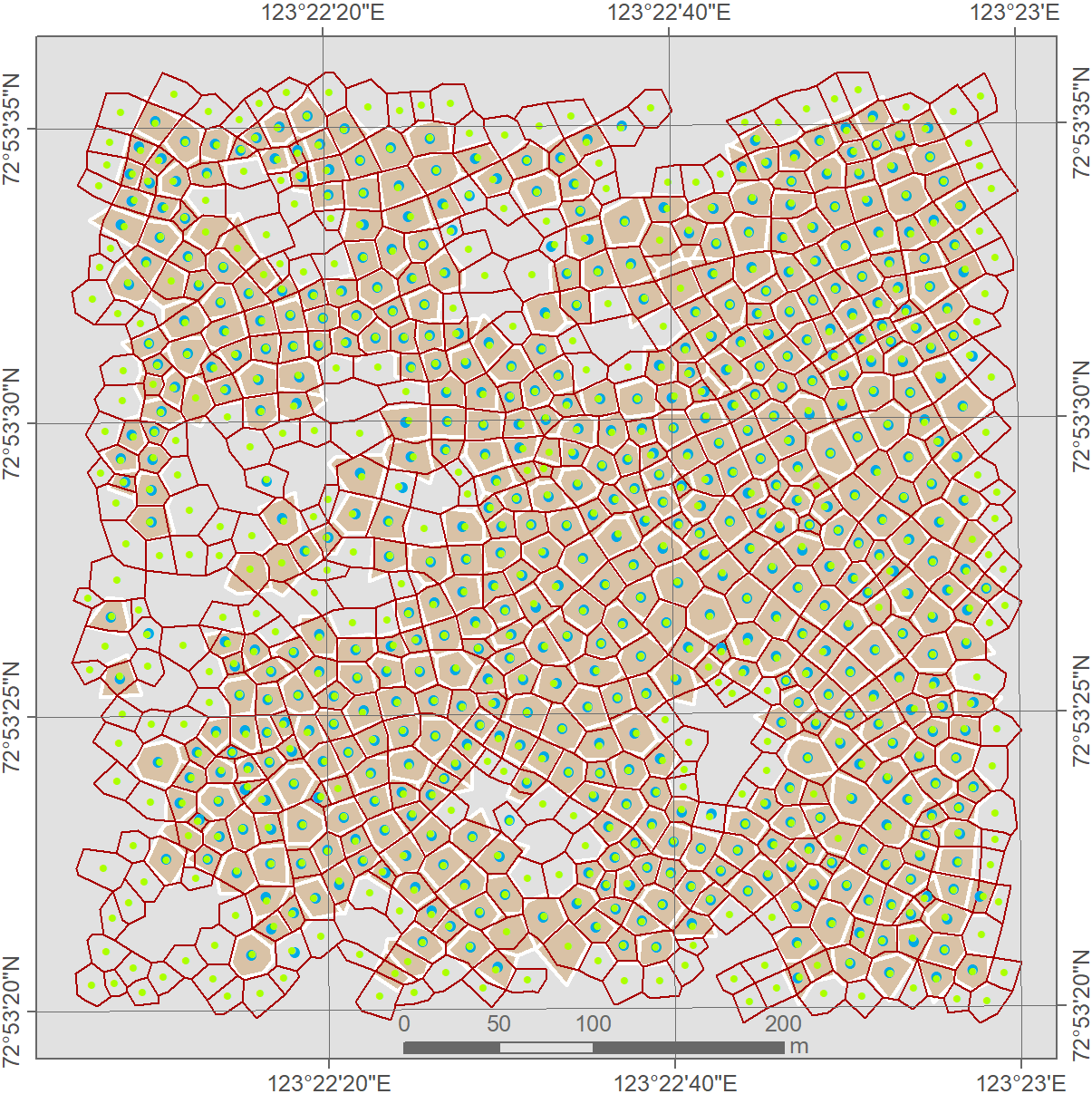
Mapped yedoma ice wedge polygon patterns from GeoEye-1, 2009, Buor Khaya, Laptev Sea coast, Siberia (RU)
Detailed calculations of ground-ice volumes in permafrost deposits are necessary to understand and quantify the response of permafrost landscapes to thermal disturbance and... -
Mapped thermokarst ice wedge polygon patterns from WorldView-1, 2009, Ebe-Basyn-Sise Island, SW Lena Delta, Siberia (RU)
Detailed calculations of ground-ice volumes in permafrost deposits are necessary to understand and quantify the response of permafrost landscapes to thermal disturbance and... -
Mapped thermokarst ice wedge polygon patterns from WorldView-1, 2008, Northern Seward Peninsula, Chukchi Sea coast,...
Detailed calculations of ground-ice volumes in permafrost deposits are necessary to understand and quantify the response of permafrost landscapes to thermal disturbance and... -
Mapped thermokarst ice wedge polygon patterns from GeoEye-1, 2010, Cape Mamontov Klyk, Laptev Sea coast, Siberia (RU)
Detailed calculations of ground-ice volumes in permafrost deposits are necessary to understand and quantify the response of permafrost landscapes to thermal disturbance and... -
Mapped yedoma ice wedge polygon patterns from WorldView-1, 2009, Ebe-Basyn-Sise Island, SW Lena Delta, Siberia (RU)
Detailed calculations of ground-ice volumes in permafrost deposits are necessary to understand and quantify the response of permafrost landscapes to thermal disturbance and... -
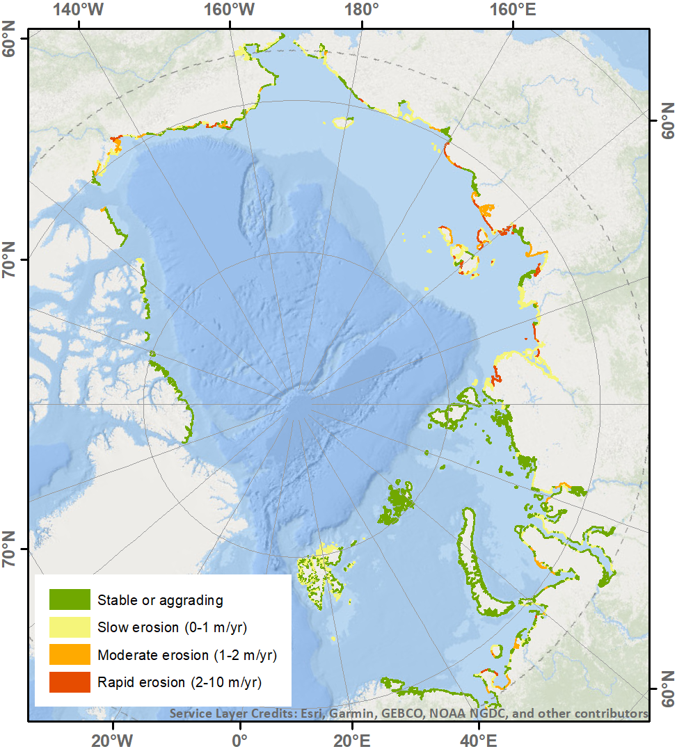
Arctic Coastal Dynamics Classification Database
An important outcome of Arctic Coastal Dynamics I was the segmentation and characterization of the entire circum-Arctic coastline by regional experts which is presented in this... -
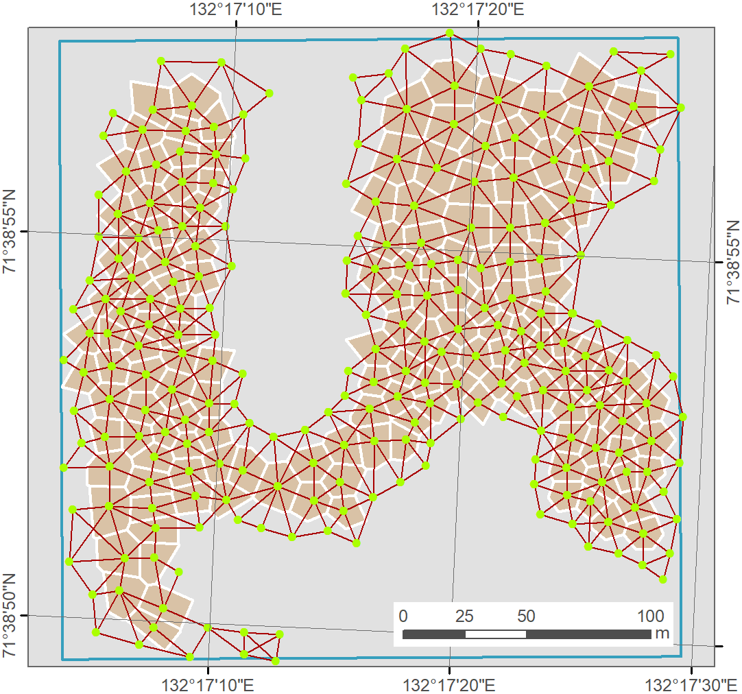
Mapped thermokarst ice wedge polygon patterns from GeoEye-1, 2009, Buor Khaya, Laptev Sea coast, Siberia (RU)
Detailed calculations of ground-ice volumes in permafrost deposits are necessary to understand and quantify the response of permafrost landscapes to thermal disturbance and...
Du får også tilgang til dette registeret med API (se API-dokumenter).


