-
Aufeis (naleds) from 1958 historical maps and 2013-2017 Landsat-8 OLI images, Indigirka River basin, Siberia (RU)
The GIS database contains the data of aufeis (naleds) in the Indigirka River basin (Russia) from historical and nowadays sources, and complete ArcGIS 10.1/10.2 and Qgis 3*... -
Aufeis (naleds) from 1958 historical maps and 2013-2019 Landsat-8 OLI images, Chukotka region, Siberia (RU)
The GIS database contains the data of aufeis (naled) in the Chukotka region from historical and nowadays sources, and complete ArcGIS 10.1/10.2 and Qgis 3* projects to view and... -
Aufeis (naleds) from 1958 historical maps and 2013-2017 Landsat-8 OLI images, Kolyma River basin, Siberia (RU)
The GIS database contains the data of aufeis (naleds) in the Kolyma River basin (Russia) from historical and nowadays sources, and complete ArcGIS 10.1/10.2 and Qgis 3* projects... -
Lake-DOC Database (PeRL-DOCv1), 1979-2017, Permafrost-Region
The pan-Arctic Permafrost-Region Lake-DOC version1 database contains surface water samples of lakes in the permafrost regions of Alaska (49.3 %), Canada (24.2 %), Greenland (3.2... -
Distribution of pingos from an IfSAR digital surface model, 2002-2006, western Arctic Coastal Plain, Northern Alaska (US)
A detailed attributed point feature shapefile of 1247 pingo locations was manually assembled from a 5m resolution digital surface model (DSM) derived from an airborne... -
Distribution of pingos from topographic maps, permafrost region, Siberia (RU)
A detailed attributed point feature shapefile of 6059 pingo locations in a 3.5 × 10⁶ km² region of northern Asia was manually assembled from 1:200 000 scale Russian... -
GTN-P (2015): Global Terrestrial Network for Permafrost metadata for permafrost boreholes (TSP) and active layer...
The Global Terrestrial Network for Permafrost (GTN-P) provides the first dynamic database associated with the Thermal State of Permafrost (TSP) and the Circumpolar Active Layer... -
Aufeis (naleds) from 1958 historical maps and 2013-2017 Landsat-8 OLI images, Yana River basin, Siberia (RU)
The GIS database contains the data of aufeis (naled) in the Yana River basin (Russia) from historical and nowadays sources, and complete ArcGIS 10.1/10.2 and Qgis 3* projects to... -
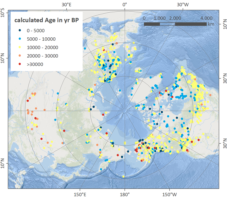
Lake Basal Ages and Origins from scientific literature, Circum-Arctic
This dataset is a compilation of 1,207 lake basal ages used to identify spatial and temporal patterns of lake formation across the high northern latitudes. Data was gathered...


