Preview
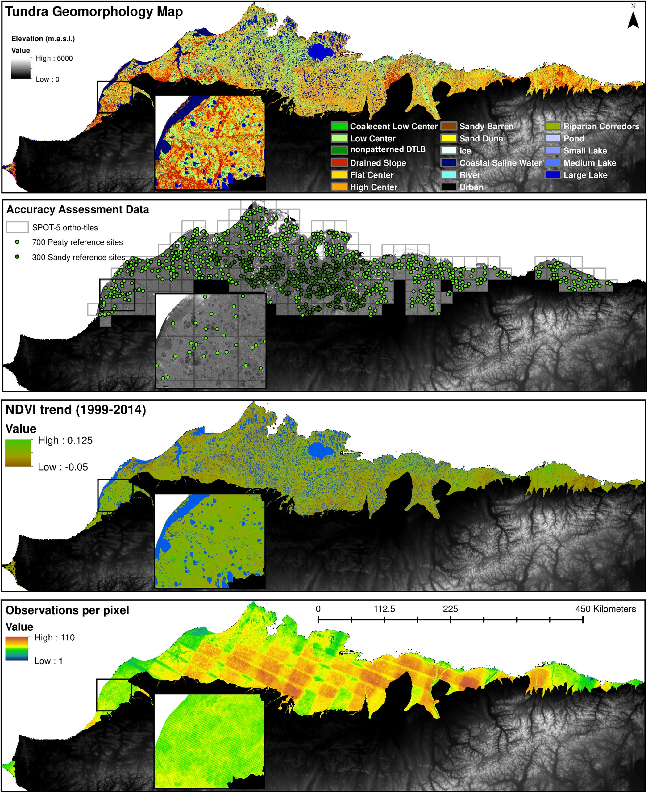
Figure 2: Geospatial datasets representing the heterogeneity in both landform and NDVI across the ACP of northern Alaska.
From: Lara, M., Nitze, I., Grosse, G. et al. Tundra landform and vegetation productivity trend maps for the Arctic Coastal Plain of northern Alaska. Sci Data 5, 180058 (2018). https://doi.org/10.1038/sdata.2018.58
The tundra geomorphology map (a) was validated with 1000 reference sites (700 and 300 in the Arctic Peaty Lowlands and Arctic Sandy Lowlands, respectively) using 249 SPOT-5 ortho-tiles (b), while the NDVI trend map (c) was developed using between 40 to 110 image observations per 30 m pixel (d).
추가 정보
| 필드 | 값 |
|---|---|
| 마지막으로 업데이트된 데이터 | 2020년 4월 29일 |
| 마지막으로 업데이트된 메타데이터 | 2025년 1월 15일 |
| 생성됨 | 2020년 4월 29일 |
| 포맷 | JPEG |
| 라이센스 | 라이센스를 제공하지 않음 |
| Datastore active | False |
| Datastore contains all records of source file | False |
| Has views | True |
| Id | b7414c8c-37d0-490e-b7d9-ce3725c3b4b9 |
| Mimetype | image/jpeg |
| Package id | c00a47dd-60eb-43eb-a70b-a6f30e9cb763 |
| Position | 5 |
| State | active |
| Tracking summary | {'total': 0, 'recent': 0} |
Attention! The specified license is that of the dataset. Licenses from other sources, e.g. publications or figures related to the dataset, may be subject to other licenses.
