-
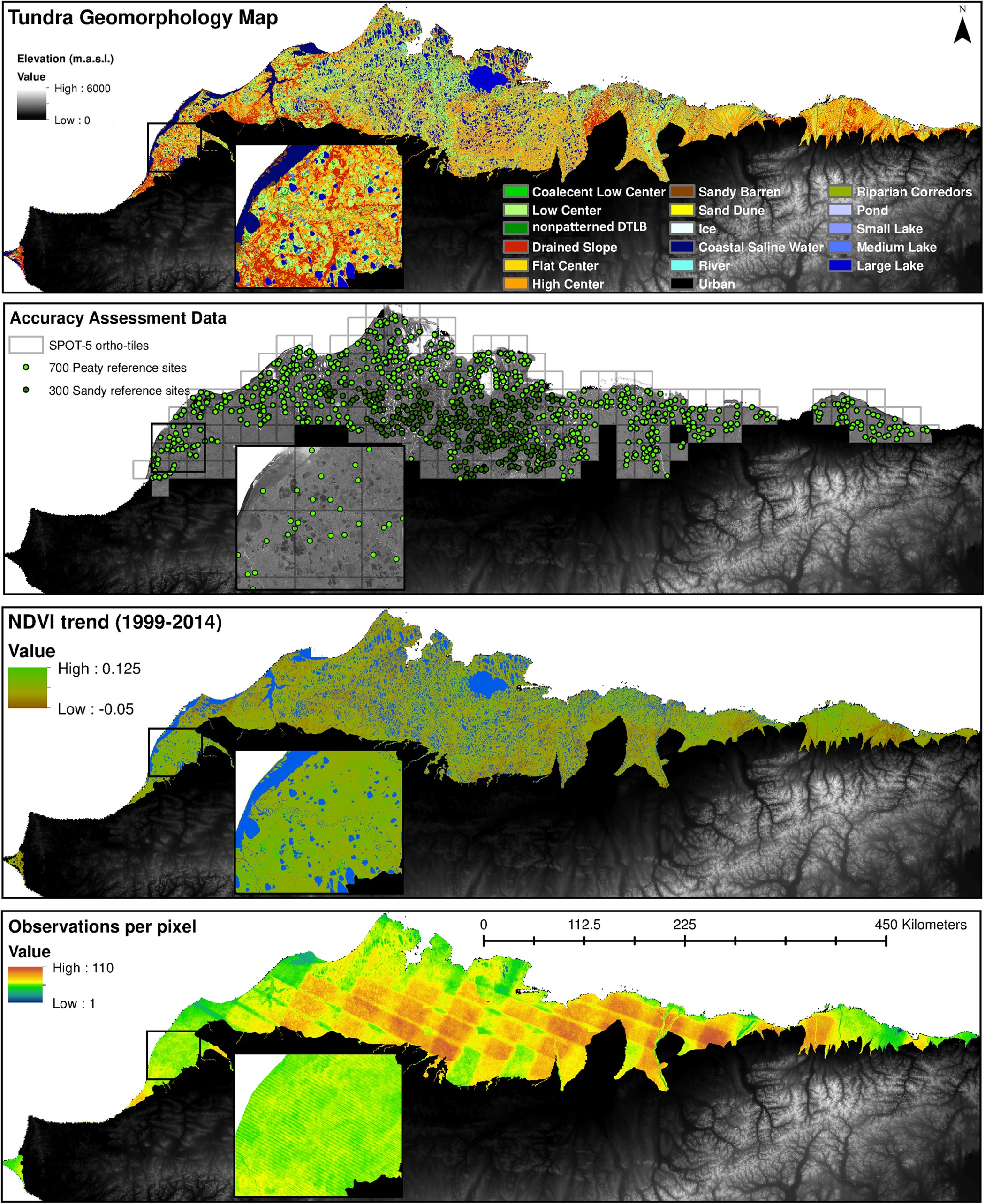
Polygonal Tundra Geomorphology Map from Landsat time series, 2014, Alaskan Arctic Coastal Plain (US)
We mosaicked twelve LandSat-8 OLI satellite images taken during the summer of 2014, which were used in an object based image analysis (OBIA) to classify the landscape. We mapped... -
Maps of ice wedge thermokarst pool expansion from twenty-seven circumpolar survey areas
This repository includes data and code to accompany the manuscript 'Topography controls variability in circumpolar permafrost thaw pond expansion' by Abolt et al. The data... -
Temperature and salinity in the surface water during 4 expeditions from spring to fall in 2019, Mackenzie Delta Region (CA)
During Leg 1, the CTD (CTD RBR Maestro) was manually lowered in the water through an ice hole. During legs 2 to 4, the CTD (CTD RBR Concerto) was installed on a Seabird... -
Hydrographic (CTD) profiles during 4 expeditions from spring to fall in 2019, Mackenzie Delta Region (CA)
During Leg 1, the CTD (CTD RBR Maestro) was manually lowered in the water through an ice hole with a velocity of less than 0.3 ms-1 and an acquisition frequency of 6 Hz,... -
PEATMAP - peatland distribution maps based on meta-analysis, 1999-2010, Global
PEATMAP is a GIS shapefile dataset that shows a distribution of peatlands that covers the entire world. It was produced by combining the most high quality available peatland map... -
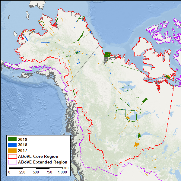
Hyperspectral Imagery AVIRIS-NG V2, 2017-2019, Alaskan and Canadian Arctic
This dataset provides Level 1 radiance and Level 2 surface reflectance measured by the Airborne Visible/Infrared Imaging Spectrometer-Next Generation (AVIRIS-NG) instrument... -
Detailed pedon data on soil carbon and nitrogen for the northern permafrost region
Soils in the northern high latitudes are a key component in the global carbon cycle; the northern permafrost region covers 22% of the Northern Hemisphere and holds almost twice... -
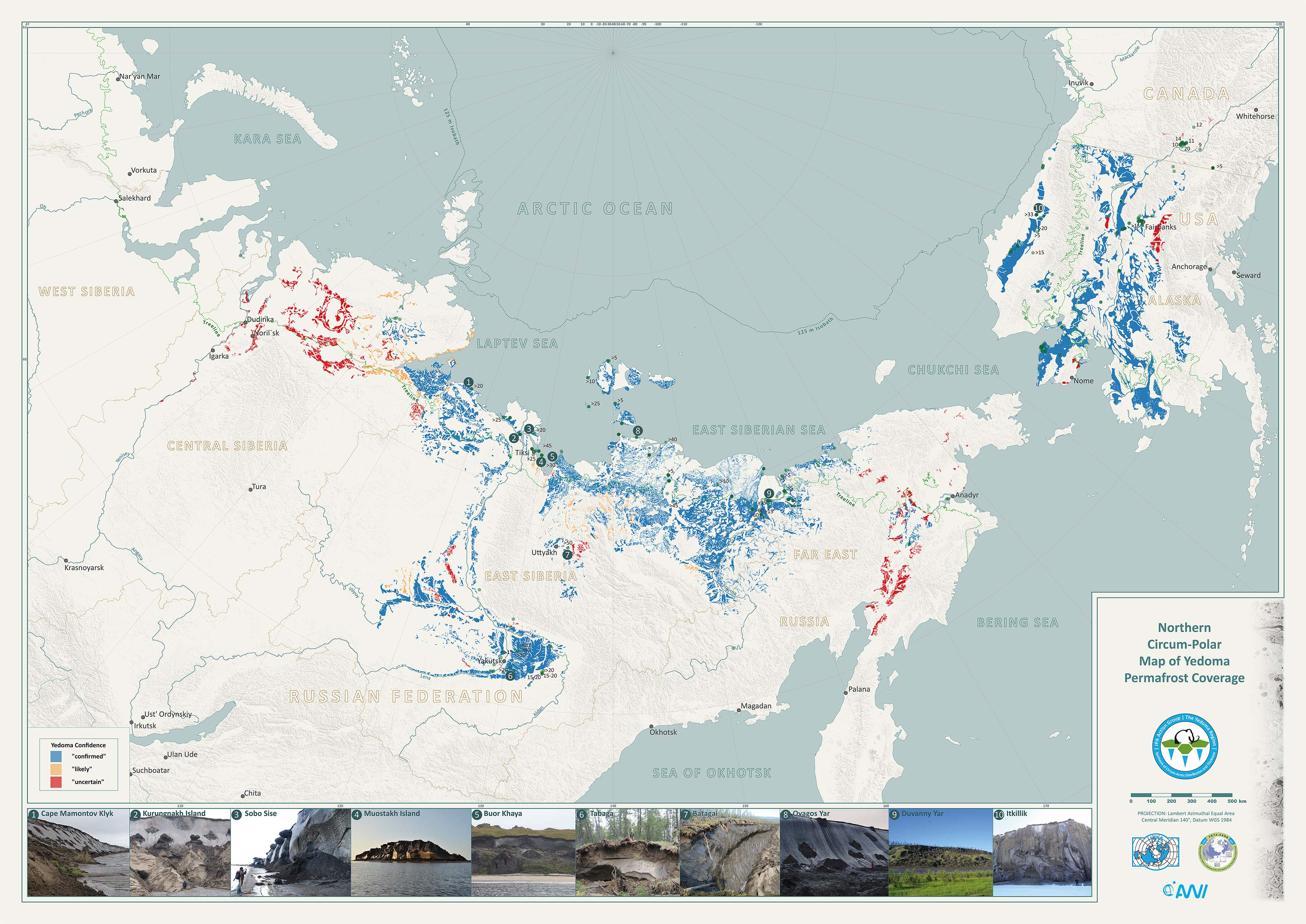
Database of Ice-Rich Yedoma Permafrost Version 2 (IRYP v2)
Ice-rich permafrost in the circum-Arctic and sub-Arctic, such as late Pleistocene Yedoma, are especially prone to degradation due to climate change or human activity. When... -
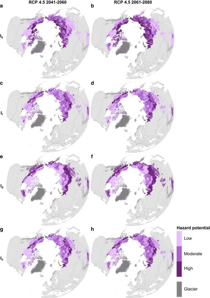
Circumpolar raster grids of permafrost extent and geohazard potential for near-future climate scenarios
One of the consequences of warming climate is rising ground temperatures and degradation of perennially frozen ground, permafrost. Thawing of near-surface permafrost can cause...


