-
DARTS: Multi-year database of AI detected retrogressive thaw slumps (RTS) and active layer detachment slides (ALD)...
This dataset, called DARTS, comprises footprints of retrogressive thaw slump (RTS) and active layer detachments slides (ALD) identified and quantified using an automated deep...
-
Pan-Arctic thermokarst lagoon distribution, area and classification from Landsat images, 1984 to 2021
Thermokarst lagoons develop in permafrost lowlands along the ice-rich Arctic coast when thermokarst lakes or basins with bottom elevations at or below sea level are breached by...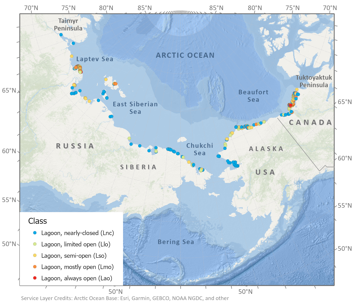
-
Pan-Arctic Visualization of Landscape Change (2003-2022), Arctic PASSION Permafrost Service
This raster dataset, in Cloud Optimized GeoTIFF format (COG), provides information on land surface changes at the pan-arctic scale. Multispectral Landsat-5 TM, Landsat-7 ETM+,...
-
T-MOSAiC 2021 myThaw data set, Circum-Arctic
The Terrestrial Multidisciplinary distributed Observatories for the Study of the Arctic Connections (T-MOSAiC) 2021 permafrost thaw data set provides standardized measurements...
-
Arctic Coastal Dynamics Classification Database
An important outcome of Arctic Coastal Dynamics I was the segmentation and characterization of the entire circum-Arctic coastline by regional experts which is presented in this...
-
Submarine Permafrost Map (SuPerMAP), modeled with CryoGrid 2, Circum-Arctic
This data set contains a first‐order estimate of distribution, thickness and ice-content of submarine permafrost on the Arctic shelf based on a numerical heat transfer model....