-
PEATMAP - peatland distribution maps based on meta-analysis, 1999-2010, Global
PEATMAP is a GIS shapefile dataset that shows a distribution of peatlands that covers the entire world. It was produced by combining the most high quality available peatland map...
-
CARVE column gas from Airborne fourier transform spectrometer, Alaska, 2012-2015
This data set provides total vertical column O2, CO2, CH4, CO, and H2O, as well as dry-air columns of CO2, CH4, CO, and H2O from airborne campaigns over the Alaskan and Canadian...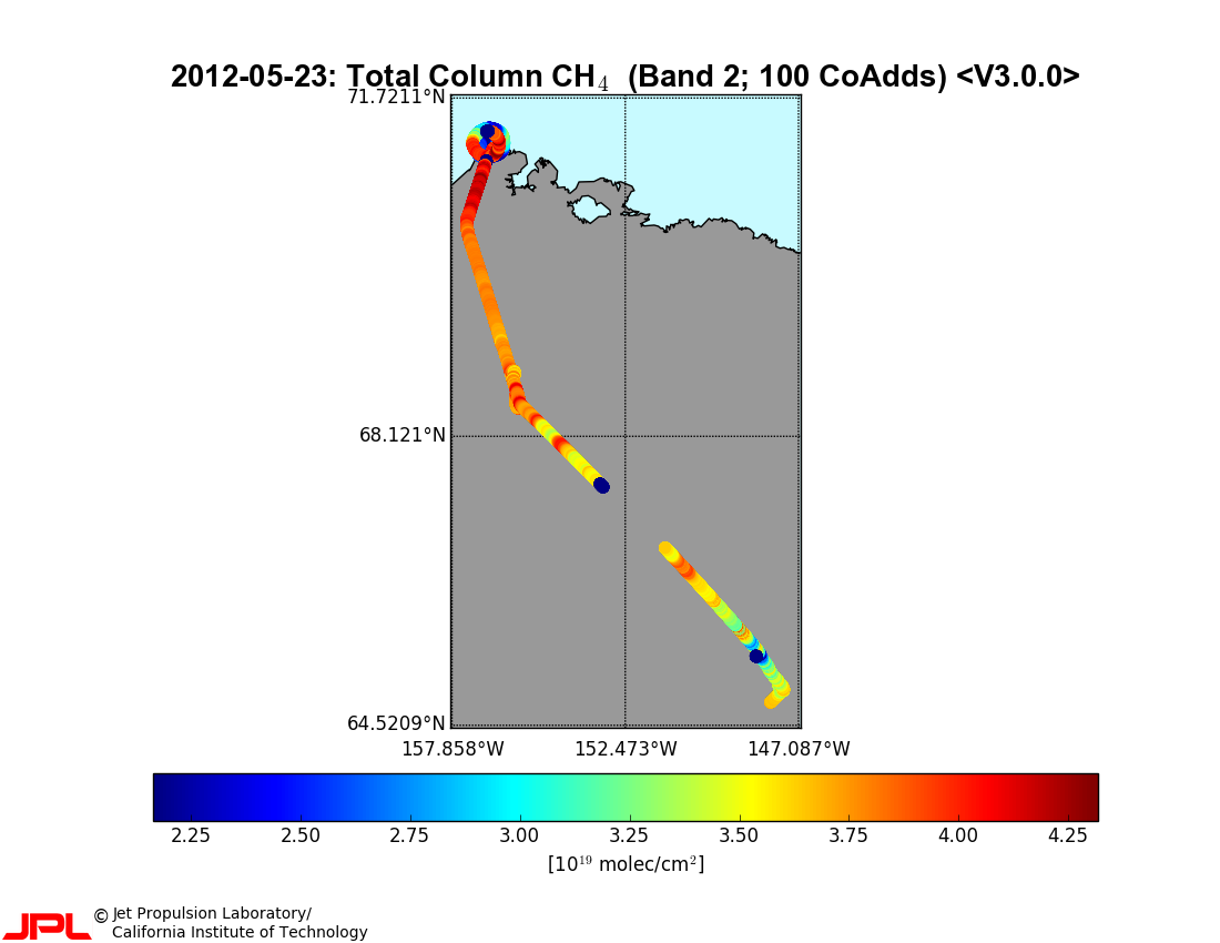
-
Wetland maps including open water extent dynamics based on ENVISAT ASAR WS for Siberia, 2007 and 2008
Wetlands store large amounts of carbon, and depending on their status and type, they release specific amounts of methane gas to the atmosphere. The connection between wetland...
-
The fractional land cover estimates from the Boreal–Arctic Wetland and Lake Dataset (BAWLD), 2021, Circum-Arctic
The Boreal and Arctic Wetland and Lake Dataset (BAWLD) provides estimates of fractional land cover of 19 land cover classes within 0.5° ×0.5° grid cells. The total area of the...
-
Growing season, non-growing season and annual CH4 fluxes from temperate, boreal, and Arctic wetlands and uplands,...
Wetlands are the single largest natural source of atmospheric methane (CH4), a greenhouse gas, and occur extensively in the northern hemisphere. Large discrepancies remain...
-
The Wetland and Wetland CH4 Inter-comparison of Models Project (WETCHIMP) data archive
This archive contains the raw and post-processed model output used in the The Wetland and Wetland CH4 Inter-comparison of Models Project (WETCHIMP). There are top-level...
-
In-situ Carbon and CH4 Flux and Meteorology at EC Towers, Atqasuk, Barrow, Ivotuk, Alaska, 2011-2015
This data set provides ground in situ flux and meteorological science data from fixed instruments at three eddy covariance tower sites located in the Alaskan Arctic tundra. Real...