-
Historic Lake Drainage from Remote Sensing Datasets, 1955-2017, Western Arctic Coastal Plain, Northern Alaska (US)
We identified all lakes larger than 10 hectares (ha) that drained completely or partially (greater than 25 %) between 1955 and 2017 using historical (original) USGS topographic... -
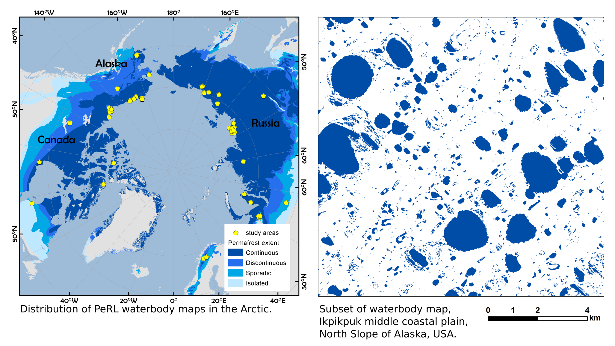
Permafrost Region Pond and Lake Database (PeRL)
The Permafrost Region Pond and Lake Database (PeRL) presents the results of a circum-arctic effort to map ponds and lakes from modern (2002-2013) high-resolution aerial and... -
Lake Database from Landsat TM and ETM+,1970s, 2000s, 2013-2014, Western Alaska (US)
This vector data layer covers 6 major lake districts (Baldwin Peninsula, Kobuk Delta, Selawik Lowland, Northern Seward Peninsula, Central Seward Peninsula, and Yukon-Kuskokwim... -
Potential Future Lake Drainage from an IfSAR-Derived Digital Surface Model, 2002-2003, Western Arctic Coastal Plain,...
Assessment of lakes for their future potential to drain relied on the 2002/03 airborne Interferometric Synthetic Aperture Radar (IFSAR) Digital Surface Model (DSM) data for the... -
Aufeis (naleds) from 1958 historical maps and 2013-2017 Landsat-8 OLI images, Yana River basin, Siberia (RU)
The GIS database contains the data of aufeis (naled) in the Yana River basin (Russia) from historical and nowadays sources, and complete ArcGIS 10.1/10.2 and Qgis 3* projects to... -
Remote sensing-based permafrost region disturbances: lakes, 1999-2014, Eastern Canada (CA)
The data quantify the abundance and distribution of the permafrost region disturbance (PRD) of lakes and their dynamics, using trend analyses of 30-m-resolution Landsat imagery... -
Remote sensing-based permafrost region disturbances: lakes, 1999-2014, Alaska (US)
The data quantify the abundance and distribution of the permafrost region disturbance (PRD) of lakes and their dynamics, using trend analyses of 30-m-resolution Landsat imagery... -
Remote sensing-based permafrost region disturbances: lakes, 1999-2014, Eastern Siberia (RU)
The data quantify the abundance and distribution of the permafrost region disturbance (PRD) of lakes and their dynamics, using trend analyses of 30-m-resolution Landsat imagery... -
Remote sensing-based permafrost region disturbances: lakes, 1999-2014, Western Siberia (RU)
The data quantify the abundance and distribution of the permafrost region disturbance (PRD) of lakes and their dynamics, using trend analyses of 30-m-resolution Landsat imagery... -
Recovered Drained Thaw Lake Basins (DTLBs) from InSAR DEM and Remote Sensing Imagery, 2002-2010, Arctic Coastal...
Paleoshorelines of Drained Thaw Lake Basins (DTLBs) on the Alaskan North Slope were mapped using the Interferometric Synthetic Aperture Radar Digital Elevation Model (InSAR DEM)... -
Beaver Dam Locations from sub-meter resolution Satellite Imagery, 2010-2019, Northern Baldwin Peninsula Alaska (US)
Arctic landscapes are in a state of transition due to changes in climate occurring during both the summer and winter seasons. Scattered observations indicate that beavers... -
Beaver Dam Locations from sub-meter resolution Satellite Imagery, 2002-2019, Kotzebue, Northwestern Baldwin...
Arctic landscapes are in a state of transition due to changes in climate occurring during both the summer and winter seasons. Scattered observations indicate that beavers... -
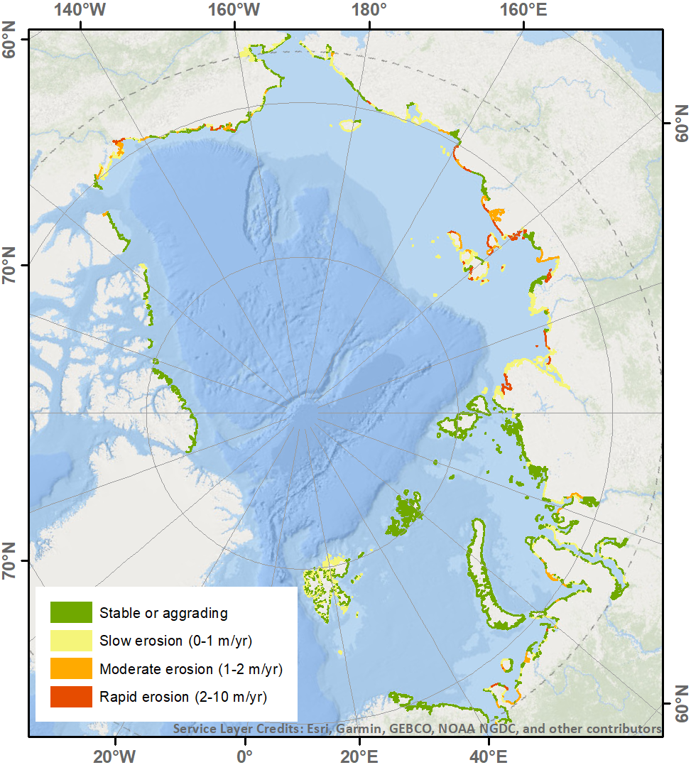
Arctic Coastal Dynamics Classification Database
An important outcome of Arctic Coastal Dynamics I was the segmentation and characterization of the entire circum-Arctic coastline by regional experts which is presented in this... -
Robust trends of landscape dynamics in the Arctic Lena Delta with temporally dense Landsat time-series stacks
The robust Theil-Sen regression algorithm was used to calculate trend parameters (slope, intercept, confidence intervals) on Landsat time-series stack in the north-east Siberian... -
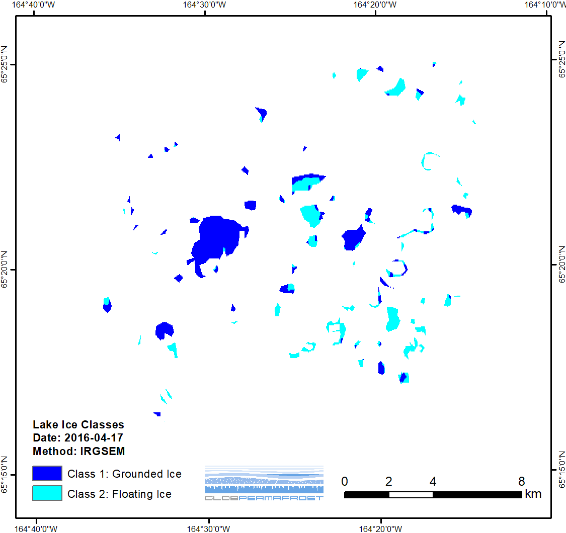
Lake Ice Classification from Sentinel-1, 2015-2016, Teshekpuk, Alaska (US)
Weekly lake ice classifications distinguish grounded ice and floating ice in lakes based on Sentinel-1A and Sentinel-1B synthetic aperture radar time-series with a resolution of... -
Lake Ice Classification from Sentinel-1, 2016-2017, Central Seward Peninsula, Alaska (US)
Lake ice classifications distinguish grounded ice and floating ice in lakes based on Sentinel-1A and Sentinel-1B synthetic aperture radar time-series with a resolution between... -
Lake Ice Classification from Sentinel-1, 2016-2017, Cape Espenberg Lowland, Alaska (US)
Lake ice classifications distinguish grounded ice and floating ice in lakes based on Sentinel-1A and Sentinel-1B synthetic aperture radar time-series with a resolution between... -
Surface Water Area from sub-meter resolution Satellite Imagery, 2002-2019, Kotzebue, Northwestern Baldwin Peninsula...
Arctic landscapes are in a state of transition due to changes in climate occurring during both the summer and winter seasons. Scattered observations indicate that beavers... -
Land Cover Classification from Sentinel-1 and Sentinel-2, 2015-2018, Western Siberia (RU)
Land cover classes have been derived from bands of Sentinel-2 (bands 3 (green, 10m), 4 (red, 10m), 8 (near infrared, 10m), 11 (SWIR, 20m) and 12 (SWIR, 20m)) as well as... -
Land Cover Classification from Sentinel-1 and Sentinel-2, 2015-2018, Yukon Delta, Alaska (US)
Land cover classes have been derived from bands of Sentinel-2 (bands 3 (green, 10m), 4 (red, 10m), 8 (near infrared, 10m), 11 (SWIR, 20m) and 12 (SWIR, 20m)) as well as...


