-
Lake-DOC Database (PeRL-DOCv1), 1979-2017, Permafrost-Region
The pan-Arctic Permafrost-Region Lake-DOC version1 database contains surface water samples of lakes in the permafrost regions of Alaska (49.3 %), Canada (24.2 %), Greenland (3.2...
-
Database of Quaternary Deposits from Maps, East and Central Siberia (RU)
This digital database is the product of collaboration between the U.S. Geological Survey, the Alfred Wegener Institute for Polar and Marine Research Potsdam, Foothill College...
-
Geochemical, lithological, and geochronological characteristics of sediment samples from Yedoma and thermokarst...
This dataset merges data from the yedoma domain in Northern Siberia (RU) and Alaska (US). It includes numerous fieldwork campaigns, which take place since 1998 . In total 224...
-
Remote sensing-based permafrost region disturbances: lakes, 1999-2014, Eastern Canada (CA)
The data quantify the abundance and distribution of the permafrost region disturbance (PRD) of lakes and their dynamics, using trend analyses of 30-m-resolution Landsat imagery...
-
Remote sensing-based permafrost region disturbances: lakes, 1999-2014, Alaska (US)
The data quantify the abundance and distribution of the permafrost region disturbance (PRD) of lakes and their dynamics, using trend analyses of 30-m-resolution Landsat imagery...
-
Remote sensing-based permafrost region disturbances: lakes, 1999-2014, Eastern Siberia (RU)
The data quantify the abundance and distribution of the permafrost region disturbance (PRD) of lakes and their dynamics, using trend analyses of 30-m-resolution Landsat imagery...
-
Remote sensing-based permafrost region disturbances: lakes, 1999-2014, Western Siberia (RU)
The data quantify the abundance and distribution of the permafrost region disturbance (PRD) of lakes and their dynamics, using trend analyses of 30-m-resolution Landsat imagery...
-
Growing season, non-growing season and annual CH4 fluxes from temperate, boreal, and Arctic wetlands and uplands,...
Wetlands are the single largest natural source of atmospheric methane (CH4), a greenhouse gas, and occur extensively in the northern hemisphere. Large discrepancies remain...
-
The Wetland and Wetland CH4 Inter-comparison of Models Project (WETCHIMP) data archive
This archive contains the raw and post-processed model output used in the The Wetland and Wetland CH4 Inter-comparison of Models Project (WETCHIMP). There are top-level...
-
Point Pedon Data of the Northern Circumpolar Soil Carbon Database, Circum-Arctic
The Northern Circumpolar Soil Carbon Database version 2 (NCSCDv2) is a geospatial database created for the purpose of quantifying storage of organic carbon in soils of the...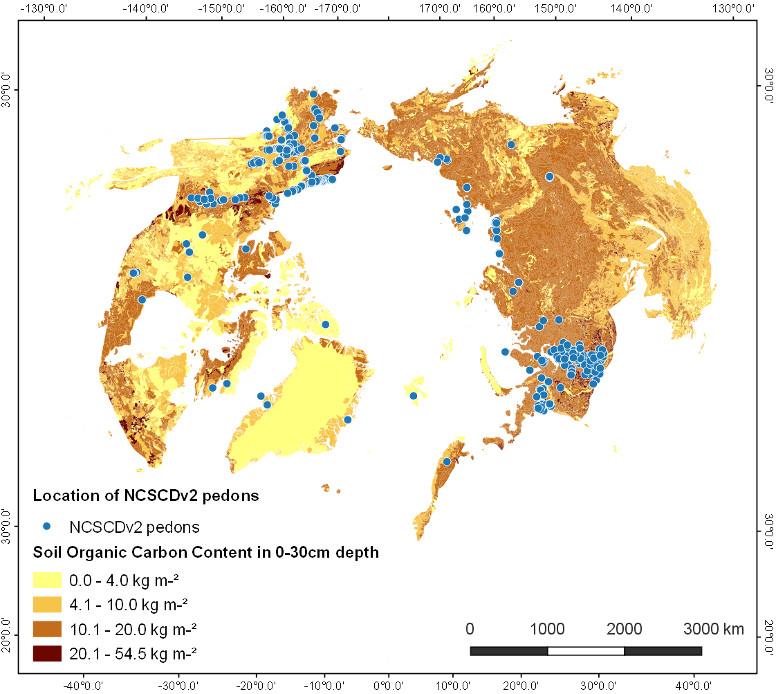
-
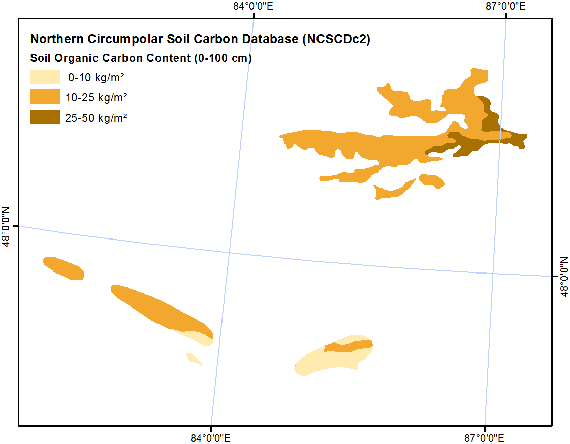
Northern Circumpolar Soil Carbon Database, Kazaksthan, geotiff- and netCDF-files
The Northern Circumpolar Soil Carbon Database version 2 (NCSCDv2) is a geospatial database created for the purpose of quantifying storage of organic carbon in soils of the...