Collections
-

AMPAC-Net Airborne
This dataset collection is a data type subset of the AMPAC-Net project and...
Разглеждане на AMPAC-Net Airborne -
AMPAC-Net Anthropogenic sources
This dataset collection is a data type subset of the AMPAC-Net project and...
Разглеждане на AMPAC-Net Anthropogenic sources -

AMPAC-Net Chambers
This dataset collection is a data type subset of the AMPAC-Net project and...
Разглеждане на AMPAC-Net Chambers -

AMPAC-Net Eddy Covariance
This dataset collection is a data type subset of the AMPAC-Net project and...
Разглеждане на AMPAC-Net Eddy Covariance -
AMPAC-Net Geospatial
This dataset collection is a data type subset of the AMPAC-Net project and...
Разглеждане на AMPAC-Net Geospatial -
AMPAC-Net Incubations
This dataset collection is a data type subset of the AMPAC-Net project and...
Разглеждане на AMPAC-Net Incubations -
AMPAC-Net Inversions
This dataset collection is a data type subset of the AMPAC-Net project and...
Разглеждане на AMPAC-Net Inversions -

AMPAC-Net Isotopes
Contains isotopic analysis data relevant to high latitude methane dynamics
Разглеждане на AMPAC-Net Isotopes -
AMPAC-Net Reference observations
This dataset collection is a data type subset of the AMPAC-Net project and...
Разглеждане на AMPAC-Net Reference observations -

AMPAC-Net Satellite Concentrations
This dataset collection is a data type subset of the AMPAC-Net project and...
Разглеждане на AMPAC-Net Satellite Concentrations -

AMPAC-Net Spatial Models
This dataset collection is a data type subset of the AMPAC-Net project and...
Разглеждане на AMPAC-Net Spatial Models -

Aufeis (naleds) from 1958 historical maps and 2013-2017/2019 Landsat-8 OLI images in North-Eastern Eurasia
Historical data collection is created based on the Cadastre of aufeis (naled)...
Разглеждане на Aufeis (naleds) from 1958 historical maps and 2013-2017/2019 Landsat-8 OLI images in North-Eastern Eurasia -

Frozen State Backscatter Intensity from Sentinel-1
Frozen state backscatter intensity was derived from Sentinel-1 acquisitions...
Разглеждане на Frozen State Backscatter Intensity from Sentinel-1 -

Lake Ice Classification from Sentinel-1
Lake ice classifications distinguish grounded ice and floating ice in lakes...
Разглеждане на Lake Ice Classification from Sentinel-1 -
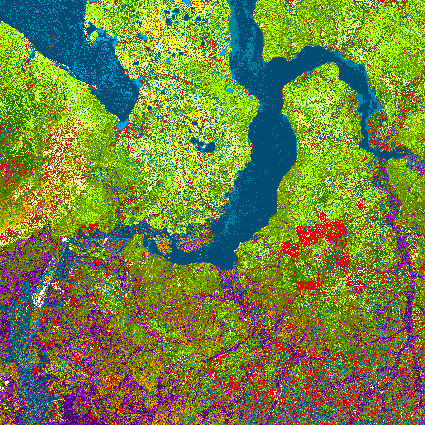
Land Cover Classification from Sentinel-1 and Sentinel-2
Land cover classes have been derived from bands of Sentinel-2 (bands 3...
Разглеждане на Land Cover Classification from Sentinel-1 and Sentinel-2 -

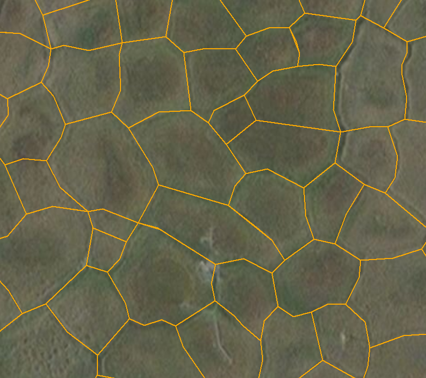
Mapped ice wedge polygon patterns from GeoEye-1, WorldView-1
Detailed calculations of ground-ice volumes in permafrost deposits are...
Разглеждане на Mapped ice wedge polygon patterns from GeoEye-1, WorldView-1 -
Mapped polygon pattern geomorphometry from HRSC-AX
Polygonal systems formed by thermal contraction cracking are complex...
Разглеждане на Mapped polygon pattern geomorphometry from HRSC-AX -

MODIS Land Surface Temperature
MODIS land surface temperature (LST) products of the ESA Data User Element...
Разглеждане на MODIS Land Surface Temperature -
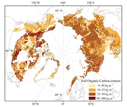
Northern Circumpolar Soil Carbon Database version 2
The Northern Circumpolar Soil Carbon Database version 2 (NCSCDv2) is a...
Разглеждане на Northern Circumpolar Soil Carbon Database version 2 -
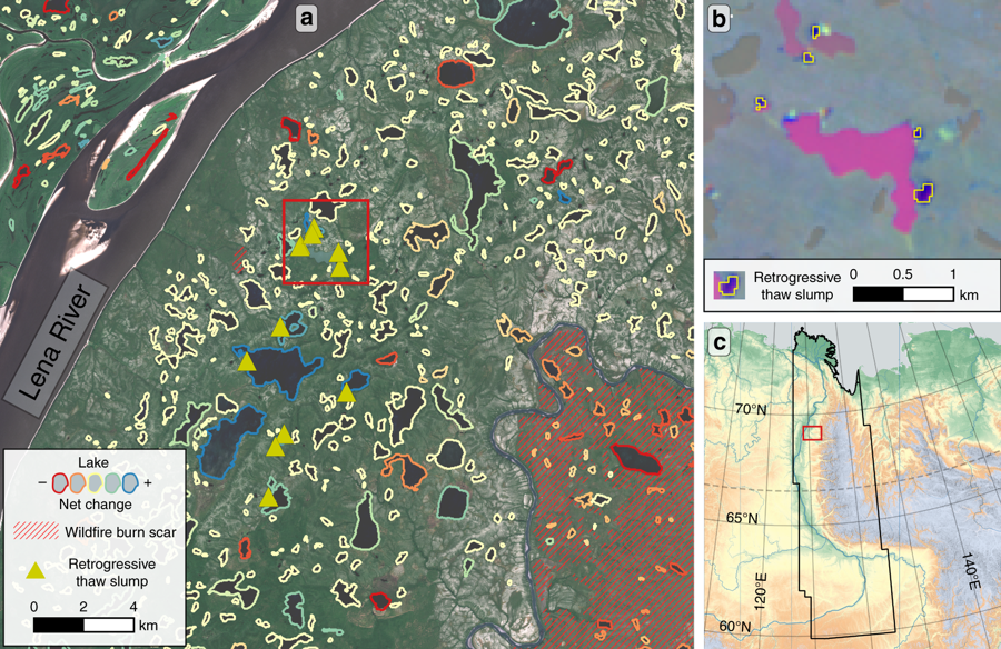
Permafrost Region Disturbances across the Arctic and Subarctic
The data quantify the abundance and distribution of three primary permafrost...
Разглеждане на Permafrost Region Disturbances across the Arctic and Subarctic