-
Spatial lake dynamics and lake-ice datasets of the Northern Seward and Baldwin Peninsulas in Alaska
The data publication contains supplementary data to the article "Supplementary Dataset to: The catastrophic thermokarst lake drainage events of 2018 in northwestern Alaska:...
-
Pan-Arctic Visualization of Landscape Change (2003-2022), Arctic PASSION Permafrost Service
This raster dataset, in Cloud Optimized GeoTIFF format (COG), provides information on land surface changes at the pan-arctic scale. Multispectral Landsat-5 TM, Landsat-7 ETM+,...
-
Distribution and morphometry of pingos, western Canadian Arctic, Northwest Territories, (CA)
GIS shape files including spatial and morphometric data of pingos in the western Canadian Arctic and accompanying Excel spreadsheet summarizing metrics for pingos of differing...
-
The fractional land cover estimates from the Boreal–Arctic Wetland and Lake Dataset (BAWLD), 2021, Circum-Arctic
The Boreal and Arctic Wetland and Lake Dataset (BAWLD) provides estimates of fractional land cover of 19 land cover classes within 0.5° ×0.5° grid cells. The total area of the...
-
Near-surface permafrost conditions from synthesis data, 1997-2016, Alaska
We compiled a near-surface permafrost temperature dataset from 72 monitoring stations in Alaska using data collected by the U. S. Geological Survey, the National Park Service,...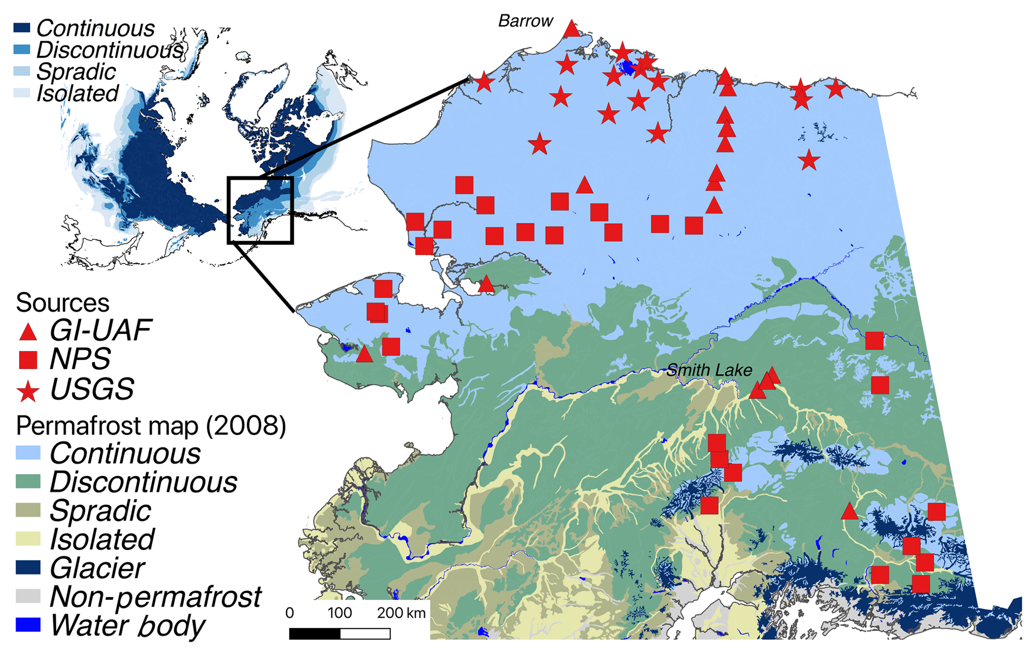
-
Database of Quaternary Deposits from Maps, East and Central Siberia (RU)
This digital database is the product of collaboration between the U.S. Geological Survey, the Alfred Wegener Institute for Polar and Marine Research Potsdam, Foothill College...