-
Pan-Arctic Visualization of Landscape Change (2003-2022), Arctic PASSION Permafrost Service
This raster dataset, in Cloud Optimized GeoTIFF format (COG), provides information on land surface changes at the pan-arctic scale. Multispectral Landsat-5 TM, Landsat-7 ETM+,...
-
Circumarctic wetland dataset based on ENVISAT ASAR Global Monitoring Mode, 2005-2011, Panarctic
A circumpolar representative and consistent wetland map is required for a range of applications ranging from upscaling of carbon fluxes and pools to climate modelling and...
-
Raster Circumpolar Arctic Vegetation Map (CAVM) from AVHRR, MODIS and elevation data
Land cover maps are the basic data layer required for understanding and modeling ecological patterns and processes. The Circumpolar Arctic Vegetation Map (CAVM), produced in...
-
Circumpolar raster grids of permafrost extent and geohazard potential for near-future climate scenarios
One of the consequences of warming climate is rising ground temperatures and degradation of perennially frozen ground, permafrost. Thawing of near-surface permafrost can cause...
-
Permafrost Extent and Ground Temperature Map, 2000-2016, Northern Hemisphere Permafrost
The product provides modeled mean annual ground temperatures (MAGT) at the top of the permafrost for the Northern Hemisphere at 1 km spatial resolution. Permafrost probability...
-
Northern Circumpolar Soil Carbon Database, Circum-Arctic Region, geotiff-files
The Northern Circumpolar Soil Carbon Database version 2 (NCSCDv2) is a geospatial database created for the purpose of quantifying storage of organic carbon in soils of the...
-
Weekly Land Surface Temperature from MODIS, 2007-2013, Circum-Arctic Region
Weekly land surface temperature (LST) products of the ESA Data User Element (DUE) Permafrost are provided at 1 km spatial resolution. Weekly LST are available for the years 2007...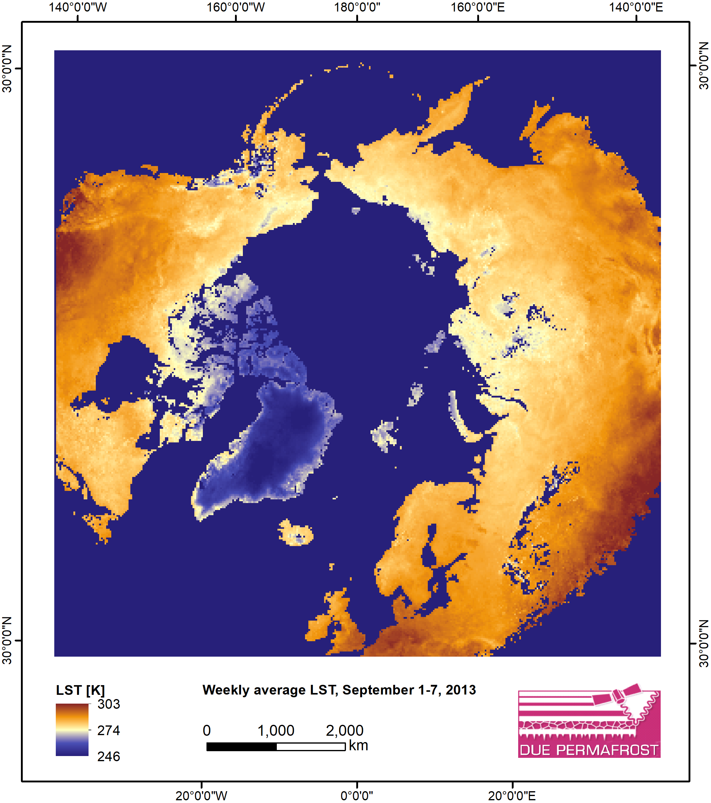
-
Monthly Land Surface Temperature from MODIS, 2007-2013, Circum-Arctic Region
Monthly land surface temperature (LST) products of the ESA Data User Element (DUE) Permafrost are provided at 1 km spatial resolution for the Alaska, Mackenzie, Laptev Sea...
