-
Northern Circumpolar Soil Carbon Database, Greenland, geotiff- and netCDF-files
The Northern Circumpolar Soil Carbon Database version 2 (NCSCDv2) is a geospatial database created for the purpose of quantifying storage of organic carbon in soils of the...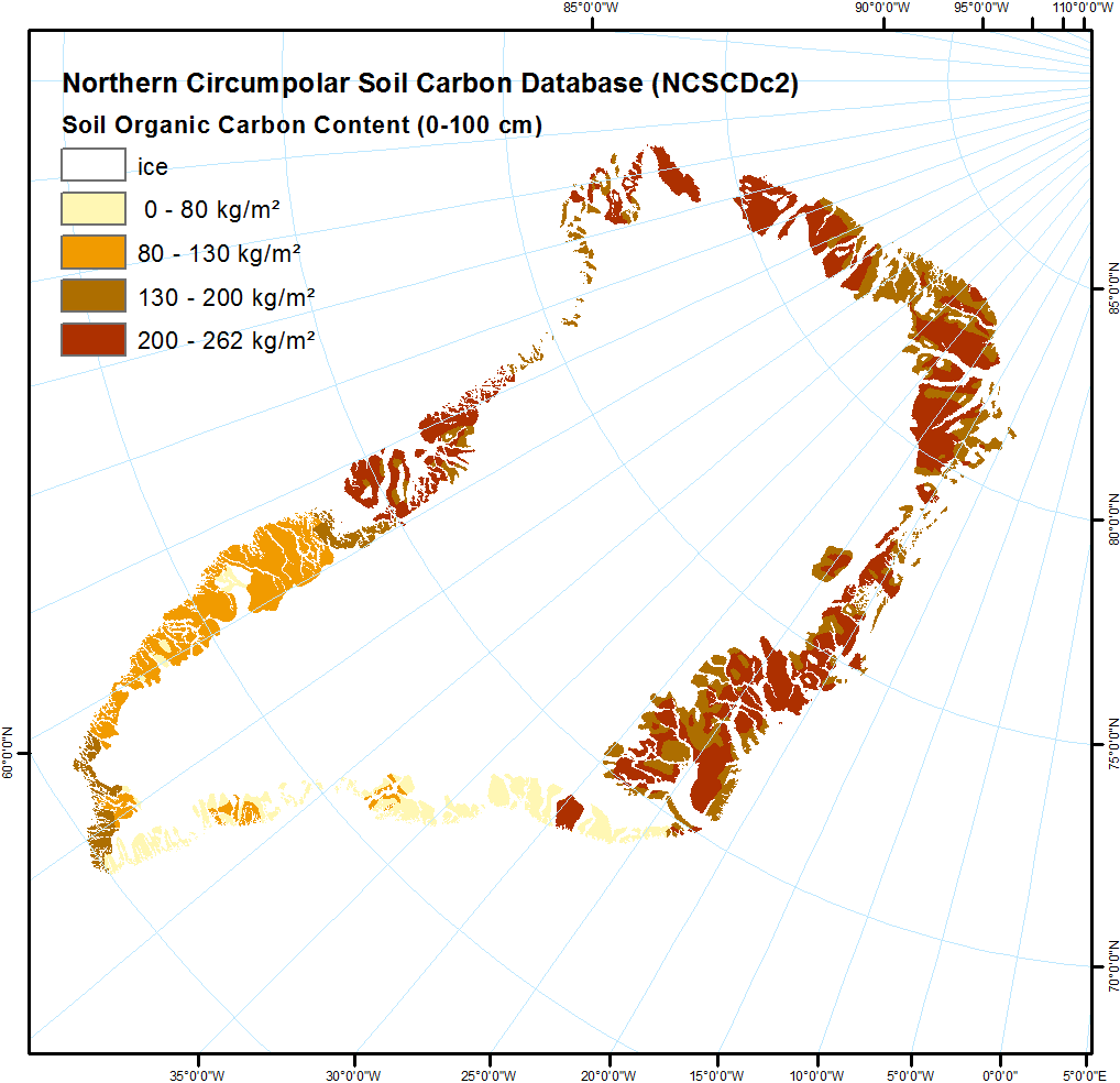
-
Surface Subsidence Map from Sentinel-1 InSAR, 2015-2018, Disko Island, Greenland
Surface subsidence was derived from Sentinel-1 synthetic aperture radar time-series with a spatial resolution of 10 m. Maps show the averaged displacement rates during the snow...
