-
Recovered Drained Thaw Lake Basins (DTLBs) from InSAR DEM and Remote Sensing Imagery, 2002-2010, Arctic Coastal Plain...
Paleoshorelines of Drained Thaw Lake Basins (DTLBs) on the Alaskan North Slope were mapped using the Interferometric Synthetic Aperture Radar Digital Elevation Model (InSAR DEM)...
-
Arctic Coastal Dynamics Classification Database
An important outcome of Arctic Coastal Dynamics I was the segmentation and characterization of the entire circum-Arctic coastline by regional experts which is presented in this...
-
Permafrost Extent and Ground Temperature Map, 2000-2016, Northern Hemisphere Permafrost
The product provides modeled mean annual ground temperatures (MAGT) at the top of the permafrost for the Northern Hemisphere at 1 km spatial resolution. Permafrost probability...
-
Point Pedon Data of the Northern Circumpolar Soil Carbon Database, Circum-Arctic
The Northern Circumpolar Soil Carbon Database version 2 (NCSCDv2) is a geospatial database created for the purpose of quantifying storage of organic carbon in soils of the...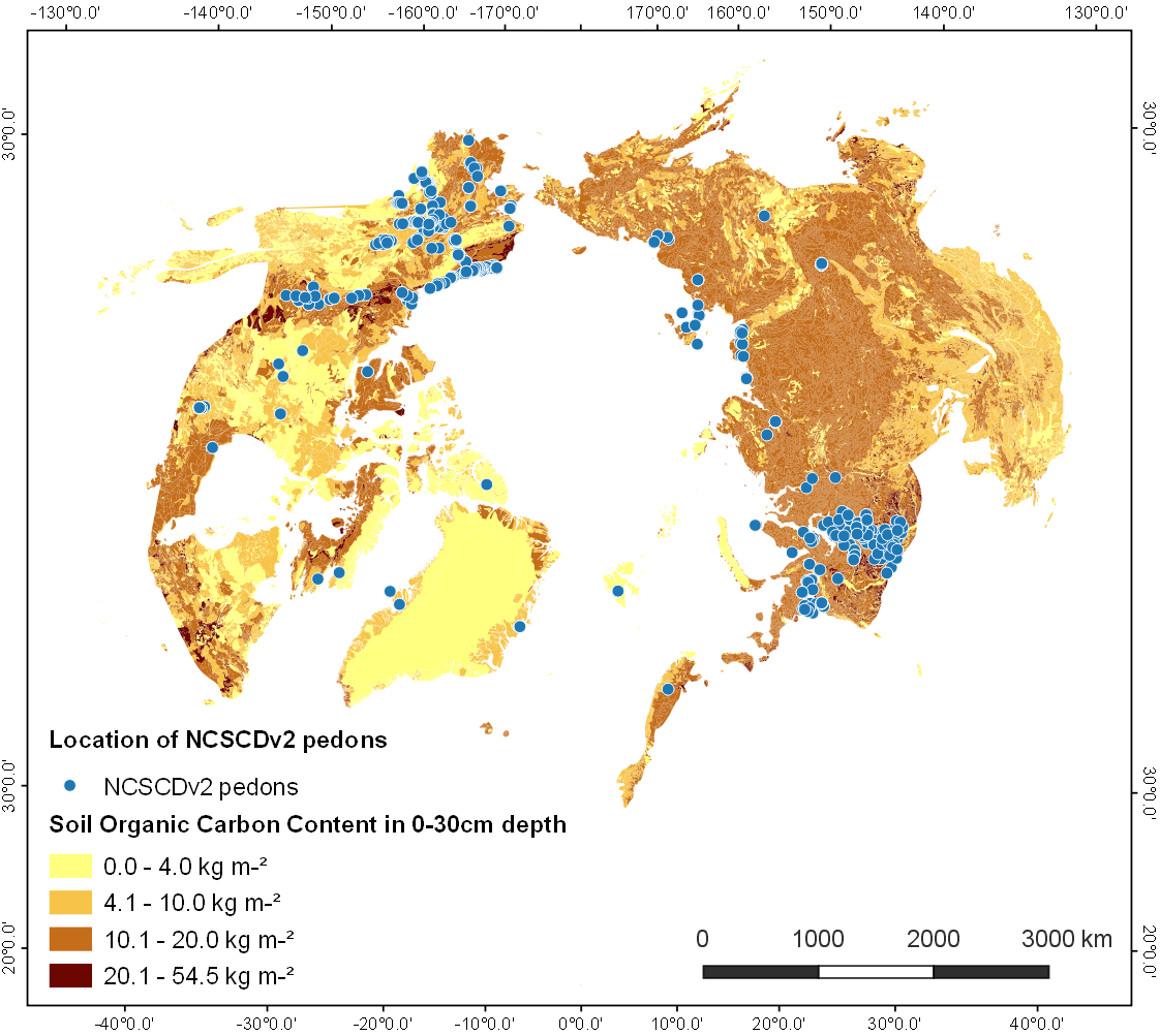
-
Footprints of MACS aerial images from POLAR 6 ThawTrend_Air_2019 flight campaign in northern Alaska (US)
This datasets contains the footprints of the DLR MACS (Modular Aerial Camera System) acquisitions (RGB + NIR) during the AWI ThawTrendAir2019 campaign on POLAR 6 from 10 July...
-
Mapped thermokarst ice wedge polygon patterns from GeoEye-1, 2009, Buor Khaya, Laptev Sea coast, Siberia (RU)
Detailed calculations of ground-ice volumes in permafrost deposits are necessary to understand and quantify the response of permafrost landscapes to thermal disturbance and...
-
Submarine Permafrost Map (SuPerMAP), modeled with CryoGrid 2, Circum-Arctic
This data set contains a first‐order estimate of distribution, thickness and ice-content of submarine permafrost on the Arctic shelf based on a numerical heat transfer model....
-
Geomorphological units from field mapping, Irizar - Crater Lake Area, Deception Island, Antarctica
The map describes the main geomorphological features according to surface cover type on Irizar - Crater Lake Area, Deception Island, Antarctica. The map was developed to support...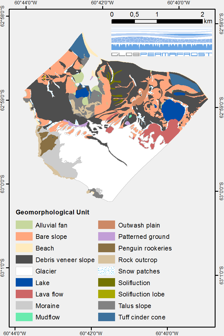
-
Geomorphological units from field mapping, Hurd Peninsula, Livingston Island, Antarctica
The map shows the geomorphological units of Hurd Peninsula on Livingston Island. Mapping was done with high resolution field mapping supported by the analysis of a QuickBird...
