-
The fractional land cover estimates from the Boreal–Arctic Wetland and Lake Dataset (BAWLD), 2021, Circum-Arctic
The Boreal and Arctic Wetland and Lake Dataset (BAWLD) provides estimates of fractional land cover of 19 land cover classes within 0.5° ×0.5° grid cells. The total area of the...
-
Polygonal Tundra Geomorphology Map from Landsat time series, 2014, Alaskan Arctic Coastal Plain (US)
We mosaicked twelve LandSat-8 OLI satellite images taken during the summer of 2014, which were used in an object based image analysis (OBIA) to classify the landscape. We mapped...
-
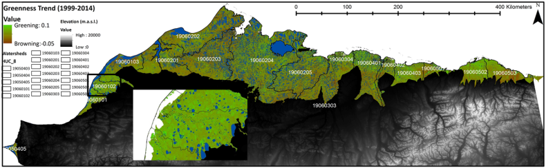
NDVI trend from Landsat time series, 1999-2014, Alaskan Arctic Coastal Plain (US)
Normalized difference vegetation index (NDVI) trend map was computed for the Alaskan Arctic Coastal Plain between 1999 and 2014. The decadal trend of each pixel was computed...