-
SAR-based Methane Ebullition Flux from Lakes, Five Regions, Alaska, 2007-2010
This dataset provides Synthetic Aperture Radar (SAR) estimates of lake-source methane ebullition flux in mg CH4/m2/d for thousands of lakes in five regions across Alaska. The...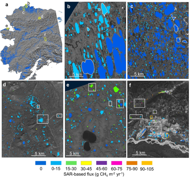
-
Raster Circumpolar Arctic Vegetation Map (CAVM) from AVHRR, MODIS and elevation data
Land cover maps are the basic data layer required for understanding and modeling ecological patterns and processes. The Circumpolar Arctic Vegetation Map (CAVM), produced in...
-
Lake Database from Landsat TM and ETM+,1970s, 2000s, 2013-2014, Western Alaska (US)
This vector data layer covers 6 major lake districts (Baldwin Peninsula, Kobuk Delta, Selawik Lowland, Northern Seward Peninsula, Central Seward Peninsula, and Yukon-Kuskokwim...
