-
Thermo-erosional valleys and streams in ice-rich permafrost lowlands from RapidEye, 2010, Buor Khaya Peninsula, Lapte...
The published data set provides an inventory of thermo-erosional landforms and streams in three lowland areas underlain by ice-rich permafrost of the Yedoma-type Ice Complex at...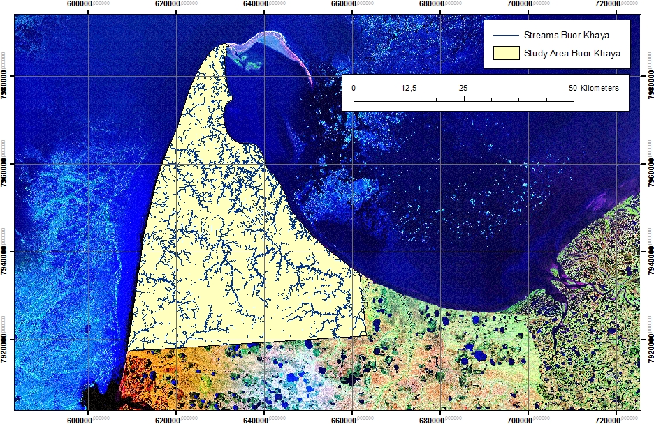
-
Thermo-erosional valleys and streams in ice-rich permafrost lowlands from Landsat, 2000, Hexagon, 1975, Lena Delta, L...
The published dataset provides an inventory of thermo-erosional landforms and streams in three lowland areas underlain by ice-rich permafrost of the Yedoma-type Ice Complex at...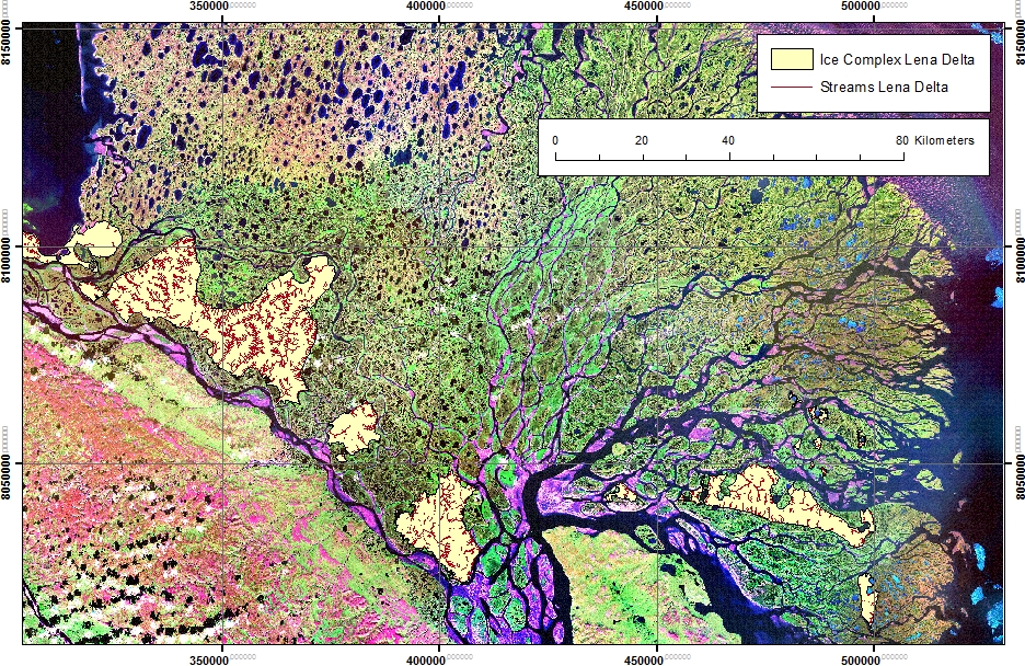
-
Thermo-erosional valleys and streams in ice-rich permafrost lowlands from Landsat, 2000, Hexagon, 1975, Cape Mamontov...
The published dataset provides an inventory of thermo-erosional landforms and streams in three lowland areas underlain by ice-rich permafrost of the Yedoma-type Ice Complex at...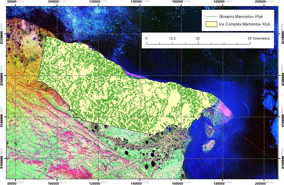
-
Freeze/Thaw Timing from ENVISAT ASAR GM, 2005-2010, Laptev Sea Coast, Laptev and East Siberian Sea Region (RU)
The SAR Freeze/Thaw product indicates the timing (day of year) of ground surface freeze-up and thawing at a resolution of 1 km. It is derived from the ENVISAT ASAR sensor...
-
Surface Subsidence Map from Sentinel-1 InSAR, 2016-2018, Lena Delta, Laptev and East Siberian Sea Region (RU)
Surface subsidence was derived from Sentinel-1 synthetic aperture radar time-series with a spatial resolution of 10 m. Maps show the averaged displacement rates during the snow...
